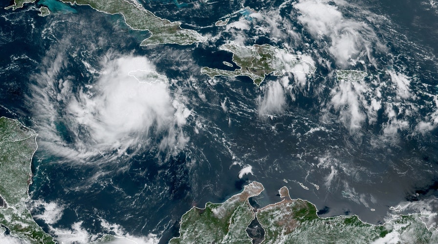
National forecast for Tuesday, September 1
Fox News senior meteorologist Janice Dean has your FoxCast.
The 14th named tropical storm of the year formed Tuesday in the Caribbean, setting yet another record in the busy 2020 Atlantic hurricane season.
The U.S. National Hurricane Center (NHC) in Miami said that aircraft data from an Air Force Reserve Hurricane Hunter aircraft indicate the area of disturbed weather has become Tropical Storm Nana.
The storm system is located about 110 miles south of Negril, Jamaica, and is moving west at 18 mph.
Nana is currently packing maximum sustained winds of 50 mph, according to the 2 p.m. EDT advisory from the NHC.

Tropical Storm Nana swirls south of Jamaica on Tuesday, Sept. 1, 2020. (NOAA/GOES-East)
A tropical storm watch has been issued for northern Honduras, Roatan Island and the Bay Islands of Honduras, and Belize.
Some additional strengthening is expected over the next 48 hours and Nana could become a hurricane just prior to landfall on Thursday, the NHC said. If it does, it would become this season's fifth hurricane.
Forecasters said that the system will move near the coast of Honduras on Wednesday and likely be approaching the coast of Belize on Thursday.
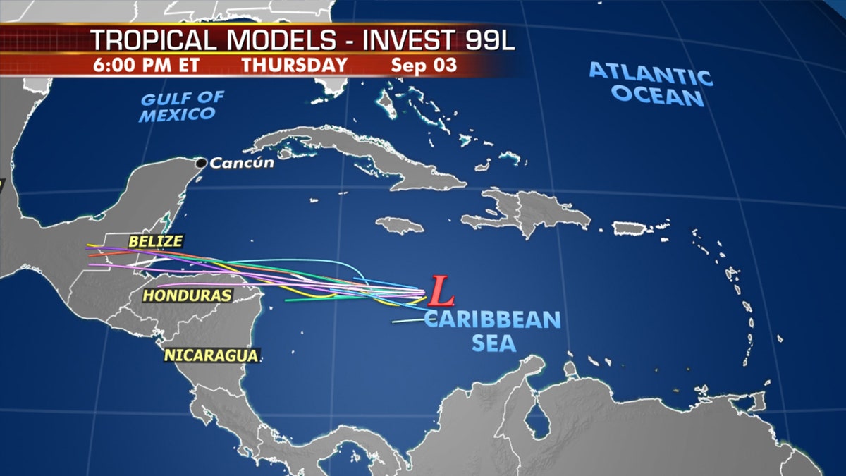
The next tropical system could impact Central America and the Yucatan Peninsula by Wednesday. (Fox News)
Between two to four inches of rain will be possible across northern Honduras, Belize, and the southeast
portion of the Mexican state of Quintana Roo beginning late Wednesday.
Tropical-storm-force winds will also arrive in the region at that time.
Tropical-storm-force winds extend outward up to 80 miles from the center of the storm, mainly in areas northeast through northwest from the center.
TROPICAL STORM WATCH VS. TROPICAL STORM WARNING: HERE'S THE DIFFERENCE
Dangerous surf is also forecast to impact the southern coast of Jamaica through Wednesday morning.
Nana has set a record for the earliest "N" named storm.
According to Colorado State University hurricane research scientist Philip Klotzbach, the prior record was Nate, which formed on Sept. 6, 2005.
This 2020 season has been active and record-breaking so far, with several storms breaking records for their respective letter for how early they formed.
On July 5, Tropical Storm Edouard become the earliest fifth-named storm on record. Tropical Storm Fay became the earliest sixth-named storm when it formed off the East Coast on July 9. Isaias, which went on to be a damaging hurricane that impacted the East Coast, also broke a record.
Laura, the season's 12th storm, became one of the strongest hurricanes ever to strike the U.S. when it made landfall in Louisiana last week as a Category 4 hurricane with 150 mph winds.
CLICK HERE FOR MORE WEATHER COVERAGE FROM FOX NEWS
The recent activity comes as the hurricane season has entered its most active month. The historical hurricane activity climbs through Sept. 10, when it peaks and starts to slowly go back down.
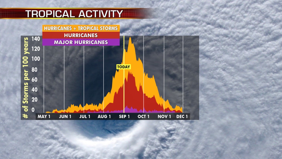
Hurricane season peaks in the month of September. (Fox News)
Historically, about two-thirds of all Atlantic hurricane activity happens between Aug. 20 to Oct. 10, Klotzbach tweeted earlier this month.
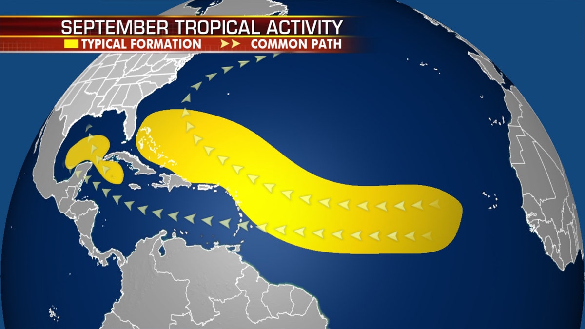
Where tropical systems tend to develop in the month of September. (Fox News)
NOAA forecasters are now calling for up to 25 named storms with winds of 39 mph or higher; of those, seven to 10 could become hurricanes. Among those hurricanes, three to six will be major, classified as Category 3, 4 and 5 with winds of 111 mph or higher.
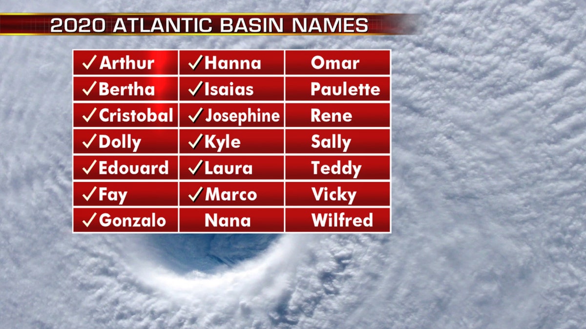
The names of the 2020 Atlantic hurricane season. (Fox News)
That's far above an average year. Based on 1981 to 2010 data, that is 12 named storms, six hurricanes and three major hurricanes. So far this year, there have been 14 named storms, including four hurricanes.
CLICK HERE FOR THE FOX NEWS APP
The 2020 Atlantic hurricane season runs from June 1 to Nov. 30 and includes the names: Arthur, Bertha, Cristobal, Dolly, Edouard, Fay, Gonzalo, Hanna, Isaias, Josephine, Kyle, Laura, Marco, Nana, Omar, Paulette, Rene, Sally, Teddy, Vicky and Wilfred.
Fox News' Janice Dean and Brandon Noriega contributed to this report.


