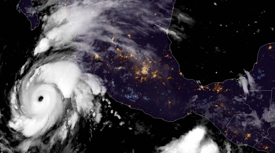
The third hurricane this season in the Eastern Pacific rapidly strengthened off Mexico's western coast on Tuesday, becoming the season's second major storm as it is forecast to swipe Baja California.
The U.S. National Hurricane Center (NHC) in Miami said that Hurricane Genevieve now has maximum sustained winds of 130 mph, and is located about 325 miles south-southeast of the southern tip of Baja California.
The storm is moving northwest at 14mph.
HURRICANE ELIDA STRENGTHENS TO CATEGORY 2 OFF MEXICO, STORM MAY CAUSE 'LIFE-THREATENING SURF'
In its 8 a.m. EDT update, the NHC said that Genevieve "rapidly intensified" to a Category 4 hurricane less than 24 hours after reaching hurricane-strength.
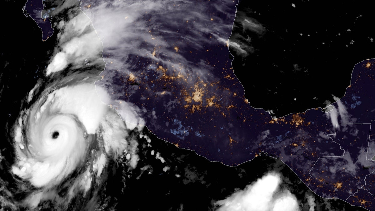
Hurricane Genevieve can be seen off the coast of Mexico on Aug. 18, 2020. (NOAA/GOES-East)
"Additional rapid strengthening is possible during the next 12 to 24 hours," the NHC stated.
Eric Blake, a hurricane specialist at the NHC, said the storm is an "impressive hurricane" on satellite.
"Quite a beast but very well anticipated by forecasts," he tweeted.
According to forecasters, Genevieve is moving toward the northwest, which is expected to continue as the storm slows down by early Thursday.
"On the forecast track, the center of Genevieve is expected to move parallel to but well offshore the coast of southwestern Mexico during the next day or so," the NHC said. "The center of the hurricane is forecast to move to the southwest of the southern portion of the Baja California peninsula on Wednesday night and Thursday."
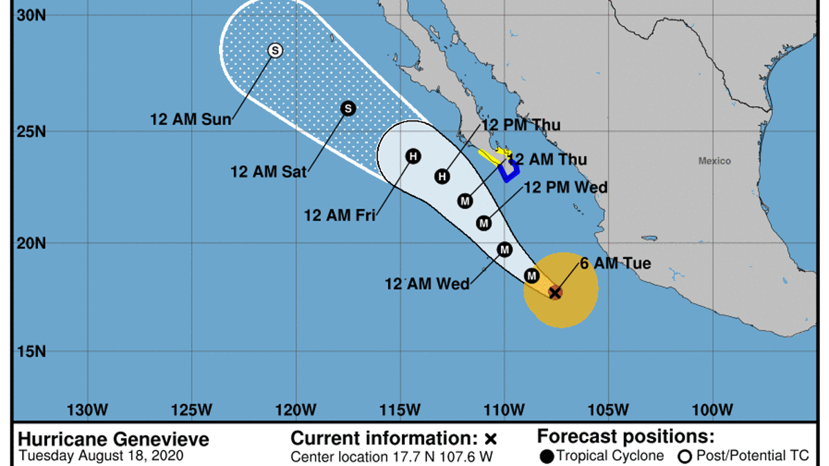
The forecast track of Hurricane Genevieve. (National Hurricane Center (NHC))
While the hurricane is now a Category 4 storm packing winds of 130 mph, forecasters say that Genevieve won't maintain that in the days ahead. Forecasters said that "rapid weakening" is expected by late Wednesday and should continue through the end of the week.
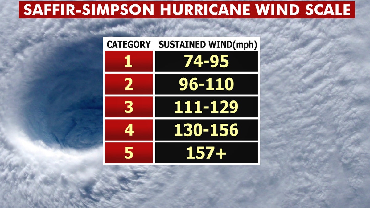
The Saffir-Simpson Hurricane Wind Scale. (Fox News)
The storm isn't forecast to make landfall, but is still expected to bring impacts to Mexico's coast.
2020 ATLANTIC HURRICANE SEASON HAS BROKEN RECORDS, NOAA NOW SAYS THERE MAY BE MORE STORMS THAN NAMES
A tropical storm warning has been posted for the southern Baja California peninsula from Los Barriles to Todos Santos, while tropical storm watches extend farther north.
Forecasters say that tropical storm conditions with high winds over 40 mph and rain are expected in the southern Baja California peninsula by Wednesday afternoon, especially over higher terrain.
Hurricane-force winds extend outward up to 30 miles from the center of the storm, while tropical-storm-force winds stretch outward up to 150 miles.
CLICK HERE FOR MORE WEATHER COVERAGE FROM FOX NEWS
Forecasters also warn that large swells produced by Genevieve are affecting portions of the southern coast of Mexico and will spread northward through Wednesday.
"These swells are likely to cause life-threatening surf and rip current conditions," the NHC said.
The hurricane is also forecast to bring 1 to 4 inches of rain across portions of far southern Baja California and the southwest coast of Mexico.
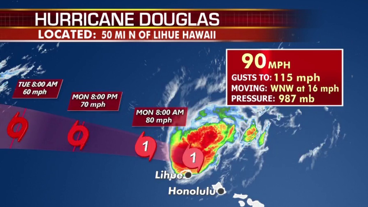
Genevieve is the seventh storm so far this season and the third hurricane and second major storm after Douglas, which strengthened into a Category 4 before giving Hawaii a near-miss last month.
Elida followed, strengthing into a Category 2 storm off Mexico and bringing rip currents to the area.
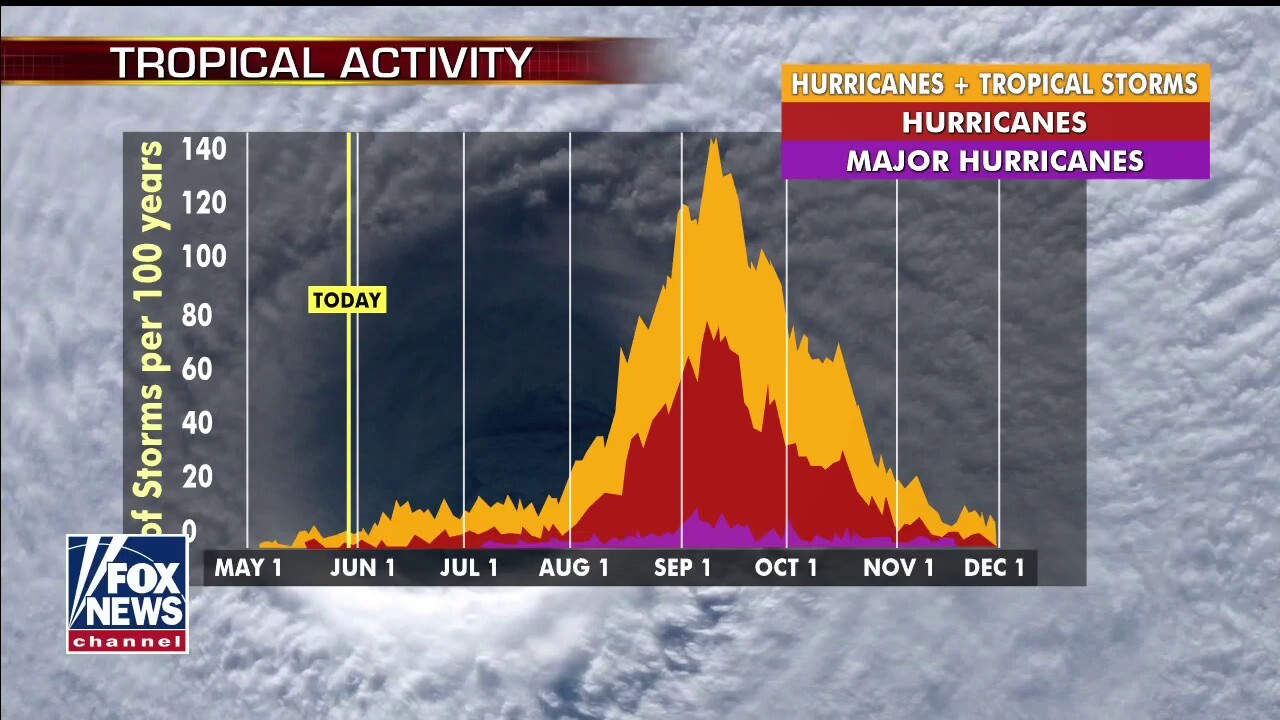
Hurricane season in the Pacific and for Hawaii lasts from June 1 until the end of November. August and September are historically active months for cyclones in the region.
Last year, four tropical cyclones developed in the Central Pacific. None directly impacted Hawaii.
CLICK HERE FOR THE FOX NEWS APP
In 2018, the massive and powerful Hurricane Lane made a last-minute turn and narrowly spared Oahu, Hawaii's most populous island. The last major hurricane to strike the state was Hurricane Iniki in 1992, which hit Kauai and caused massive damage across the island.
Fox News' Adam Klotz, Brandon Noriega, and The Associated Press contributed to this report.
