National forecast for Wednesday, August 19
Fox News meteorologist Adam Klotz has your FoxCast.
One of the tropical disturbances in the Atlantic is showing signs of life on Wednesday as the 2020 hurricane season appears ready to kick into high gear in the next couple of days.
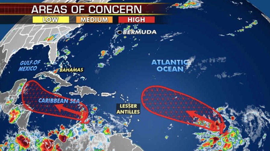
The U.S. National Hurricane Center (NHC) in Miami said Wednesday morning it's now tracking three tropical waves in the Atlantic basin that have the potential for development, including two labeled "high" with a greater than 60% chance.
"The disturbance with the greatest chance for development in the next couple of days is the one approaching the Leeward Islands," the NHC said.
ATLANTIC HURRICANE SEASON: WHERE DO TROPICAL STORMS FORM IN AUGUST?
According to the NHC, the first disturbance located about 1,000 miles east of the Lesser Antilles will likely develop into a depression or tropical storm sometime in the next day or two.
Forecasters put the formation chance at 90% and said the system continues to produce a "concentrated area of showers and thunderstorms" on its western side.
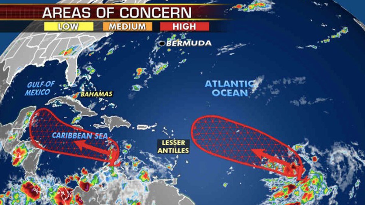
Forecasters are monitoring two areas with a high potential for development across the Atlantic basin. (Fox News)
The system is forecast to continue moving west-northwestward at 15 to 20 mph across the central and western portions of the tropical Atlantic in the coming days.
Another disturbance in the eastern Caribbean is also showing some signs of organization on Wednesday as it produces disorganized showers and thunderstorms.
A tropical depression is likely to form here in the next few days as it moves across the Caribbean toward Mexico's Yucatan Peninsula.
NOAA FORECASTING ACTIVE PEAK HURRICANE SEASON WITH UP TO 6 MAJOR STORMS
The NHC said that there's an 80% chance this develops into a tropical depression in the next 5 days when the system reaches the northwestern Caribbean Sea.
Areas across the Caribbean toward the Yucatán Peninsula may see impacts later this week or by this upcoming weekend.
A third, "vigorous tropical wave" is producing a large area of showers and thunderstorms over Guinea and
Sierra Leone as it moves off the African continent. As this system moves over the warm waters of the Atlantic, forecasters said that environmental conditions are expected to be conducive for some development as it enters the eastern Atlantic.
Forecasters put formation chances at 20% over the next five days, but say that conditions may become "less favorable" by early next week.
The next tropical system that forms would get the name "Laura," followed by "Marco." These two storms could potentially set another record this year if they form in the next week, according to Colorado State University's hurricane research scientist Phil Klotzbach.
The current record dates for the earliest 12th and 13th Atlantic named storms are August 29 and September 2, according to Klotzbach.
CLICK HERE FOR MORE WEATHER COVERAGE FROM FOX NEWS
NOAA forecasters are now calling for up to 25 named storms with winds of 39 mph or higher; of those, seven to 10 could become hurricanes. Among those hurricanes, three to six will be major, classified as Category 3, 4, and 5 with winds of 111 mph or higher.
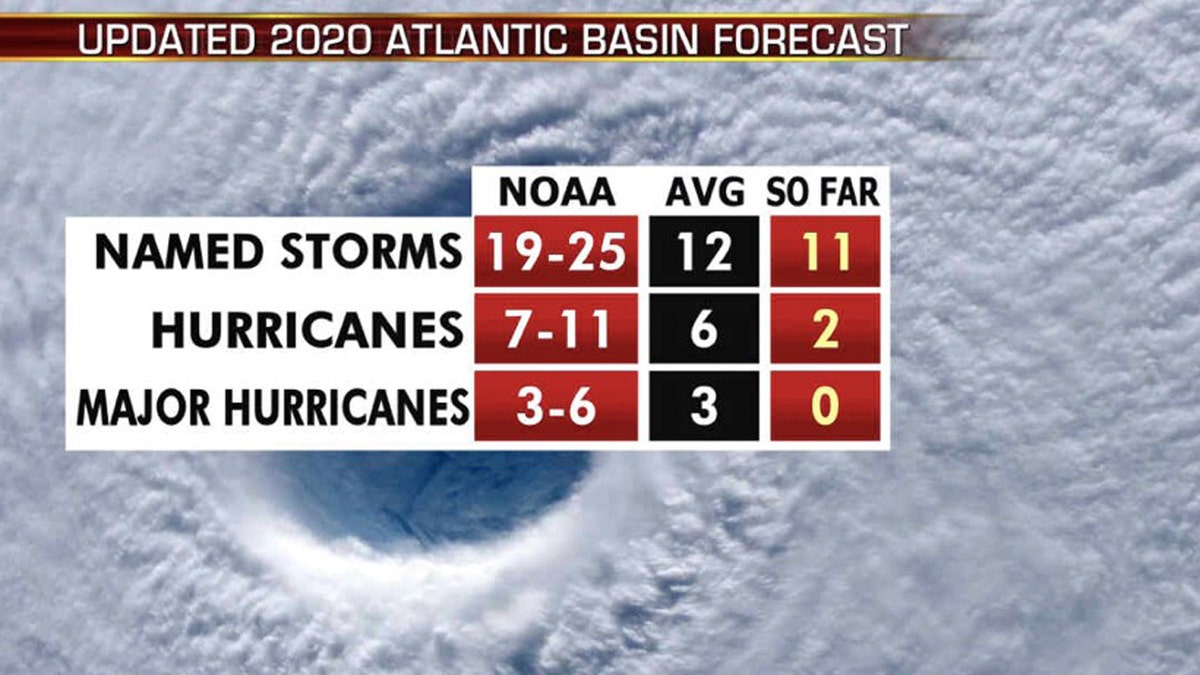
The updated 2020 Atlantic hurricane season forecast. (Fox News)
That's far above an average year. Based on 1981 to 2010 data, that is 12 named storms, six hurricanes, and three major hurricanes. So far this year, there have been 11 named storms, including two hurricanes.
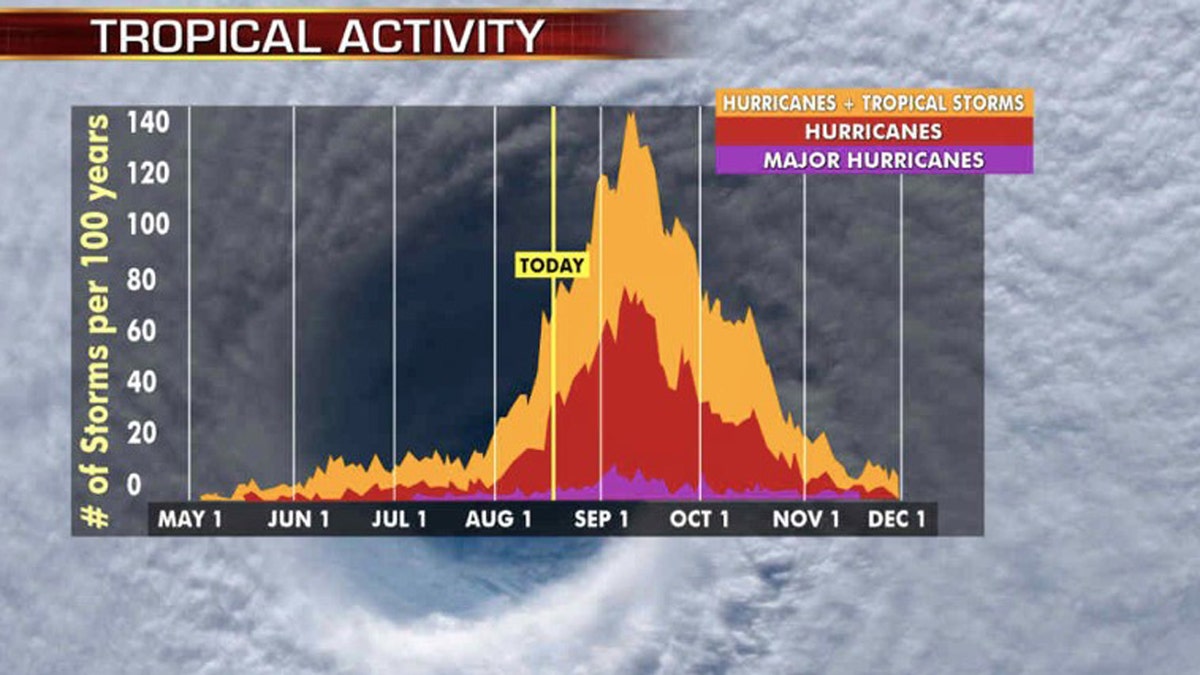
The most active stretch of the hurricane season is from late August to early October when most storms and major hurricanes are seen. (Fox News)
The most active stretch of the hurricane season is from late August to early October when most storms and major hurricanes are seen.
CLICK HERE FOR THE FOX NEWS APP
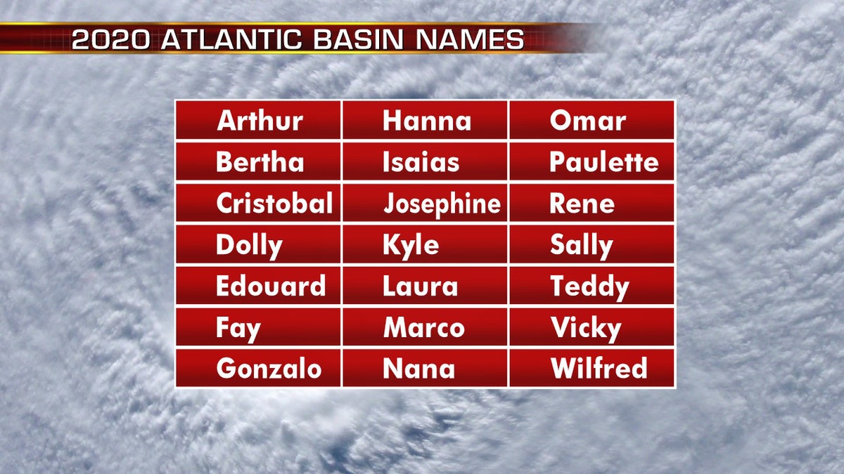
The names for the 2020 Atlantic hurricane season. (Fox News)
The 2020 Atlantic Hurricane Season runs from June 1 to Nov. 30 and includes the names: Arthur, Bertha, Cristobal, Dolly, Edouard, Fay, Gonzalo, Hanna, Isaias, Josephine, Kyle, Laura, Marco, Nana, Omar, Paulette, Rene, Sally, Teddy, Vicky and Wilfred.
Fox News' Janice Dean contributed to this report.


