Fox News Flash top headlines for August 29
Fox News Flash top headlines are here. Check out what's clicking on Foxnews.com.
Strong to severe storms will be possible Monday along a cold front that stretches from the Midwest down into Texas.
Some areas could be at risk for large hail, damaging winds, heavy rain and isolated tornadoes.
After flooding rainfall over Mississippi, skies should clear today for the state.
The heat is going to build once again across the Western U.S., especially the Southwest.
DOZENS OF MISSISSIPPI DAYCARE CHILDREN, WORKERS RESCUED FROM RISING FLOODWATERS
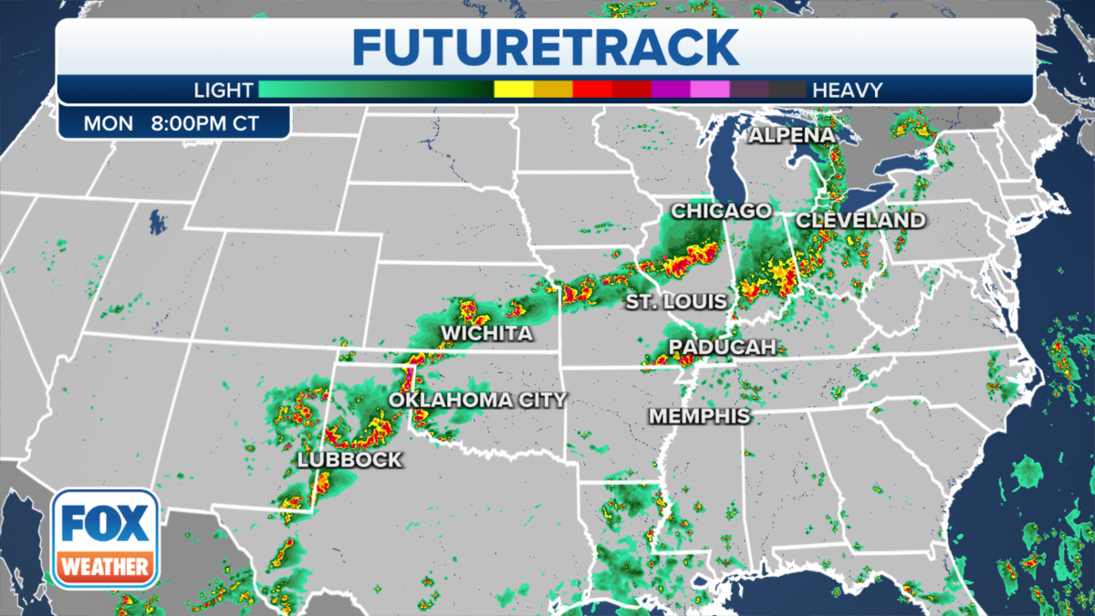
Expected severe weather for Monday, Aug. 29. (Fox News)
DINOSAUR TRACKS UNEARTHED IN TEXAS STATE PARK AS DROUGHT DRIES RIVER
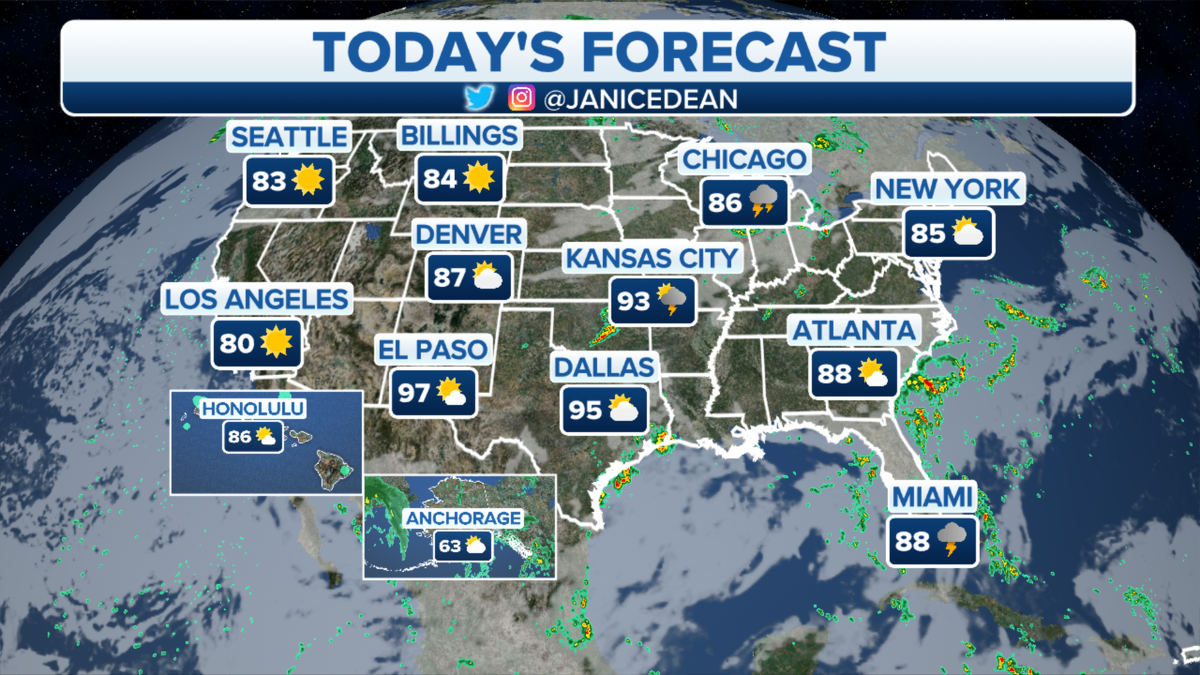
The national forecast for Monday, Aug. 29. (Fox News)
Daytime highs there will be well over 100 degrees.
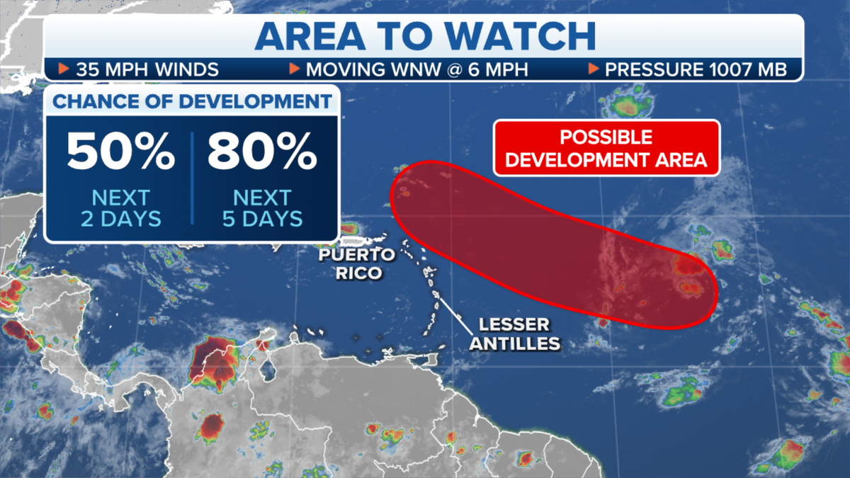
Tropical weather activity that is developing in the Atlantic Ocean. (Fox News)
Excessive heat watches are in effect starting Tuesday morning.
CLICK HERE TO GET THE FOX NEWS APP
Meanwhile, the tropics are starting to perk up in the Atlantic with several areas worth monitoring.


