Tornado approaching road in the heartland caught on video
A twister that tore across the heartland Friday approached a road and was caught on camera. (Credit: Fox Weather)
Additional rounds of life-threatening severe weather are likely over the Southern Plains, after twisters ripped through the nation's heartland on Friday. In addition, confidence is increasing for flash flooding in parts of east-central Oklahoma where 5-10 inches of rain may fall through Sunday. Over 50 million people are under threat of severe weather as the atmosphere recharges, stretching more than 1,500 miles from the Gulf Coast to the Great Lakes.
The greatest threat for tornadoes on Saturday stretched from Oklahoma through the Upper Mississippi Valley but is expected to slide eastward on Sunday.
Due to the risk, the NWS office in Norman, Oklahoma, launched a special weather balloon on Saturday afternoon to help survey the atmosphere to determine if storms would be able to blossom during the evening.
The Storm Prediction Center received over 100 reports of severe weather on Saturday, with most being of large hail, but several tornadoes were spotted in Kansas and Oklahoma.

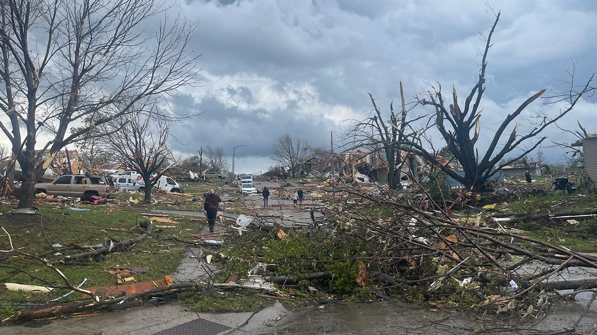
Downed trees and tornado debris after a tornadoes swept through Elkhorn, Nebraska on Friday, April 26. (Thomas Hinterdorfer @hinto62 on X)
The severe weather threat is expected to wane into Sunday, but still presents a widespread risk of additional storms across the Mississippi Valley. A Level 2 severe weather threat covers over 20 million people from Austin and Dallas in Texas to southeastern Iowa and western Illinois.
Once again, tornadoes, large hail and damaging wind gusts are all in play, but the storms are not expected to be as intense as on Friday.
Flash flooding likely in severe weather outbreak zone
If tornadoes, hail and wind were not enough, much of the Southern Plains is also at a significant risk of flash flooding into Sunday.
Thunderstorms may be slow movers or stall, leading to multiple inches of rain to fall on the same areas and significant flooding.

Debris is seen from a destroyed home northwest of Omaha, Neb., after a storm tore through the area on Friday, April 26, 2024. (AP)
NOAA’s Weather Prediction Center has now put parts of Oklahoma along the Interstate 40 corridor east of Oklahoma City in a Level 4 out of 4 flash flood risk into Sunday morning.
24-hour rainfall totals in the Level 4 flash flooding risk zone may approach or exceed 10 inches, forecasters said. But even 3-6 inches or more and flash flooding is expected from the Red River Valley into much of Oklahoma, including Oklahoma City and Tulsa.
CLICK HERE TO GET THE FOX NEWS APP
"High" risks for flash flooding are only issued on about 4% of days (including tropical and non-tropical events), but this risk category accounts for 39% of flood-related fatalities and 83% of flood-related damages in the continental U.S., according to research by WPC meteorologists. What's more, 46% of high-risk flood days have at least one fatality or injury, and 62% of such days have at least $1 million in damages, Greg Carbin, forecast operations branch chief at the WPC, noted in the research.
