


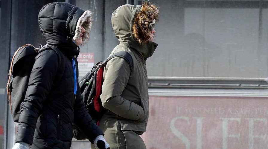
Midwest braces for potentially record-breaking cold air
Winds which typically hold the polar vortex in place over the North Pole have destabilized, allowing super cold air to dip south; Mike Tobin reports from Chicago.
A winter storm system bringing blizzard-like conditions across the Upper Midwest on Monday will dump wintry weather across parts of the Deep South and Northeast by midweek, creating treacherous travel conditions.
The National Weather Service's Weather Prediction Center said that parts of southeastern Minnesota and Wisconsin could see over a foot of snow. The winter storm will then bring upwards of a foot of snow to Michigan before targeting the Northeast overnight Monday into Tuesday.
Rain and snow will develop along an arctic front associated with the storm over parts of the Ohio Valley stretching into the Lower Mississippi Valley on Monday, according to the NWS.
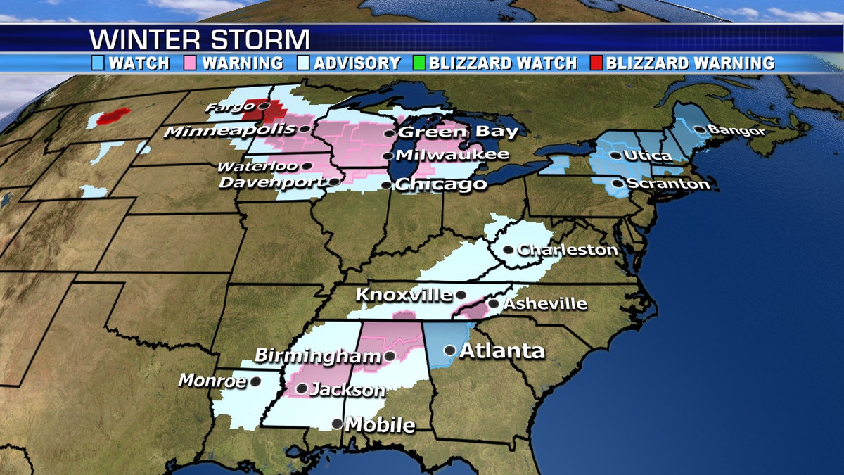
Winter storm warnings and advisories associated with a system that will usher in arctic air across parts of the country. (Fox News)
The snow and rain will move eastward by Tuesday afternoon, affecting cities such as Birmingham, Atlanta and Nashville.
WIND CHILLS OF MINUS-45 TO MINUS-60 EXPECTED IN CHICAGO, MUCH OF UPPER MIDWEST
"A dangerous week of cold air and travel conditions are coming up," Fox News Senior Meteorologist Janice Dean said Monday. "Snow and ice will coat even the Deep South Tuesday through Wednesday, which will make travel incredibly difficult and possibly crippling."
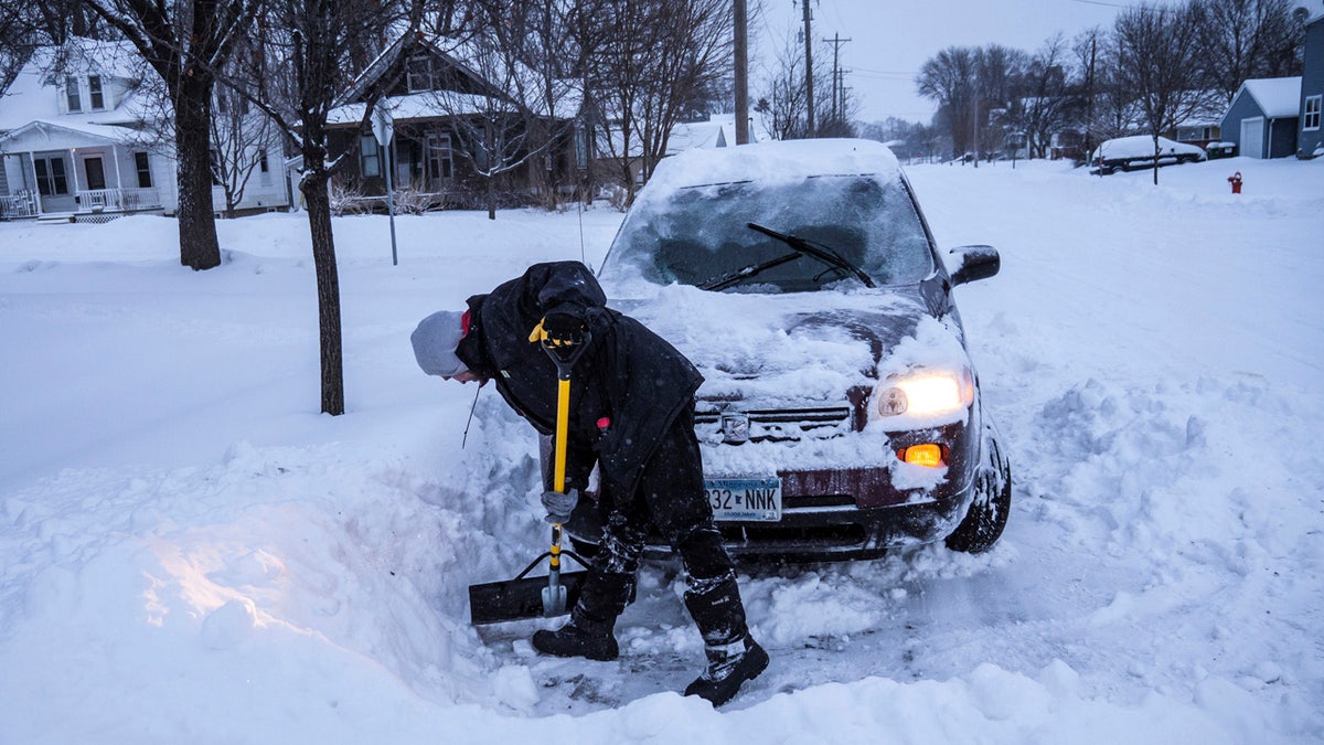
Adam Fischer shovels out his vehicle to go to work Monday, Jan. 28, 2019, in Rochester, Minn. (Joe Ahlquist/The Rochester Post-Bulletin via AP)
Winter storm warnings and advisories were posted stretching from Mississippi stretching up through Tennessee into West Virginia.

The winter storm will bring snow into parts of the Deep South on Tuesday. (Fox News)
Winter storm watches were also posted for the Atlanta area for Tuesday were up to 2 inches of snow may fall, FOX5 reported. Public works crews were spending Monday pretreating roads in Atlanta, which has a busy week ahead of the Super Bowl on Sunday.
Snowplow drivers had trouble keeping up with the snow in Wisconsin and Minnesota, where up to 14 inches is expected. Chicago-area commuters woke up to heavy snowfall, with more than 5 inches already on the ground. In Michigan, non-essential government offices were closed, including the Capitol.

Stephen Johnson clears snow off his neighbor's driveway into Court Street during a winter snowstorm on Monday, Jan. 28, 2019, in Flint, Mich. (Jake May/The Flint Journal via AP)
In Chicago, O'Hare International Airport had about 790 canceled flights Monday morning and about 220 canceled flights were reported at Midway International Airport. The high temperature forecast at O'Hare on Wednesday is negative 14 degrees, which would break a record set on Jan. 18, 1994.

Mike Johnson snow blows his driveway Monday, Jan. 28, 2019, in Rochester, Minn. (Joe Ahlquist/The Rochester Post-Bulletin via AP)
The largest public school districts in Wisconsin and Minnesota were among those closed Monday, including districts in Milwaukee, Minneapolis and St. Paul. The Minnesota State Patrol was responding to scores of spin outs and crashes early Monday in the Twin Cities metro area, even before the busiest commute time, because of snow-covered and icy roads.
In Wisconsin, plow drivers were having a difficult time keeping up with the snow in Sheboygan. Minutes after a plow passed, roads were once again becoming snow covered, according to the Department of Public Works.
What is a polar vortex?
The polar vortex could sweep across the east coast this winter, bringing with it harsh conditions, climate scientists have warned.
WHAT IS A POLAR VORTEX? A LOOK AT WHAT COULD BE IN THE FORECAST THIS WINTER
Up to 3 inches of snow is expected in the South, while the interior Northeast will see between 6 inches and a foot of snow by Wednesday night.
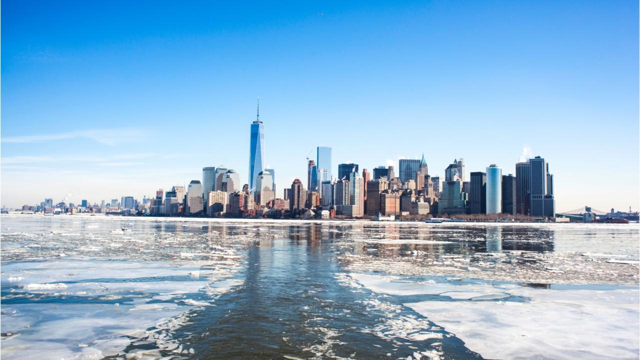
The storm system is associated with an arctic front that is responsible for a cold air outbreak associated with the polar vortex that will bring bone-chilling cold to the Midwest.
CLICK HERE TO GET THE FOX NEWS APP
Temperatures on Wednesday could fall to 30 degrees below zero, and could feel as cold as 60 degrees below zero because of the wind chill.

Bitter cold is forecast to impact the Upper Midwest by Wednesday and Thursday. (Fox News)
"Some of the coldest air in decades will pour in across the Northern Plains, Midwest and Great Lakes with windchills in the negative-40 to negative-50 degree range and air temperatures below zero for several days," Dean said. "This will be dangerous and potentially deadly for these regions, and people need to stay inside."
The Associated Press contributed to this report.

True Crime
The hottest stories ripped from the headlines, from crime to courts, legal and scandal.
By entering your email and clicking the Subscribe button, you agree to the Fox News Privacy Policy and Terms of Use, and agree to receive content and promotional communications from Fox News. You understand that you can opt-out at any time.
