


After a quiet weather start to the month of November, changes will begin on Thursday that will eventually sweep eastward.
The quiet warm, dry weather pattern across the U.S. is about to end, especially across the West as several systems move, bringing widespread rain and mountain snow to the region.
"Big changes going on here with plenty of rain and mountain snow over the next couple of days," Fox News senior meteorologist Janice Dean said on "Fox & Friends."
AMERICA'S TOP 5 SNOWIEST CITIES
A dip in the jetstream will allow for big changes as we head into the weekend and next week.

Snow will arrive in the Cascades and sweep into the Sierra Nevada by this weekend in a new wintry blast for the West. (File: AP Photo/David Zalubowski)
Moisture coming in off the Pacific combined with colder air will bring snow to the Cascades in the Pacific Northwest.
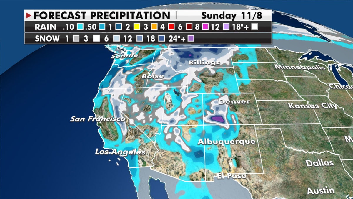
Expected precipitation from the next storm system that will impact the West. (Fox News)
Winter weather advisories are up for Friday night across northern California, and a winter weather watch has been issued for the highest elevations in the Sierra Nevada into Saturday.
Over the Plains, strong winds with the incoming storm system and dry conditions will raise the fire danger.
AMERICA'S TOP 5 COLDEST STATES
Red flag warnings are also up for California and Nevada on Thursday due to the gusty conditions.
In areas ahead of the storm system, high temperatures have been 20 to 35 degrees above normal, with some places having the potential of breaking record highs.
That warm weather will continue to shift east, giving the Midwest and Northeast warm conditions for the weekend.
CLICK HERE FOR MORE WEATHER COVERAGE FROM FOX NEWS
"The rest of the country, very quiet, very beautiful," Dean said Thursday.
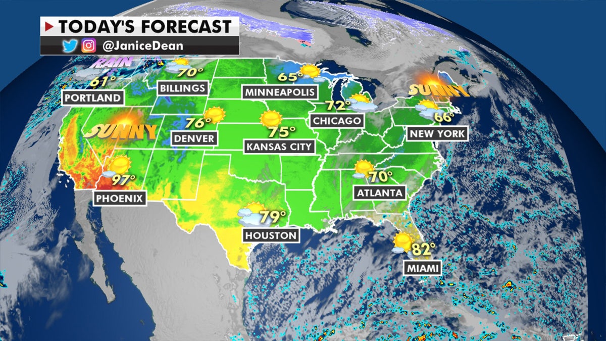
The national forecast for Thursday, Nov. 5, 2020. (Fox News)
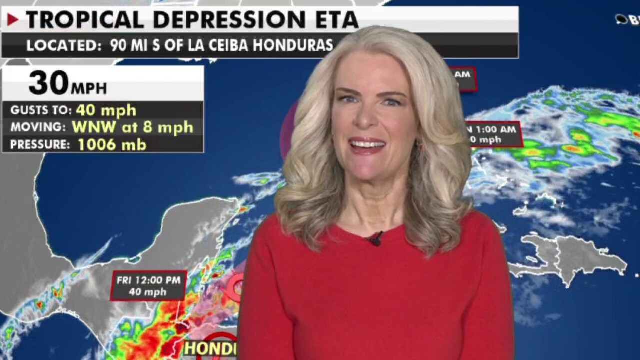
That could change by early next week in Florida when what's left of Tropical Depression Eta may edge close to the southern part of the state.

True Crime
The hottest stories ripped from the headlines, from crime to courts, legal and scandal.
By entering your email and clicking the Subscribe button, you agree to the Fox News Privacy Policy and Terms of Use, and agree to receive content and promotional communications from Fox News. You understand that you can opt-out at any time.
