Fox News Flash top headlines for April 15
Fox News Flash top headlines are here. Check out what's clicking on Foxnews.com.
A historic winter storm across the northern Plains is finally winding down.
Additional light snowfall will continue on Friday, but the heaviest snow has ended.
NEW MEXICO WILDFIRE KILLS 2, CONTINUES TO RAGE ACROSS WEST
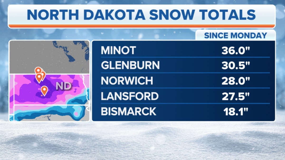
In total, as many as 36 inches of snow were reported in North Dakota and 47 inches in Montana.

North Dakota snow totals (Credit: Fox News)
In North Dakota, travel remains widely shut down, as snowdrifts as high as 7 feet have been reported.
The last of the snowfall from this system will taper off across Minnesota and Wisconsin on Friday.
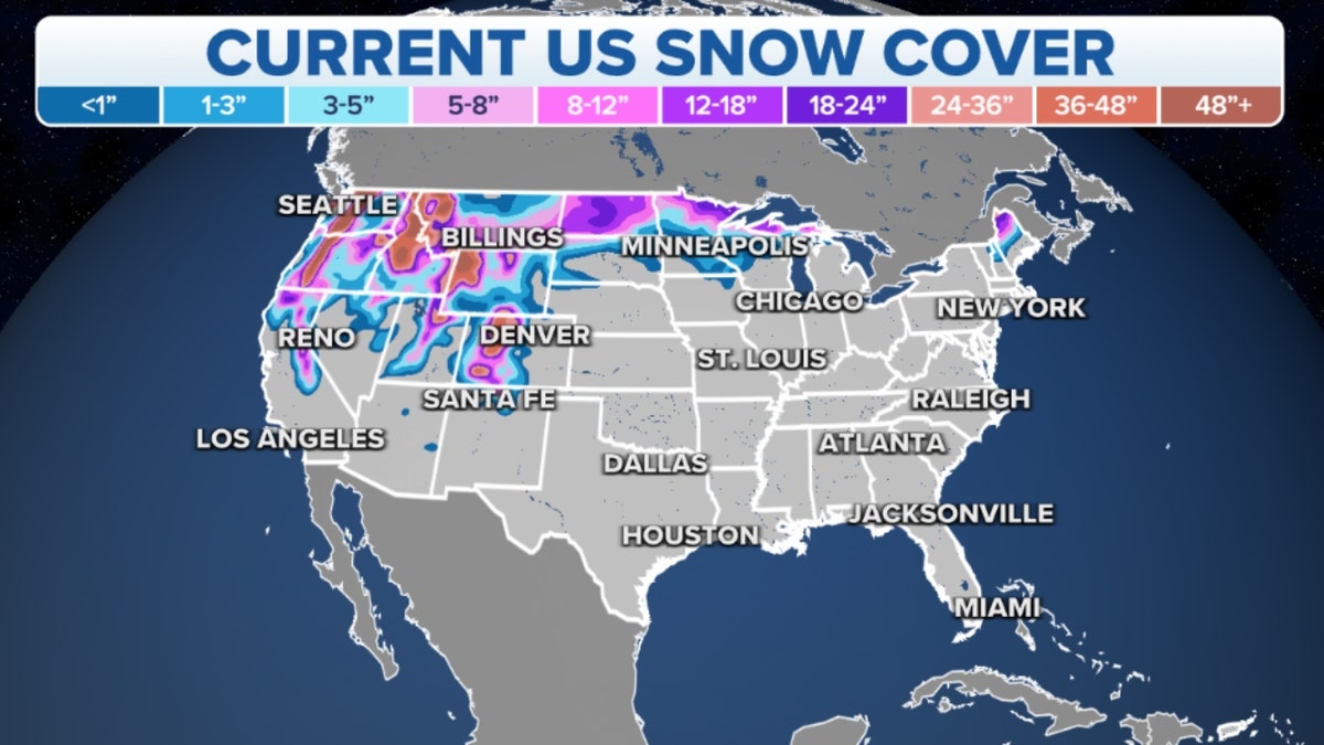
However, the heavy snowfall totals will stick around for a while.

Map of current U.S. snow cover (Credit: Fox News)
Temperatures across these areas will remain below freezing until the middle of next week.
In the southern U.S., an active period of some stormy weather is forecast for Easter weekend.

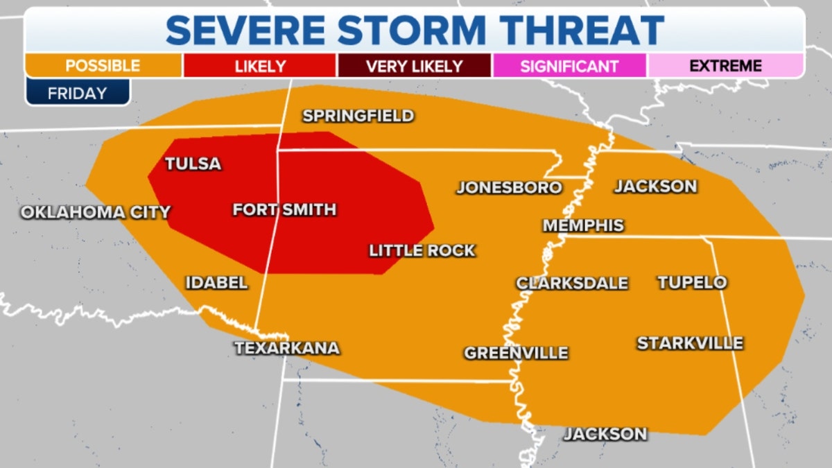
Map of southern severe storm threats (Credit: Fox News)
The severe potential for these storms is limited, but isolated severe storms will be possible each day.
Beginning Friday evening, storms will start from Oklahoma into the lower Mississippi Valley.
CLICK HERE TO GET THE FOX NEWS APP
Excessive moisture may be the biggest concern with these storms.
Totals of over 2 inches will be widespread, while local amounts may reach 4-5 inches.


