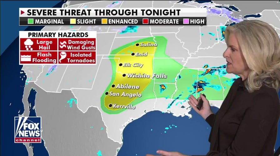
A strengthening storm system is expected to bring the risk for several days of severe weather across the Plains and into Deep South.
More heavy snow will also be in the forecast over some of the same areas that received historic snowfall over the weekend.

The national forecast for Tuesday, March 16. (Fox News)
Heavy rain, flash flooding and severe storms will start later today and continue through Thursday.
RECORD-BREAKING BLIZZARD IS WORST TO HIT DENVER IN NEARLY 15 YEARS

The risk of severe weather through tonight. (Fox News)
The highest risk for strong storms, including tornadoes, will be on Wednesday, where the National Weather Service's Storm Prediction Center has issued a "moderate" risk bullseye for large hail, damaging winds and the possibility for destructive tornadoes.
CLICK HERE TO GET THE FOX NEWS APP
This area includes cities like Birmingham, Alabama, Little Rock, Arkansas and Memphis.

The risk of severe weather in the days ahead. (Fox News)
Also, high winds, warm temperatures and low humidity will keep the fire danger high over parts of the southern High Plains.


