


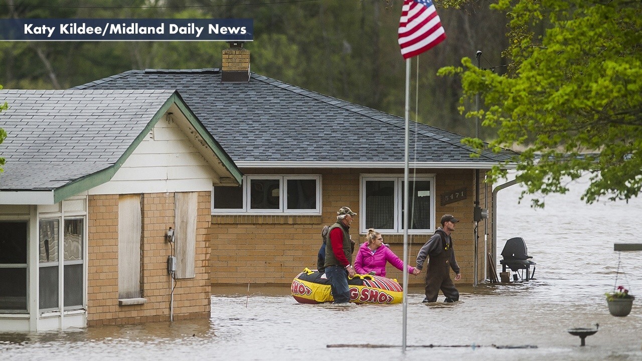
Severe flooding in central Michigan called a 'life-threatening situation'
Flooding in Michigan hits record levels; Mike Tobin reports.
Get all the latest news on coronavirus and more delivered daily to your inbox. Sign up here.
Residential neighborhoods filled with floodwater, a university football field turned into an island, and more devastation were captured in new satellite images from Wednesday that show the extent of flooding in central Michigan.
Officials said the Tittabawassee River crested Wednesday night at just over 35 feet in the city of Midland, about 3 feet below the forecast level after floodwaters overtook two dams and forced the evacuation of about 10,000 people from their homes.
President Trump on Thursday declared a state of emergency for Michigan, freeing up federal aid for storm and flood relief.
Midland officials urged residents not to return yet, with Midland County Board of Commissioners Chairman Mark Bone saying Wednesday that the river won't drop to the 24-foot flood stage until "the end of the weekend or later during Memorial Day."
“It’s essentially a mess out there, and it isn’t safe to drive around barriers or travel on the roads that are deemed closed,” he told reporters. “Everybody please stay safe and do your best out there and we’ll get through this.”
SWOLLEN MICHIGAN RIVER CRESTS AS WHITMER, OFFICIALS WARN FLOOD DANGER ISN'T OVER YET
Satellite imagery collected by Maxar shows the extent of the expanding floodwaters near Midland.
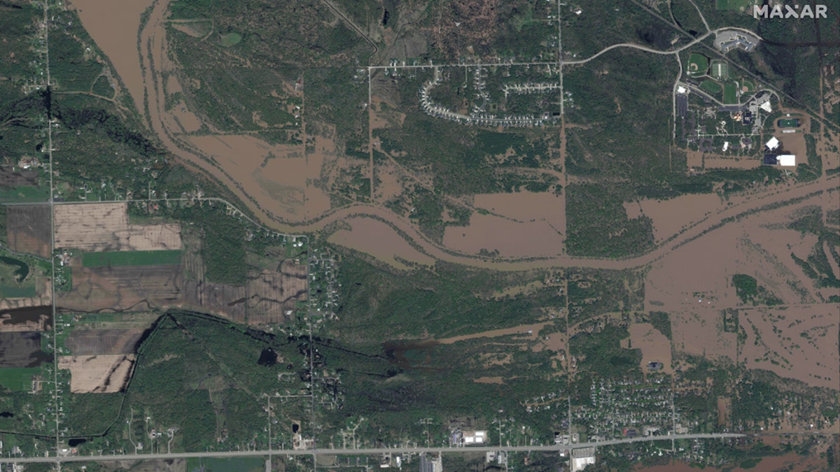
Flooding along the Tittabawassee River in central Michigan as seen in this satellite photo from Maxar on Thursday. (Satellite image ©2020 Maxar Technologies)
The images show flooded streets and homes in residential areas.
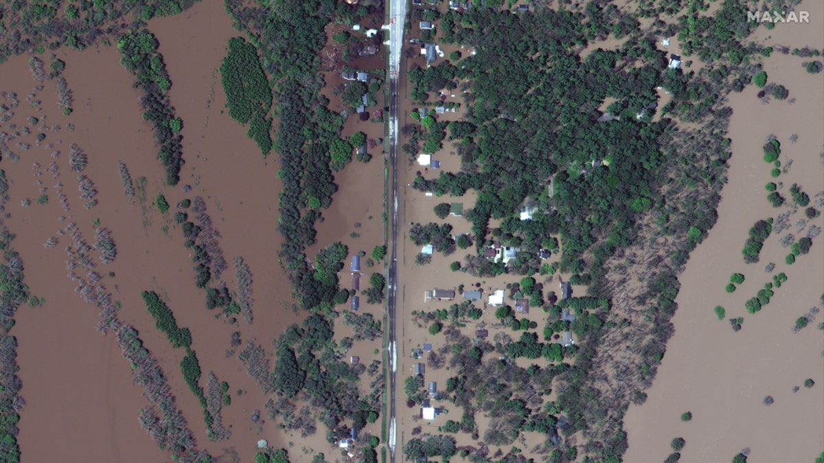
Flood residential neighborhoods can be seen in satellite images in central Michigan on Wednesday. (Satellite image ©2020 Maxar Technologies)
A close-up shows Windover High School in West Midland, with a flooded playground visible amidst the floodwaters.
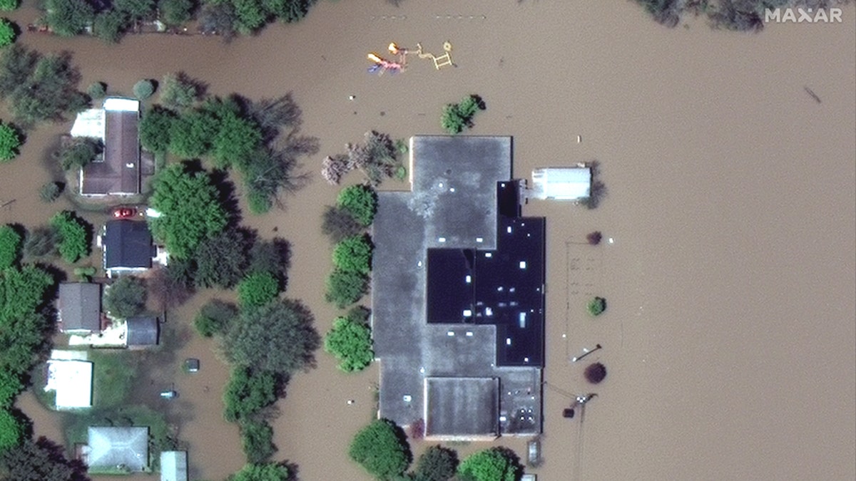
The flooded grounds of Windover High School in West Midland, Michigan, on May 20. (Satellite image ©2020 Maxar Technologies)
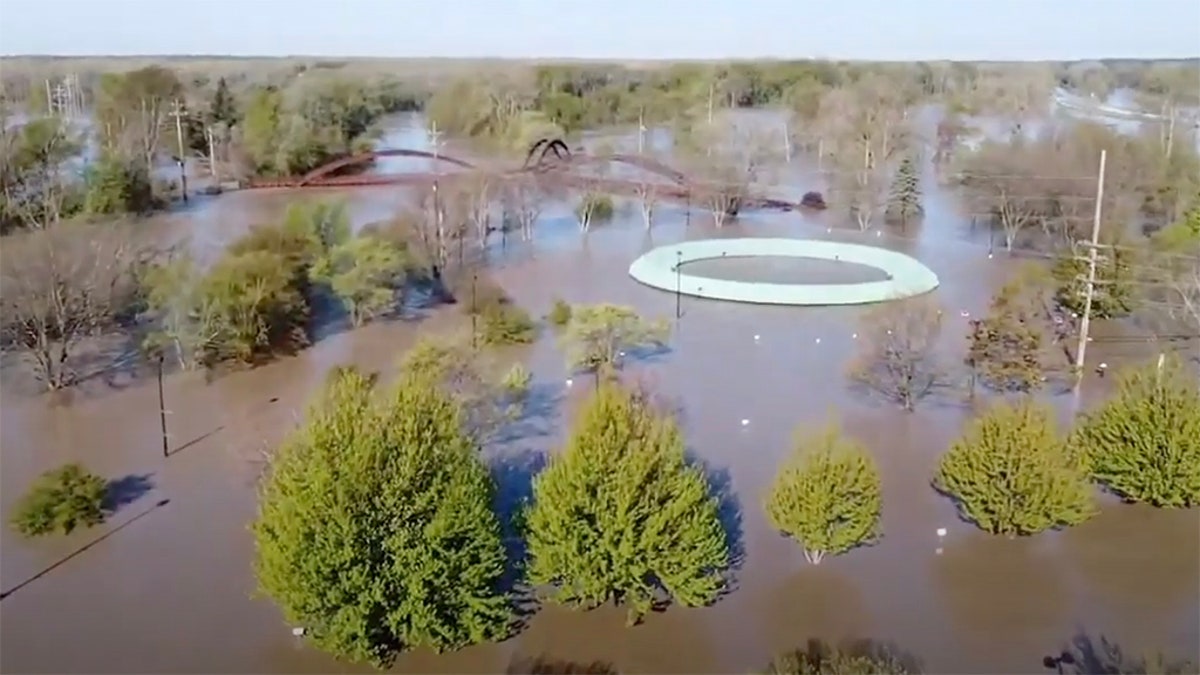
The campus of Northwood University can be seen with floodwaters encroaching, making the school's football field an island surrounded by brown water.
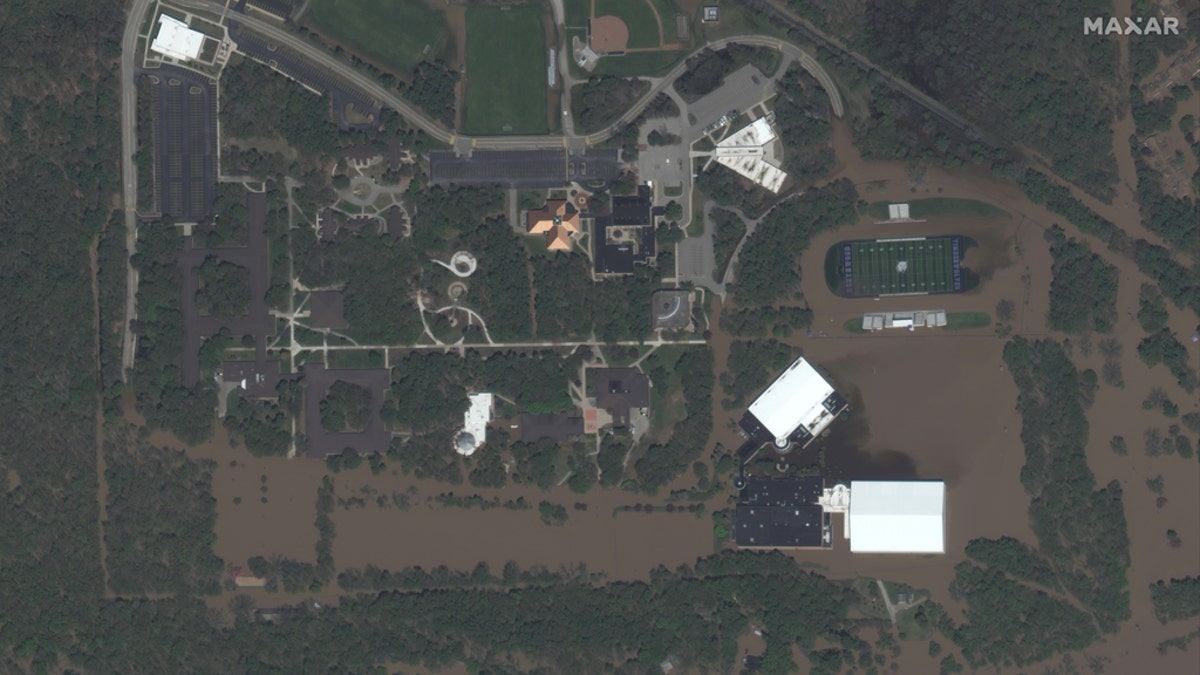
Northwood University's campus impacted by floodwaters on May 20. (Satellite image ©2020 Maxar Technologies)
Other impacted areas along the swollen Tittabasassee River and the communities to the west of Midland also can be seen in the images released by Maxar.
Midland City Manager Brad Kaye said that flood heights reached that of a "500-year flood." The United States Geological Survey (USGS) says that a "500-year-flood" means there's a 0.002 percent chance -- 1 in 500 -- of it occurring in a given year.
MICHIGAN DAM THAT FAILED HAD LICENSE REVOKED BY FEDS OVER FEARS IT COULDN'T WITHSTAND MAJOR FLOODING
Michigan Gov. Gretchen Whitmer, who declared a state of emergency in Midland County, went to Midland Wednesday afternoon and followed up with President Trump soon after, requesting federal aid to help residents.
"I think, like everyone, it was hard to believe we're in the midst of a 100-year crisis, a global pandemic and we're also dealing with a flooding event that looks to be the worse in 500 years," she said.
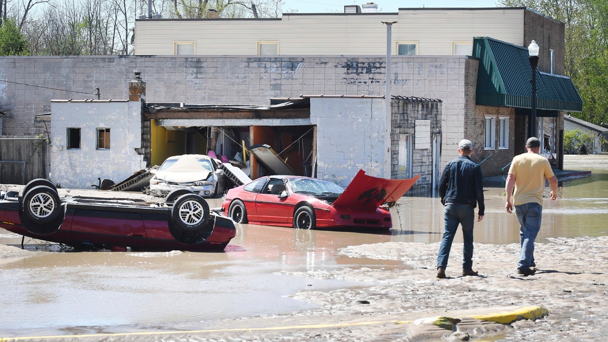
Cars are scattered and tipped over in downtown Sanford, Mich. after flooding along the Tittabawassee River on May 20. (Daniel Mears/ The Detroit News via AP)
As of Thursday morning, no deaths or injuries have been reported due to the flooding in Michigan. There is some concern that the floodwaters are mixing with containment ponds at a Dow Chemical Co. plant and could displace sediment from a downstream Superfund site, though the company said there was no risk to people or the environment.
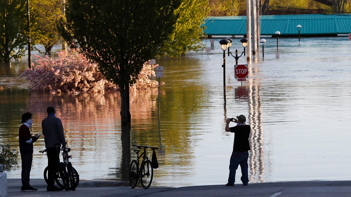
People photograph the floodwaters of the Tittabawassee River that encroached on downtown Midland, Mich., May 20. (AP Photo/Carlos Osorio)
Dow told FOX2 in a statement the ponds hold only water, and it has not detected chemical releases from the plant in Midland where the company was founded, though the U.S. Environmental Protection Agency said state officials would evaluate the plant when it is able.
CLICK HERE FOR MORE WEATHER COVERAGE FROM FOX NEWS
Once the flooding recedes, Dow will be required to assess the Superfund site — contaminated with dioxins the company dumped in the last century — to determine if any contamination was released, the EPA said.
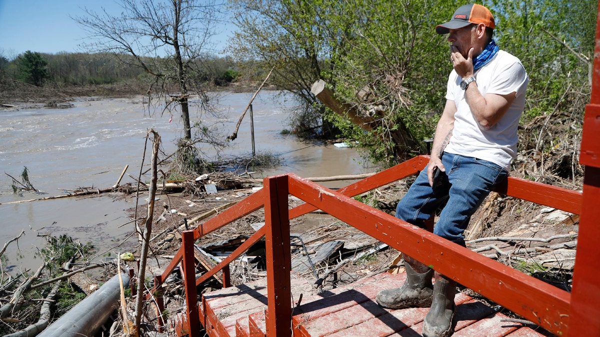
Dan Dionne looks over his former deck outside his home, May 20, in Edenville, Mich. (AP Photo/Carlos Osorio)
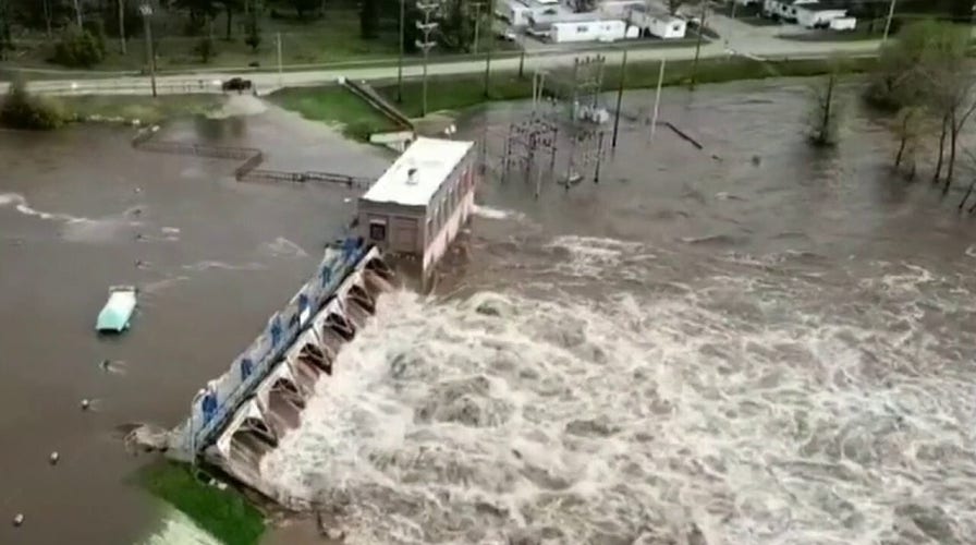
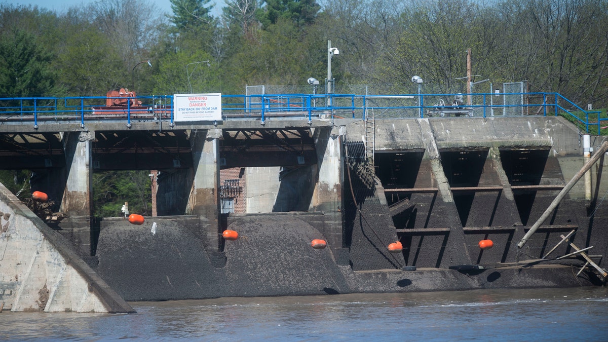
Residents near the river were urged to seek higher ground following what the National Weather Service (NWS) called “catastrophic dam failures” at the Edenville Dam, about 20 miles northwest of Midland, and the Sanford Dam, about 8 miles downriver.
Midland City Manager Brad Kaye said Wednesday that the Sanford Dam is overflowing, but that the extent of structural damage isn’t yet known.
This footage, filmed by Anthony Clark on May 20, shows an aerial view of Floodwaters in Midland, Mich. can be seen on May 20, after two dams in were overtaken following heavy rainfall, forcing the evacuation of communities downstream. (Anthony Clark via Storyful)
In 2018, the Federal Energy Regulatory Commission (FERC) revoked Boyce Hydro’s license to operate the Edenville Dam due to non-compliance issues that included spillway capacity and the inability to pass the most severe flood reasonably possible. That year, the state rated the dam, built in 1924, in unsatisfactory condition.
CLICK HERE FOR THE FOX NEWS APP
Whitmer said the state would investigate the operators of the dams and “pursue every line of legal recourse we have.”
The remains of the Edenville Dam, as seen on Wednesday, May 20, 2020 in Edenville Township north of Midland. (Jake May/The Flint Journal, MLive.com via AP)
“The initial readout is that this was a known problem for a while and that’s why it's important that we do our due diligence,” Whitmer said Wednesday.
Fox News' Nick Givas, Kellianne Jones and The Associated Press contributed to this report.

True Crime
The hottest stories ripped from the headlines, from crime to courts, legal and scandal.
By entering your email and clicking the Subscribe button, you agree to the Fox News Privacy Policy and Terms of Use, and agree to receive content and promotional communications from Fox News. You understand that you can opt-out at any time.
