


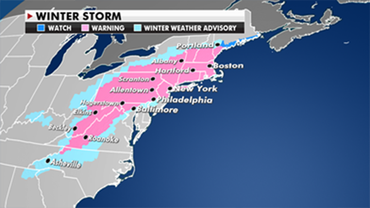
A major nor’easter is set to pack a punch and bring big snow to the Mid-Atlantic and Northeast on Wednesday afternoon and into Thursday morning.
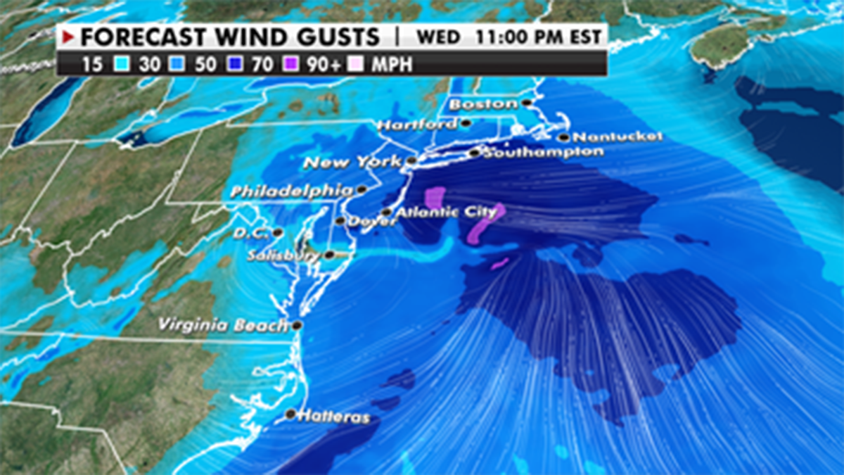
A classic coastal low will set up just off the Northeast Coast and bring rain, ice, heavy snow, strong winds and blizzard conditions in some areas. The southern Appalachians and the interior sections of the Mid-Atlantic will see the possibility for accumulating ice, which will lead to travel disruptions, possible powerline damage and tree damage.
Heavy snow will then move into areas northwest of the Interstate 95 corridor. Parts of the interior sections of Pennsylvania and New York could see over 2 feet of snow, while Washington, D.C., will see some snow but mainly a wintry mix.
LIVE UPDATES: NOR'EASTER COULD BE BIGGEST EAST COAST STORM IN YEARS
Philadelphia will also get a mixture, which could cut back off some of the snow totals; however, it looks like New York and Boston could get some impressive totals depending on where the low sets up offshore.
Parts of West Virginia and southern Maine could see a foot or more as well. This would be more snow in one storm than some regions saw all last winter.
Forecasters recommend residents in these regions be prepared for a major weather event and stay tuned to local forecasts.
FEDEX, PFIZER SAFEGUARD COVID-19 VACCINE DISTRIBUTION AHEAD OF SEVERE WEATHER
Very strong winds will also bring the potential of blizzard conditions and coastal flooding. We could also see the potential for some strong thunderstorms over parts of the Outer Banks and eastern North Carolina.
CLICK HERE TO GET THE FOX NEWS APP
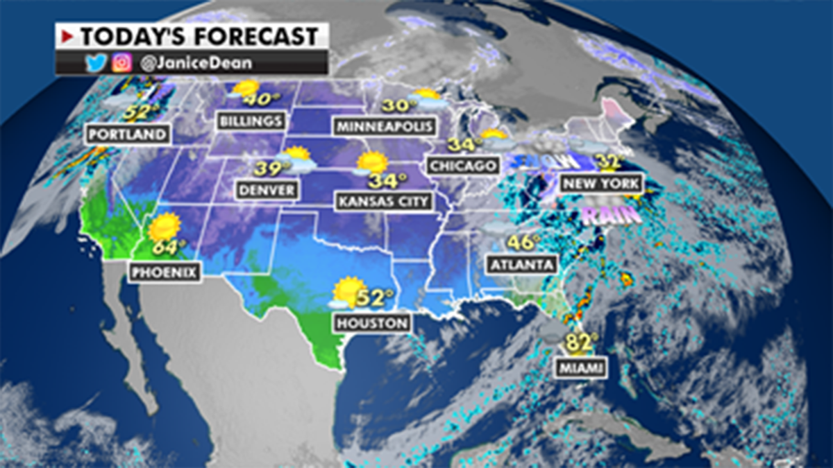
In other weather news, the Northwest is also seeing rain and mountain snow with a couple of systems moving in over the next few days.

True Crime
The hottest stories ripped from the headlines, from crime to courts, legal and scandal.
By entering your email and clicking the Subscribe button, you agree to the Fox News Privacy Policy and Terms of Use, and agree to receive content and promotional communications from Fox News. You understand that you can opt-out at any time.
