


Tropical Storm Beta nears Texas coast
Fox News senior meteorologist Janice Dean has your FoxCast.
The core of Hurricane Teddy is passing east of Bermuda on Monday, but the large storm will have impacts stretching across the East Coast of the U.S.
The National Hurricane Center (NHC) said Monday that Hurricane Teddy is a Category 2 storm, packing maximum sustained winds of 100 mph and is located about 160 miles southeast of Bermuda, moving north-northeast at 9 mph.
Teddy will pass east of Bermuda throughout the day, with tropical storm conditions already moving over the island.
TROPICAL STORM BETA TAKES AIM AT TEXAS, LOUISIANA AS GULF COAST SEES STORM SURGE, FLOODING
Teddy will then lose its tropical characteristics as it transitions into a very strong post-tropical system as it races toward Atlantic Canada.
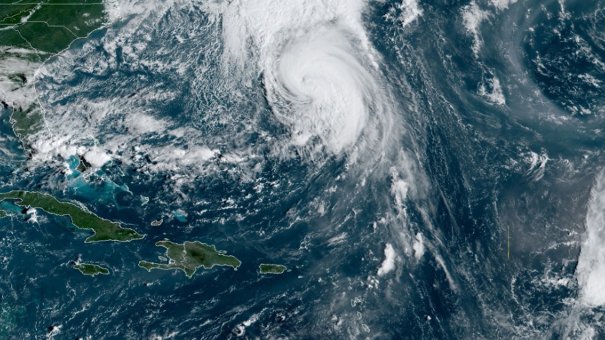
Hurricane Teddy can be seen passing near Bermuda on Sept. 21, 2020. (NOAA/GOES-East)
The storm will then pass over the Canadian Maritimes from Tuesday night into Wednesday.
Teddy is a large hurricane, with hurricane-force winds extending outward up to 70 miles of the storm while tropical storm-force winds stretch up to 230 miles.

The forecast track of Hurricane Teddy (Fox News)
The storm's large size is generating dangerous ocean conditions that are reaching the U.S.
"We are going to see the potential for dangerous life-threatening surf and rip currents all along the East Coast," Fox News Senior Meteorologist Janice Dean said on "Fox & Friends."
LOUISIANA RESIDENTS FACE TOUGH ROAD TO RECOVERY WITH CORONAVIRUS RESTRICTIONS AFTER HURRICANE LAURA
Life-threatening high surf and rip currents will be very dangerous along the East Coast throughout this week.
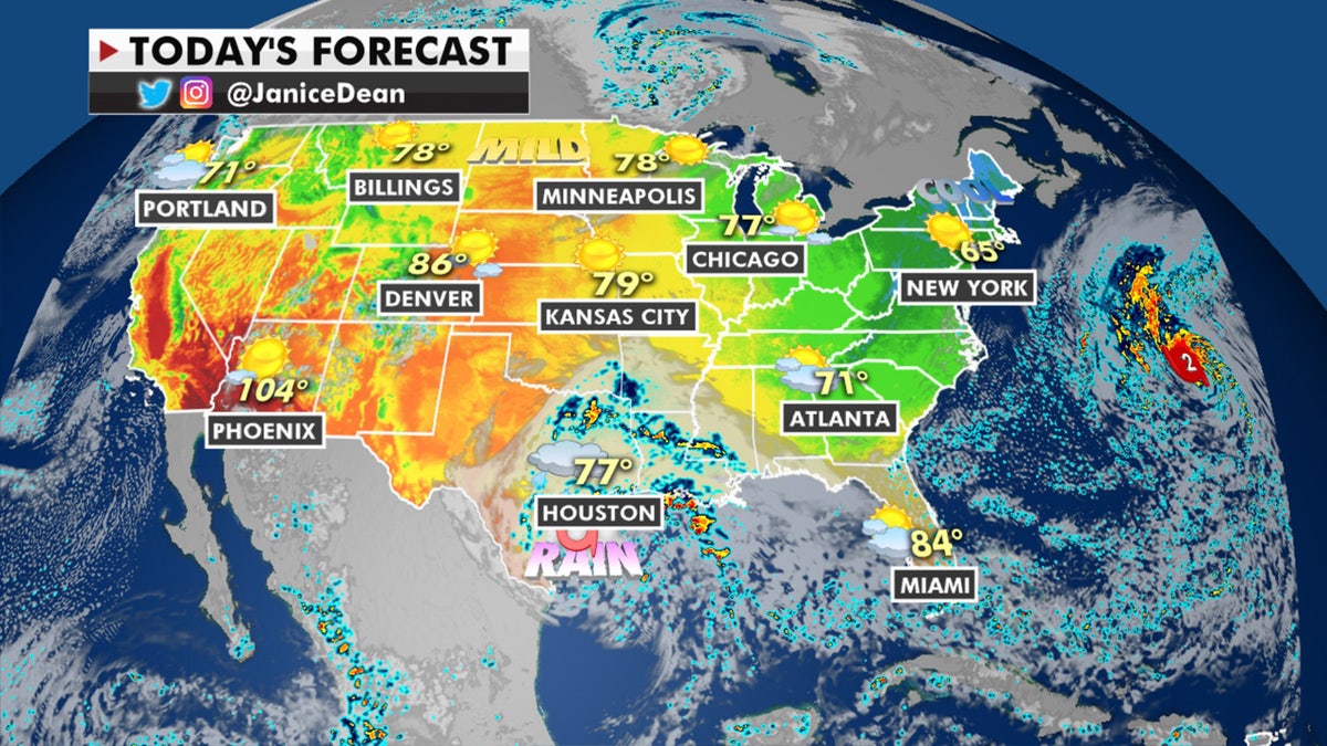
The national forecast for Sept. 21, 2020 (Fox News)
Gusty winds with some rainfall will also impact eastern Maine as Teddy moves into Canada.
CLICK HERE FOR MORE WEATHER COVERAGE FROM FOX NEWS
In other weather news, below-average temperatures have once again arrived in parts of the Northeast.

A brisk air mass has resulted in frost and freeze advisories across the Northeast. (Fox News)
Freeze and frost advisories are up Monday morning due to this brisk airmass.
Above-normal temperatures will return for the Western U.S. on Monday, with gusty winds bringing fire concerns for parts of the Great Basin.

A look at active wildfires burning across the West on Sept. 21, 2020. (Fox News)
Fall officially begins Tuesday morning, with the autumnal equinox at 9:30 a.m. EDT
CLICK HERE FOR THE FOX NEWS APP
It will be a warm start to fall across the Central and Northern Plains, with afternoon highs on Tuesday afternoon well into the 80s. The Northeast and Mid-Atlantic will be in the 60s and 70s, while Phoenix will be near 102 degrees.

True Crime
The hottest stories ripped from the headlines, from crime to courts, legal and scandal.
By entering your email and clicking the Subscribe button, you agree to the Fox News Privacy Policy and Terms of Use, and agree to receive content and promotional communications from Fox News. You understand that you can opt-out at any time.
