


For the first time in a while, the forecast pattern is pretty quiet for much of the country with the exception of the Northwest and Northeast on Monday.
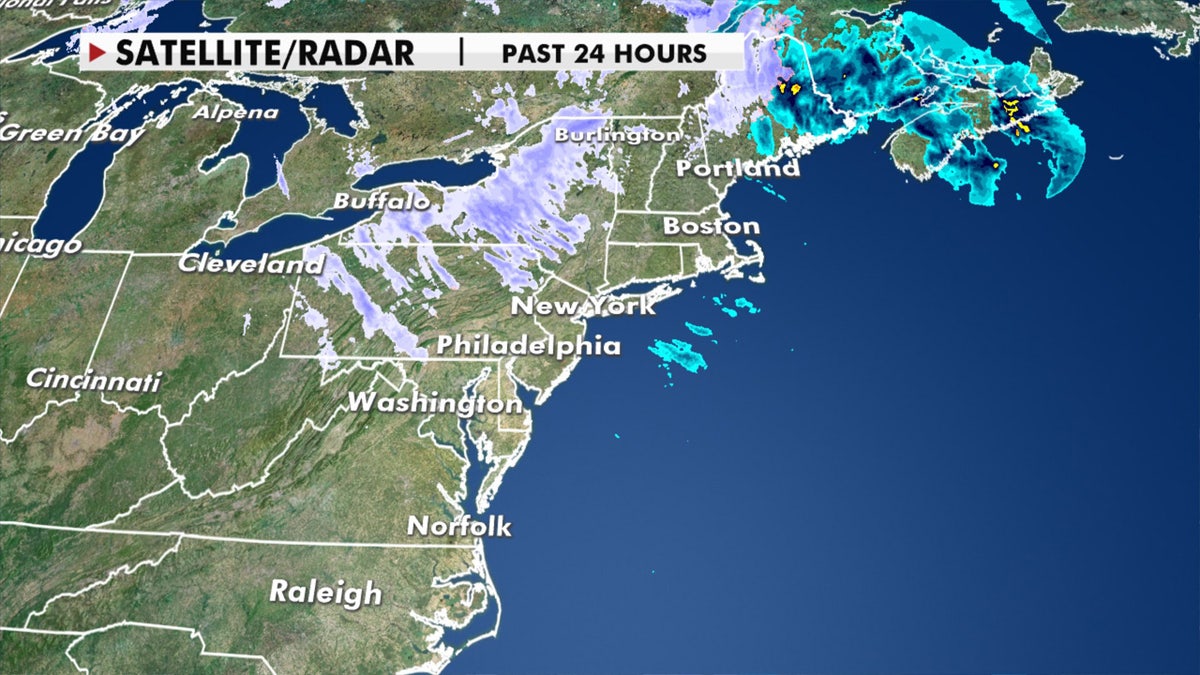
Light snow and cold rain will fall over parts of the Northeast through Tuesday as a couple of cold fronts clear the coast.
THE LATEST FOX NEWS 2020 BATTLEGROUND POWER RANKINGS
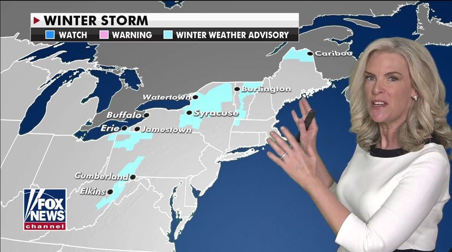
Several inches of snow are possible across portions of the interior Northeast and into New England, where scattered winter weather advisories are in effect.

Winter weather advisories have been posted across the interior Northeast and into New England. (Fox News)
The entire Northeast will otherwise be cool and windy to start the week.
Rounds of light snow can be expected across the interior Northeast on Monday into Tuesday. (Fox News)
Snow showers will end by the early afternoon across the Northeast on Tuesday, with windy conditions continuing.

Light snow is possible across portions of the Northeast on Tuesday morning. (Fox News)
Cold air across the Mid-South will begin to rebound and make way for warmer temperatures this week.

Frost and freeze advisories stretch across the Mid-South. (Fox News)
The West is warm, and those above-average temperatures will spread into the Plains.
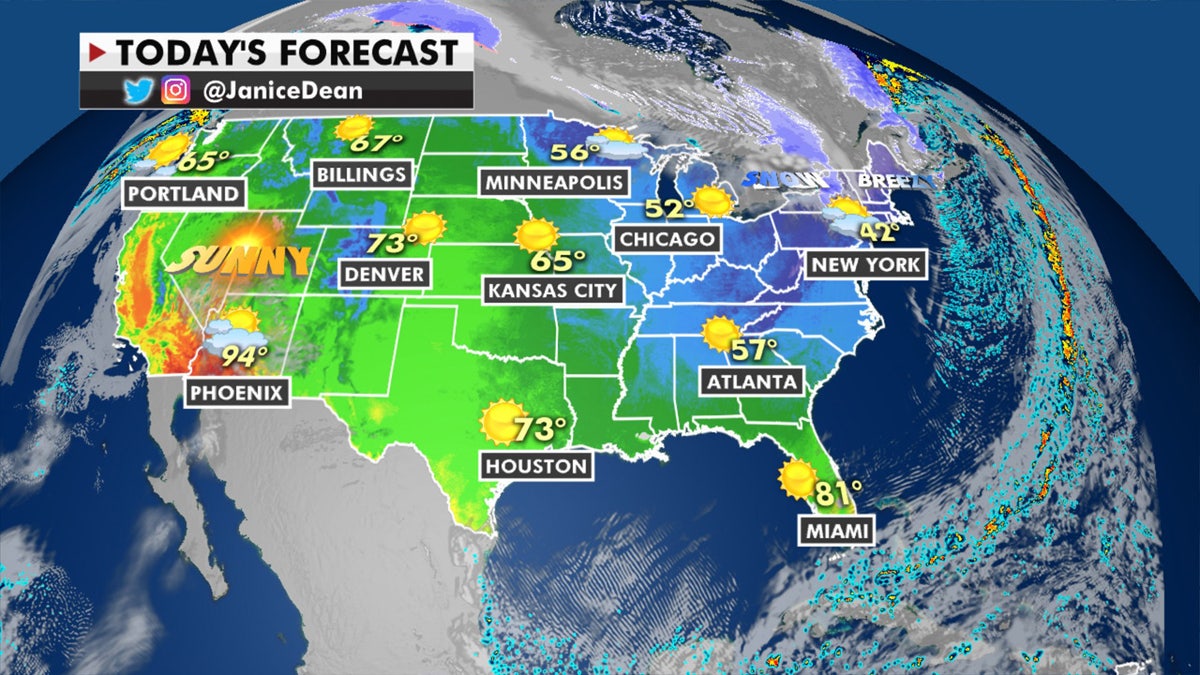
The national forecast for Monday, Nov. 2, 2020. (Fox News)
A new system will move into the Northwest on Tuesday, but moisture should be limited, to begin with. Later this week, a more consistent pattern will bring more rain/mountain snow.

Other than a system moving into the Pacific Northwest and some snow showers across the Northeast, conditions will remain dry for Election Day. (Fox News)
The rest of the country is very quiet and will remain that way on Tuesday for Election Day.
THE OTHER ELECTION FORECAST: HOW WEATHER AFFECTS TURNOUT
With the exception of the Northeast, Pacific Northwest and Desert Southwest, the entire rest of the country will see highs in the 60s and 70s on Tuesday, so overall pleasant temperature conditions.

The national forecast for Election Day. (Fox News)
CLICK HERE FOR MORE WEATHER COVERAGE FROM FOX NEWS
In terms of the tropics, Hurricane Eta is moving into Nicaragua and Honduras and will make landfall overnight spreading flooding rain and winds into the region.

The forecast track of Hurricane Eta. (Fox News)
Eta has maximum sustained winds of 75 mph and is located about 155 miles east of the Nicaragua-Honduras border, according to the National Hurricane Center (NHC). It was moving west at 12 mph.

Forecast rainfall amounts from Hurricane Eta. (Fox News)
The storm could undergo rapid strengthening and may become a major hurricane before its expected landfall early Tuesday.

True Crime
The hottest stories ripped from the headlines, from crime to courts, legal and scandal.
By entering your email and clicking the Subscribe button, you agree to the Fox News Privacy Policy and Terms of Use, and agree to receive content and promotional communications from Fox News. You understand that you can opt-out at any time.
