


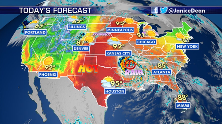
National forecast for Monday, June 8
Fox News senior meteorologist Janice Dean has your FoxCast.
The third named storm of the 2020 Atlantic hurricane season, Cristobal, weakened to a tropical depression Monday morning after making landfall in southeastern Louisiana.
The storm system that made landfall near Grand Isle, La., with 50 mph winds will continue to bring heavy rain and tropical storm-force wind gusts into Mississippi and Alabama.
Isolated tornadoes are also possible north and east of Cristobal on Monday, especially across Mississippi and Alabama.
TROPICAL STORM CRISTOBAL MAKES LANDFALL OVER LOUISIANA, PACKING STRONG WINDS AND RAIN
There’s a high risk for excessive rainfall over parts of the Mississippi Valley as the storm moves northward.
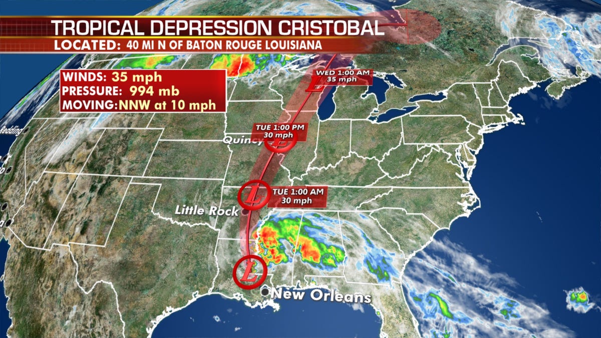
The forecast track of Tropical Depression Cristobal. (Fox News)
Forecasters from the National Hurricane Center (NHC) said that Cristobal is forecast to produce rainfall amounts of 5 to 10 inches from the central and eastern Gulf Coast into the lower Mississippi Valley, with isolated amounts of up to 15 inches.
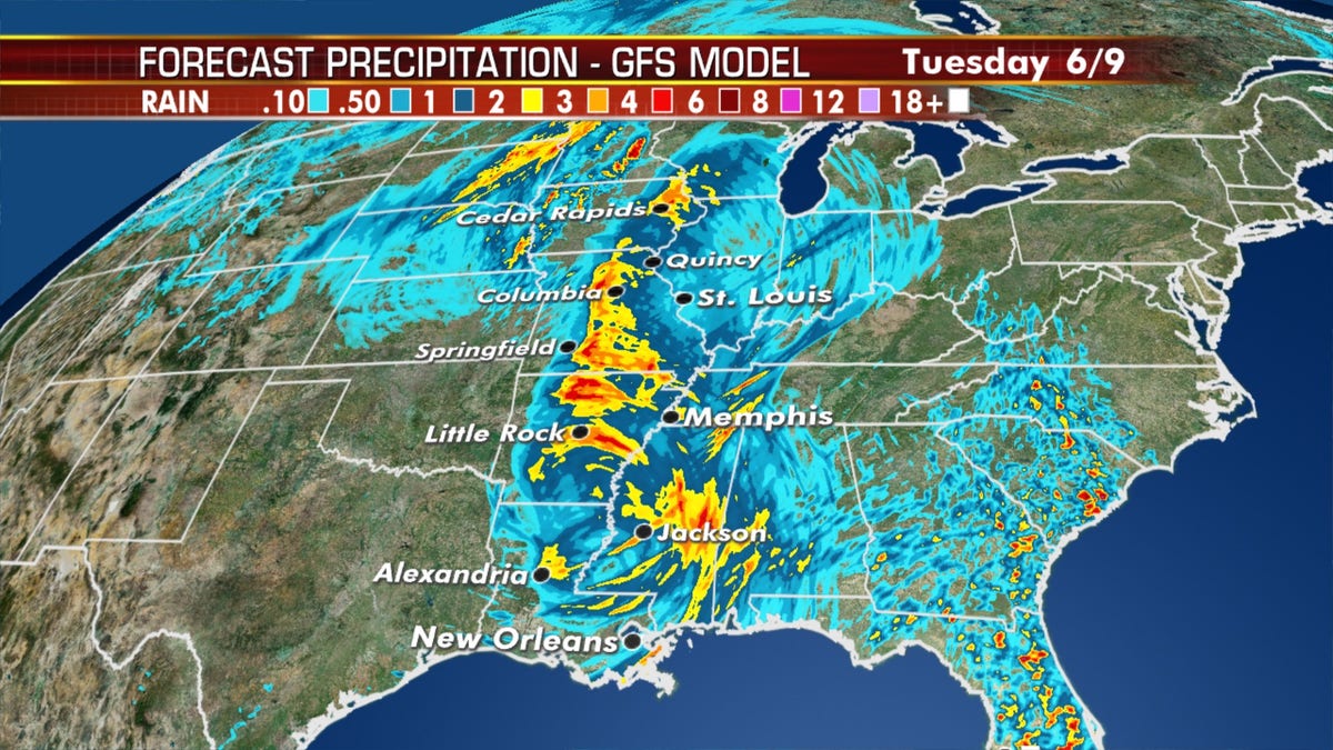
The rainfall forecast from Tropical Depression Cristobal. (Fox News)
Further north, 2 to 4 inches of rain, with higher amounts up to 6 inches, are expected as the storm system moves north.
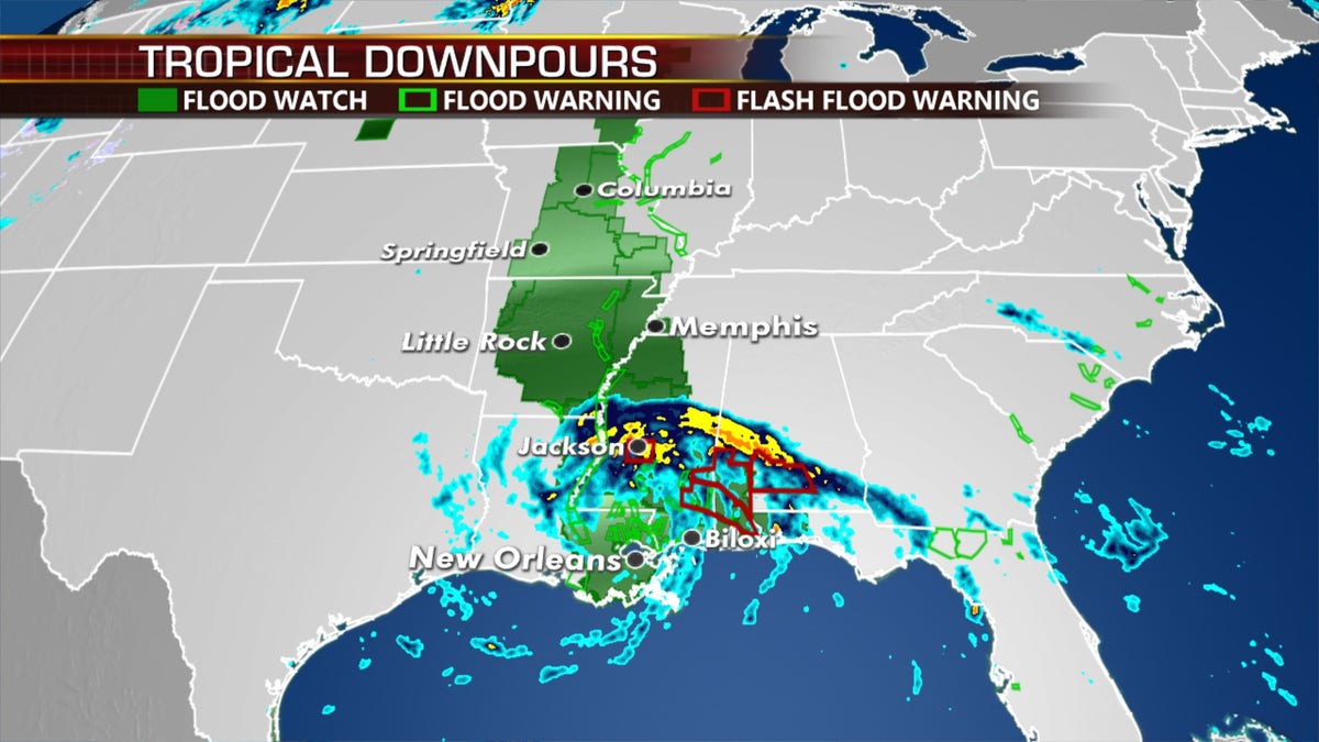
Tropical Depression Cristobal is bringing the threat of flooding. (Fox News)
In addition to the flood threat, there's also a chance of severe weather along the path up into the Great Lakes and the Midwest, as the remnants of Cristobal and a strong cold front interact.
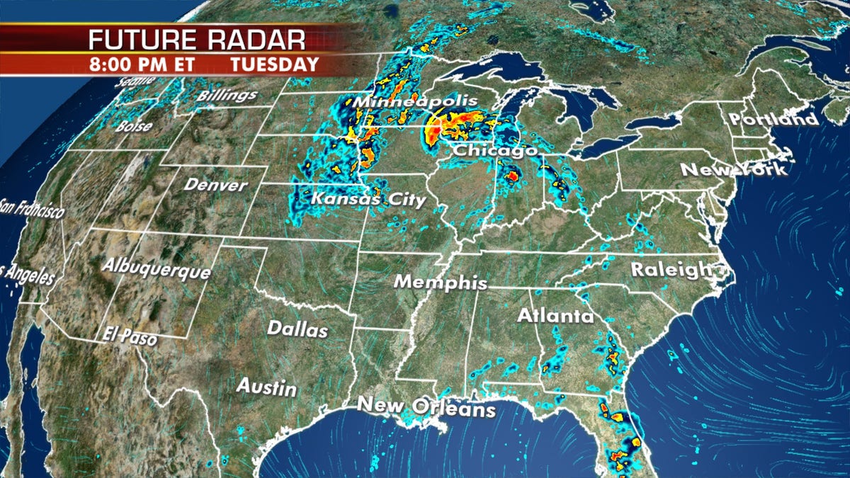
Tropical Depression Cristobal is bringing the threat of flooding and severe weather to the Upper Midwest by Tuesday. (Fox News)
That same cold front will bring heavy snow over the Northern Rockies, and severe storms for the Northern and Central Plains.
CLICK HERE FOR MORE WEATHER COVERAGE FROM FOX NEWS
Across the rest of the country, the West will cool off on Monday but strong winds are elevating fire danger to areas of the southern Rockies and High Plains.
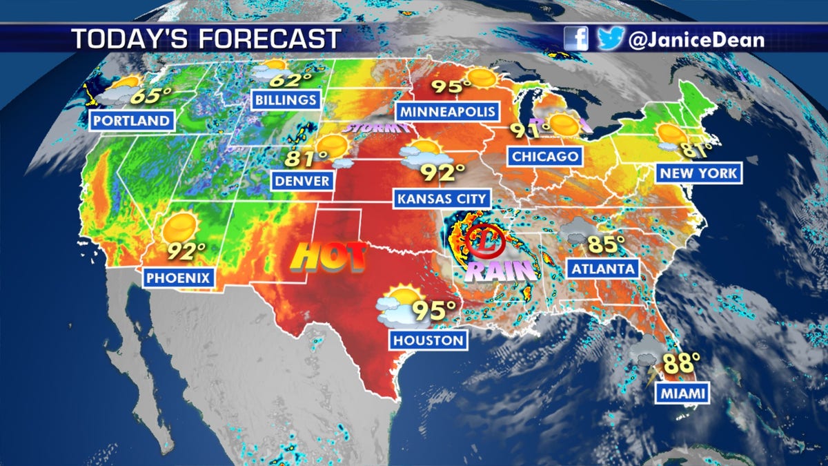
The forecast across the U.S. on June 8, 2020. (Fox News)
Fox News' Travis Fedschun contributed to this report.

True Crime
The hottest stories ripped from the headlines, from crime to courts, legal and scandal.
By entering your email and clicking the Subscribe button, you agree to the Fox News Privacy Policy and Terms of Use, and agree to receive content and promotional communications from Fox News. You understand that you can opt-out at any time.
