Time-lapse footage shows plane fly through Hurricane Laura
Raw video: NOAA plane records time-lapse footage as it flies through Hurricane Laura over the Gulf of Mexico.
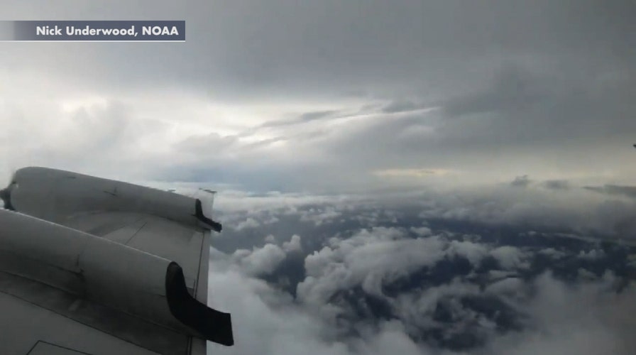
A beautiful sunrise can be seen for a moment as a hurricane hunter aircraft passes through Laura while the storm gathered strength Tuesday over the Gulf of Mexico.
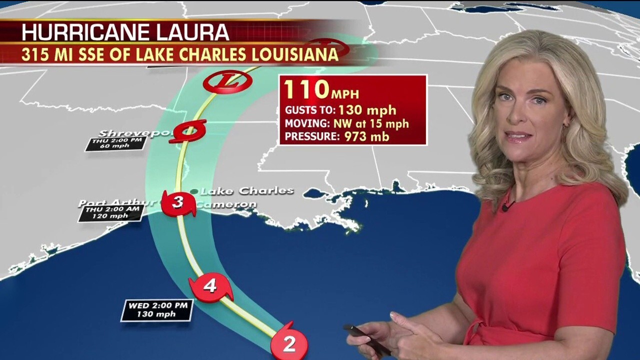
The National Hurricane Center (NHC) said early Thursday morning that Laura is “rapidly intensifying” into a "catastrophic" Category 4 hurricane and is predicted to make landfall somewhere in the region of eastern Texas and Louisiana.
"Potentially catastrophic storm surge, extreme winds, and flash flooding expected along the northwest Gulf Coast tonight," forecasters said early Wednesday, adding: "Steps to protect life and property should be rushed to completion in the next few hours."
HURRICANE LAURA FORECAST TO BE CATEGORY 4 STORM AS TEXAS, LOUISIANA BRACE FOR LANDFALL
A time-lapse video filmed Tuesday by Nick Underwood of the National Oceanic and Atmospheric Administration (NOAA) shows a hurricane hunter aircraft passing into the storm as it moved over the Gulf.

A hurricane hunter aircraft flies from Laura on Tuesday, Aug. 25, 2020. (Nick Underwood/NOAA)
"We found Laura as a hurricane today," Underwood tweeted.
In the video, the aircraft emerges from the clouds as sunrise can be seen before heading back into the heart of the storm.
Another video from NOAA on Tuesday shows the view from the aircraft from the eye of the storm.
Laura grew nearly 70% in power in just 24 hours to reach maximum sustained winds of 115 mph as it churns some 280 miles out from Lake Charles, La.
LAURA NOW FORECAST TO BE A CATASTROPHIC CATEGORY 4 HURRICANE
Category 4 storms bring "catastrophic damage" with well-built framed homes at risk of losing most of the roof structure and/or exterior walls.
"Most trees will be snapped or uprooted and power poles downed. Fallen trees and power poles will isolate residential areas," the NHC states on an overview of damage from similar-sized storms. "Power outages will last weeks to possibly months. Most of the area will be uninhabitable for weeks or months."
CLICK HERE FOR MORE WEATHER COVERAGE FROM FOX NEWS
Laura is becoming a large hurricane as it strengthens by the hour, with hurricane-force winds extending 70 miles from the center and tropical storm-force winds extending outward of up to 175 miles.
Impacts and hazards from the storm will be widespread – not just where the center of the storm makes landfall. A life-threatening storm surge of 7 to 15 feet will inundate the coast just east of the trajectory.
A storm surge warning is in effect from Freeport, Texas, to the mouth of the Mississippi River.
CLICK HERE FOR THE FOX NEWS APP
According to the NHC, the worst of the storm surge will be along the immediate coast near and to the right of the landfall location, where the surge will be accompanied by "large and destructive waves."
"This storm surge could penetrate up to 30 miles inland from the immediate coastline in southwestern Louisiana and far southeastern Texas," forecasters said.
Fox News' Janice Dean contributed to this report.


