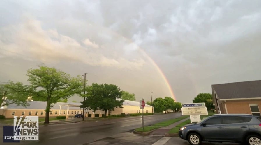
Lightning strike, double rainbow caught on camera: See the moment!
Thunderstorms hit parts of Central Texas — causing a lightning show for residents in the area. See the strike and double rainbow!
It's certainly common to see the rain and the snow fall, depending on the seasons.
But the state of the atmosphere actually can cause strange climatic events.
Take a look at some bizarre weather occurrences that have happened or could happen in the U.S.
WEATHER QUIZ! SEE IF YOU HAVE WHAT IT TAKES TO BE A METEOROLOGIST
From fire tornados to "raining" fish and frogs, here's a list of weird weather phenomena – plus some of the fascinating and numerical facts behind them.
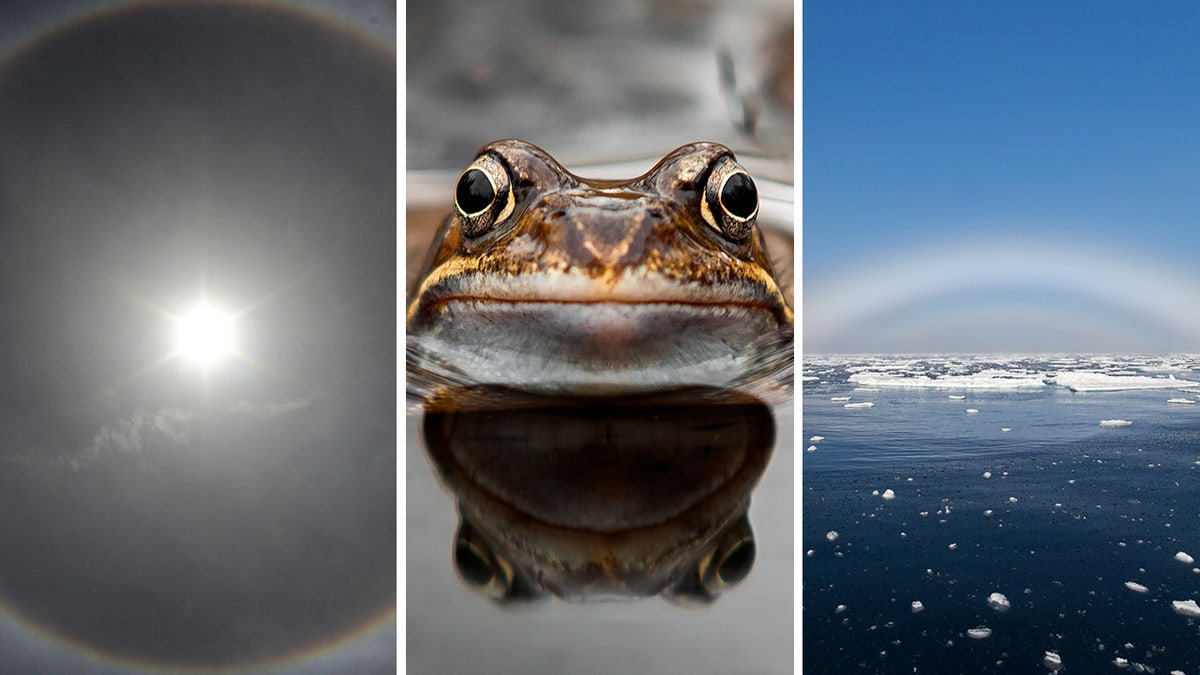
Take a look at eight bizarre weather occurrences that have happened in U.S. history – plus some interesting and numerical facts behind them. (Ali Owidha/Anadolu Agency/Getty Images/iStock/Arterra/Universal Images Group)
1. Ghost rainbows: At what degree does the sun need to be for you to spot one?
Ghost rainbows, or fogbows, are only different from their colorful counterparts due to appearance.
The two ingredients to form a fogbow are still sunlight and water droplets.
DOUBLE RAINBOWS AND THE SPIRITUAL MEANINGS BEHIND THEM: 'A HUG FROM ABOVE'
"The sun needs to be at a low angle to the existing fog in the atmosphere," said the Farmer's Almanac, adding that the burning star can vary between 30 and 40 degrees in order for a fogbow to appear.
The weather occurrence is commonly spotted in the early mornings and late evenings, the Farmer's Almanac continued.

Ghost rainbows, or fogbows, are formed when the sun hits fog at a 30-40 degree angle. (Arterra/Universal Images Group via Getty Images)
2. What is 'hair ice' and when was it discovered?
"Hair ice" was first discovered in 1918 by a scientist named Alfred Wegener, as Fox News Digital previously reported.
This rare ice formation is believed to have some connection to a fungus found on dead wood.
Last March, Mathew Nichols, a nature photographer, documented hair ice at Washington's Hoh Rainforest in Olympic National Park.
WATCH: SURREAL 'HAIR ICE' GROWS FROM DEAD BRANCH ON FROZEN WASHINGTON MORNING
"Hair Ice is caused by a fungus that lives within the decaying wood, and this fungus 'breathes' or releases its spores through the night, pushing the moisture harnessed within the wood out of the wood's pores, causing it to immediately freeze with contact of the below freezing temperatures," Nichols told Fox News Weather.
3. What happens when a halo forms around the sun?
The sun halo is often referred to as the 22-degree halo by scientists because of the size of the radius formed.
"They bear this name because the radius of the circle around the sun or moon is approximately 22 degrees," reported EarthSky, an Austin, Texas-based weather information site.
AWE-INSPIRING SUN HALO BRIGHTLY DISPLAYS NATURE'S BEAUTY ABOVE WESTERN NEW YORK
Sun halos are a sign of "high, thin cirrus clouds drifting 20,000 feet" in the sky.
The weather forecast after a halo appears, according to EarthSky, is "ring around the moon means rain soon."
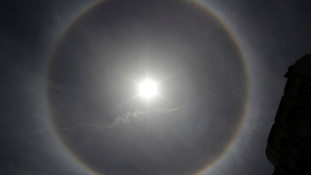
The sun halo, also called the 22-degree halo, has a radius of 22 degrees when formed around the sun or moon. (Ali Owidha/Anadolu Agency/Getty Images)
4. For how long will a sand storm linger in the sky?
Haboobs, derived from an Arabic word meaning wind or blow, are strong dust and sand storms that could form in the southwestern region of the U.S., the National Oceanic and Atmospheric Administration (NOAA) said.
Haboobs can last from 10 to 30 minutes. On rare occasions, they can last even longer, according to the government agency.
ILLINOIS DUST STORM RESPONSIBLE FOR ‘MULTIPLE FATALITIES’ AFTER CARS PILE UP IN WRECKAGE
The intense storm can create "winds of speeds up to 60 mph [and] can stir up dust and sand and create a blowing wall as high as 10,000 feet," the NOAA wrote.
#Haboob photo from #DolanSprings earlier this evening from Joe DuArte! Dust moved through w/ ~40 mph winds. #azwx pic.twitter.com/z9nV3HdliC
— NWS Las Vegas (@NWSVegas) July 2, 2014
5. How large can snow rollers be in size?
True to its name, snow rollers look like rolled up blankets of snow, which are naturally sculpted due to certain weather conditions.
Snow rollers can vary in size, but the rare occurrence is made even rarer because it requires the perfect mixture of "moisture, snow, wind and temperature," the National Weather Service reported.
HOLY SNOW ROLLERS! STRANGE SNOWBALLS INVADE THE US
"The snow has to be a light dusting, sticky enough to adhere to itself but on a surface that it won’t cling to. The wind has to be strong enough to encourage these mounds of snow to curl up and form their signature loop, but not so strong that the whole thing gets blown apart," the weather service continued.
"Alternatively, the snow could be on a hill and gently roll downslope to form the same shape."
In 2016, snow rollers were found to have formed in Idaho. They reached sizes up to 18 inches in diameter, LiveScience previously reported.
6. What speed did the California fire tornado reach in 2018?
Fire tornados are another bizarre phenomena that occur but are rarely captured on video.
THE VIRGIN MARY, MOTHER OF JESUS, MYSTERIOUSLY 'APPEARED' ON FLORIDA BUILDING 27 YEARS AGO TODAY
In 2018, a fire tornado formed in Redding California, with speeds reaching up to 143 mph, the Library of Congress stated.
The fire whirls can even uproot trees as tall as 49 feet, the library added.
Fire tornadoes often form during intense bushfires—and can spew embers thousands of feet in the air pic.twitter.com/BqtfSRh9Bc
— National Geographic (@NatGeo) April 25, 2018
7. When were 'raining' animals documented in the US?
The mysterious phenomena of "raining frogs" and other water creatures may sound impossible, but they've reportedly occurred in America.
The first documented appearance of raining frogs was in Kansas City in 1873, according to a report in Scientific American, which credited a tornado or possible waterspout for the odd moment.
FISH RAIN ON TEXAS TOWN, SPARKING LOCAL OFFICIALS TO SPEAK OUT: 'THIS ISN'T A JOKE'
In Texarkana, Texas, there was more strange precipitation – this time in the form of fish – falling from the sky.
That prompted the city to share a Facebook post further explaining the 2022 weather occurrence.

Frogs and fish may come down at the same time as rain – making it appear as if such creatures are falling from the sky. (iStock)
"Animal rain is a phenomenon that occurs when small water animals like frogs, crabs and small fish are swept up in waterspouts or drafts that occur on the surface of the earth. They are then rained down at the same time as the rain," the post noted.

In Texarkana, Texas, citizens reportedly witnessed a truly bizarre weather phenomenon: raining fish. (The City of Texarkana, Texas)
8. What speed must winds reach to create a derecho?
On July 4, 2022, a derecho made its way through Sioux Falls, South Dakota, leaving the sky a mysterious green color.
CLICK HERE TO SIGN UP FOR OUR LIFESTYLE NEWSLETTER
In order for a thunderstorm to be considered a derecho, "the thunderstorm outflow winds reach 75 mph or greater at several points along the damage path," according to the NOAA.
The skies looked mean and green as severe storms moved through Sioux Falls, South Dakota on Tuesday.
— FOX Weather (@foxweather) July 6, 2022
These incredible images were captured by @TwstdSkyStudios. #SDwx
Wondering why this happened? We explain here: https://t.co/v2H68VsfwG pic.twitter.com/9kmFryPe5r
The derecho in South Dakota was carrying a great deal of moisture, which helped create the green hue in the sky.
CLICK HERE TO GET THE FOX NEWS APP
"When the reddish light scattered by the atmosphere illuminates the blue water/ice droplets in the cloud, they will appear to glow green," National Weather Service meteorologist Cory Martin told Fox Weather at the time.
For more Lifestyle articles, visit www.foxnews.com/lifestyle.


