2019 Atlantic Hurricane season expected to pack some punch
The United States may get hit by two to four major hurricanes before the end of the 2019 hurricane season. Forecasters are calling this year's season near normal.
The fifth hurricane of the 2019 Atlantic hurricane season roared in the open ocean on Thursday, strengthening into a Category 4 storm as another tropical system closer to the U.S. is forecast to weaken by the weekend.
The National Hurricane Center in Miami said that as of 11 a.m. Lorenzo is a Category 4 hurricane with maximum sustained winds of 130 mph, moving west-northwest at 13 mph and is located about 1,055 miles west of the southernmost Cabo Verde Islands.
"Additional strengthening is possible today, and fluctuations in intensity are expected tonight through Friday night," the NHC said.
LORENZO BECOMES FIFTH HURRICANE OF THE ATLANTIC SEASON, FORECAST TO BECOME MAJOR STORM
A "major hurricane" is defined as having winds above 111 mph, according to the Saffir-Simpson Hurricane Wind Scale. Category 3, Category 4 and Category 5 storms are all labeled “major” hurricanes.

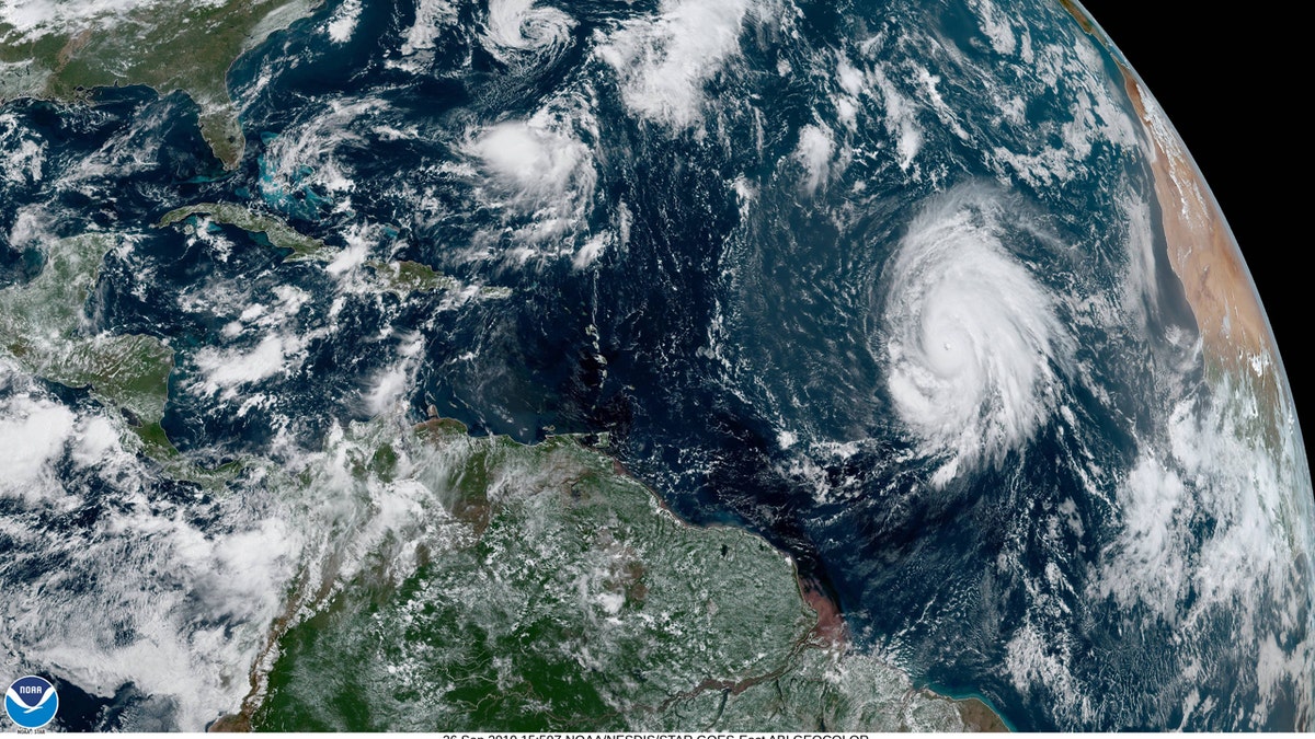
Hurricane Lorenzo can be seen swirling in the eastern Atlantic on Thursday. (NOAA/GOES East)
Lorenzo is forecast to remain far out over the eastern Atlantic, making a turn to the northwest by Thursday night into Friday.
"Very happy that #Lorenzo is turning out to sea- that is a beastly hurricane," tweeted Eric Blake, a meteorologist at the National Hurricane Center. "You won’t find anything comparable in that part of the basin for strength and size except for Gabrielle 1989, and that was several degrees west."
As the storm has developed and strengthened, a well-defined eye can now be seen on satellite.
"Lorenzo is a large hurricane," the NHC said. "Hurricane-force winds extend outward up to 45 miles from the center and tropical-storm-force winds extend outward up to 255 miles," the agency said.
Colorado State University hurricane research scientist Phil Klotzbach noted on Twitter that Lorenzo has another notable distinction: It's now the only Atlantic hurricane on record to reach Category 4 intensity this far east, except for Hurricane Julia in 2010.
'HISTORIC' SNOWSTORM MAY BRING BLIZZARD CONDITIONS TO MONTANA, SEVERAL FEET OF SNOW TO MOUNTAINS
As Lorenzo roars to life, another tropical system closer to the U.S. is on the outs.
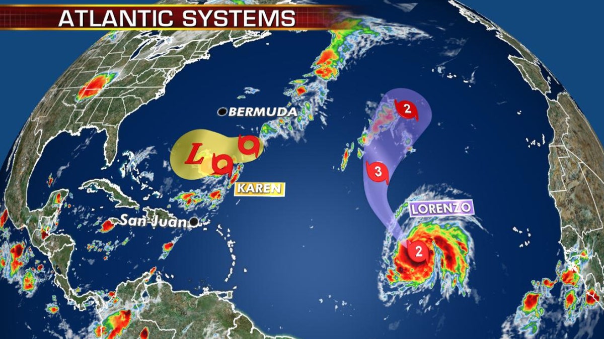
The NHC said that Tropical Storm Karen is located about 405 miles south-southeast of Bermuda, moving north-northeast at 14 mph with sustained winds of 45 mph.

Current tropical activity in the Atlantic basin. (Fox News)
The storm has been swirling in the ocean since impacting Puerto Rico and is forecast to make a slow, clockwise loop before ultimately moving westward by early Sunday. Forecasters believe that Karen will weaken by the weekend, and become remnant low by Sunday.
"Still watching the tropics, although it appears that Karen and Lorenzo will not impact the U.S.," Fox News Senior Meteorologist Janice Dean said Thursday.
CLICK HERE FOR THE FOX NEWS APP
The National Oceanic and Atmospheric Administration has said it expects 10-17 named storms this hurricane season, with winds of 39 mph or higher, of which five to nine could strengthen into hurricanes. Of those storms, there will be two to four major hurricanes.
The 2019 Atlantic Hurricane Season runs from June 1 to Nov. 30, and this year includes the names: Andrea, Barry, Chantal, Dorian, Erin, Fernand, Gabrielle, Humberto, Imelda, Jerry, Karen, Lorenzo, Melissa, Nestor, Olga, Pablo, Rebekah, Sebastien, Tanya, Van, and Wendy.


