


An incredibly strong weather pattern has set up across the northern tier of the county on Thursday, bringing yet more October snow to the region.
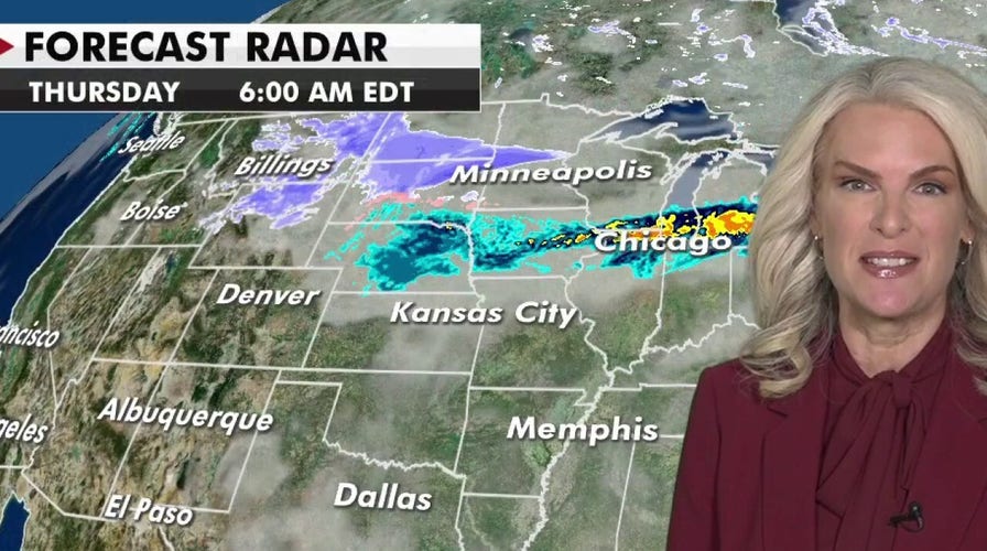
A storm system moving across the Central High Plains will bring more snow from the Northwest through the northern and central Rockies and into the Upper Midwest.
"This is round two. We have round three that's around the corner," Fox News senior meteorologist Janice Dean said on "Fox & Friends."We've had record-breaking snow across some of these areas, 'Snowtober' here it is."
SNOWSTORM IN MINNESOTA SHATTERS RECORD, CAUSES HUNDREDS OF CRASHES AND SPINOUTS
This region has just seen record-breaking snow for the month of October in recent days, and more is on the way.
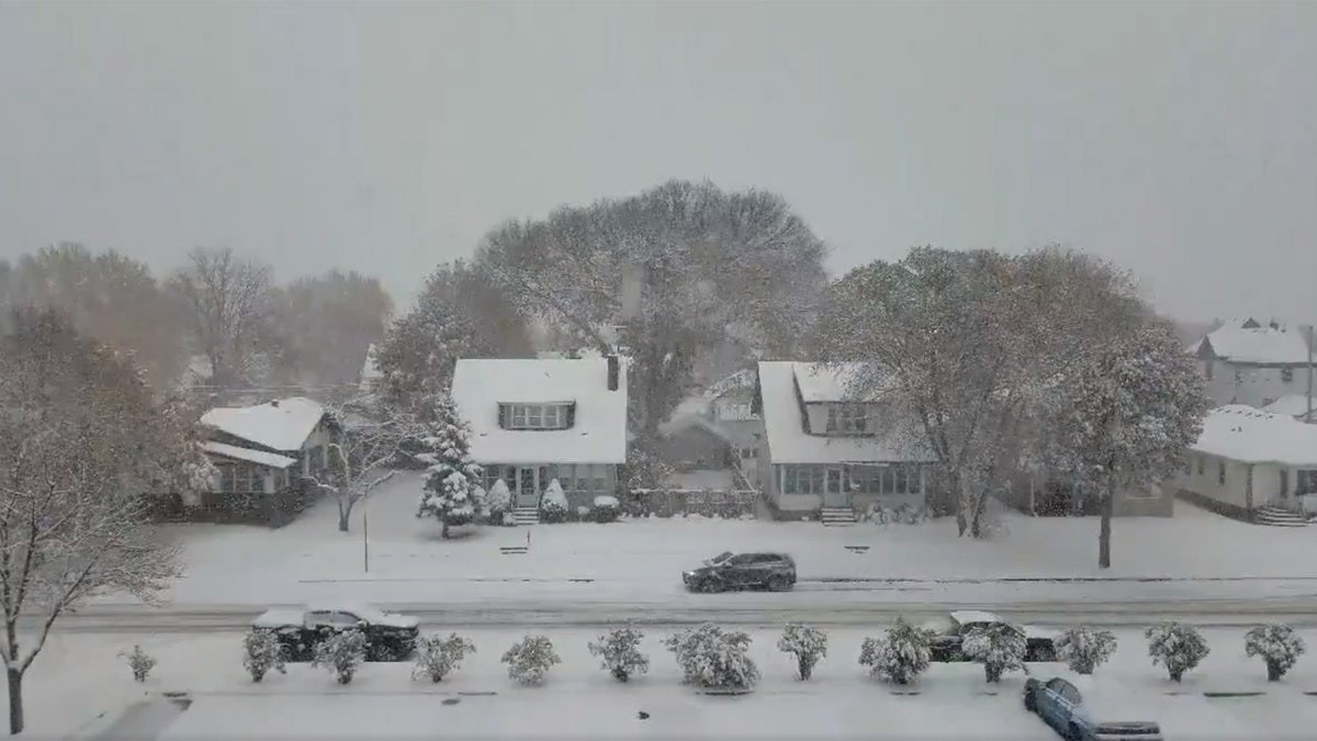
The Minneapolis and St. Paul areas were blanketed with nearly 8 inches of snow from a storm on Tuesday. More snow is expected across the region. (Mark J Westpfahl via Storyful)
Winter storm warnings and watches are in effect, as several more inches of snow will fall over parts of the Upper Mississippi Valley.
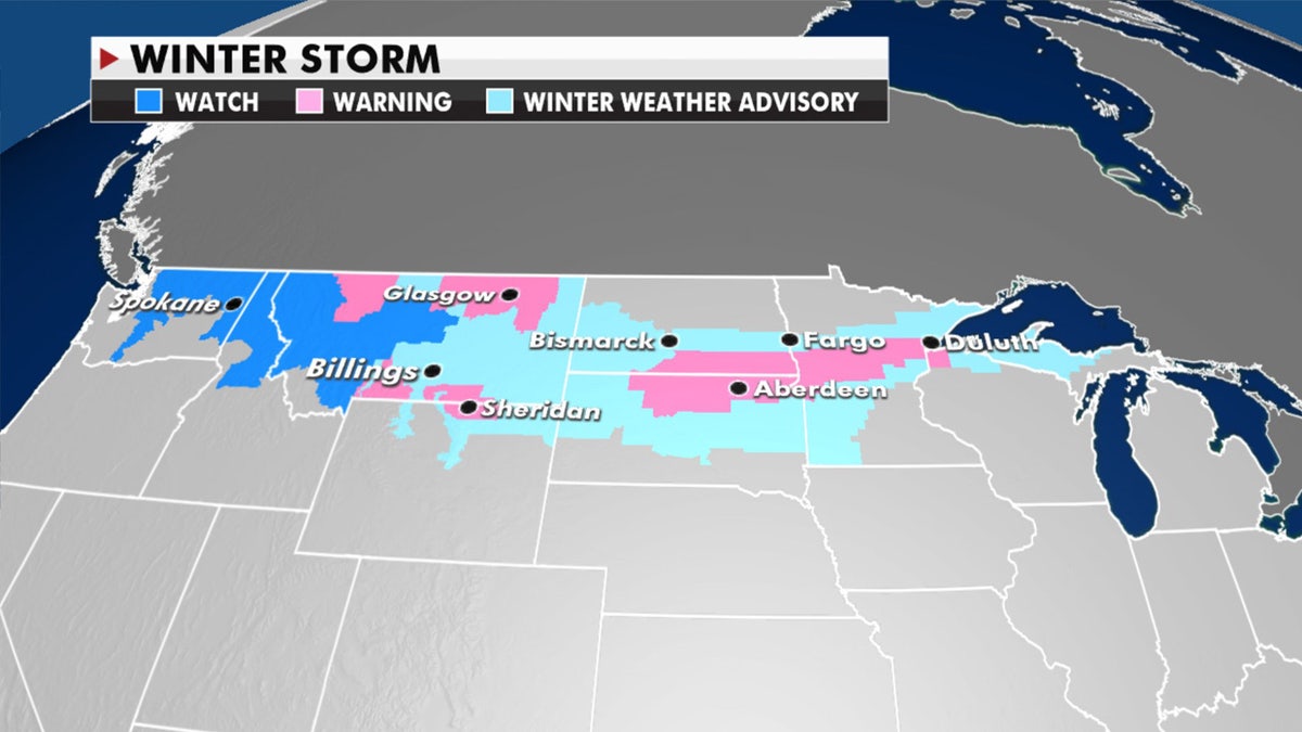
Winter storm warnings, watches, and advisories have been posted for the next storm system.
"In some cases, over a foot of snow on top of what they've already received this week," Dean said.
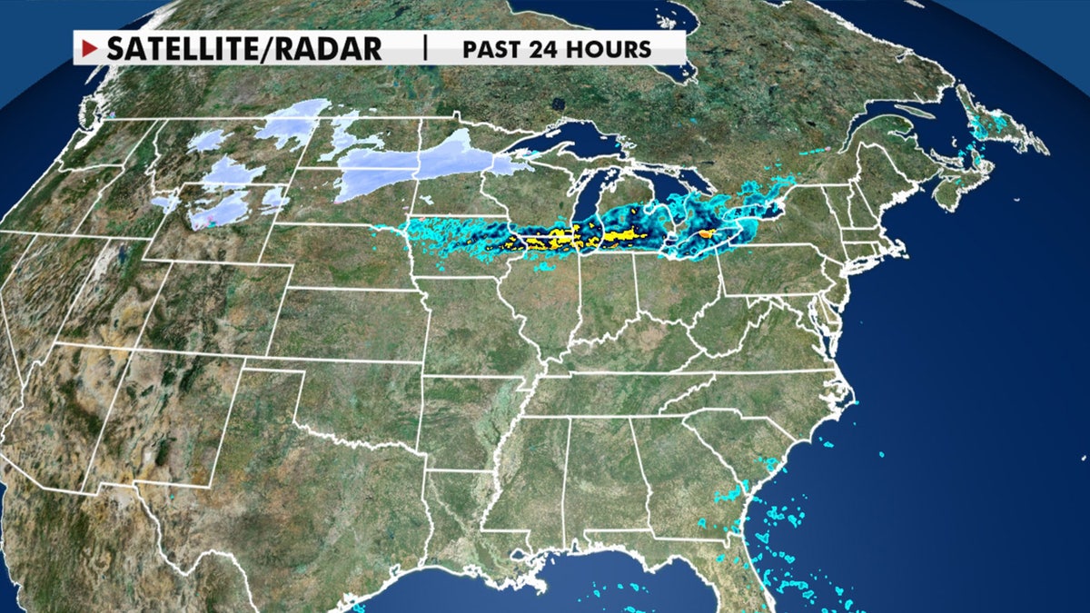
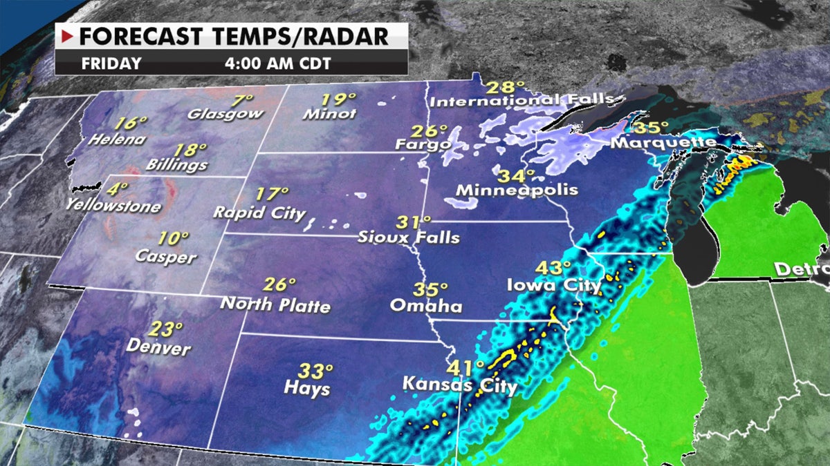
More snow is developing across the Upper Midwest after the region has seen record-breaking snow totals for October. (Fox News)
Northern tier snow developing through Thursday night will blanket the Northern Rockies, Northern Plains, and Upper Midwest through Thursday night.
Gusty winds over 35 mph and a widespread 6-12 inches are expected from this system, making for dangerous road conditions at times.

Forecast snow totals through Sunday. (Fox News)
Yet another wintry storm will develop over the weekend, moving from the Rockies into the Plains, but this one will be much more widespread, digging deeper into the Central U.S.
WINTER WEATHER BRINGS 'MULTIPLE' ROUNDS OF SNOW TO UPPER MIDWEST, IOWA HIT WITH SNOW SQUALLS
The cold air associated with this storm system will reach as far south as Texas on Friday. Travel will be difficult and dangerous in many cities across these regions.
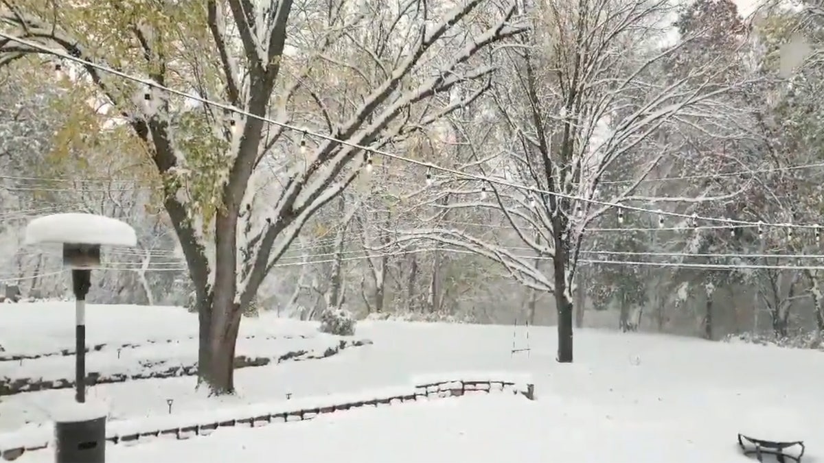
The Minneapolis and St. Paul areas were blanketed with nearly 8 inches of snow from a storm on Tuesday. More snow is expected across the region. (Mark J Westpfahl via Storyful)
Where it’s too warm for snow, strong to severe thunderstorms will be a risk along with heavy rain over the Mid-Mississippi Valley up into the Great Lakes.
Cold air will filter south associated with the next storm system. (Fox News)
Meanwhile, the risk for fire danger remains high over California, the Southwest, and parts of the Texas panhandle with dry, warm, breezy conditions not helping the situation.
CLICK HERE FOR MORE WEATHER COVERAGE FROM FOX NEWS
Gusty winds and warm temperatures will not budge, even as areas to the north are seeing snow.
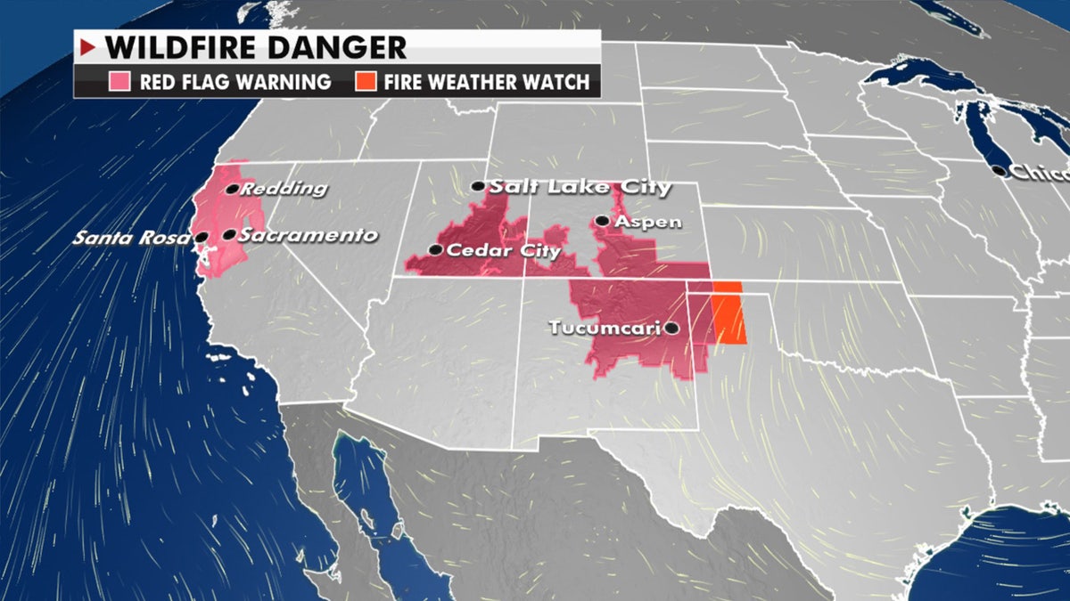
Gusty winds and warm air to the south are fueling the risk of wildfires out West. (Fox News)
"So, unfortunately, we're not getting any of that moisture into areas that need to see it where we have the wildfires that continue to burn," Dean said.
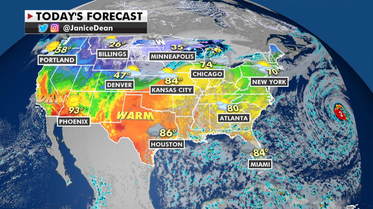
The national forecast for Oct. 22, 2020. (Fox News)

True Crime
The hottest stories ripped from the headlines, from crime to courts, legal and scandal.
By entering your email and clicking the Subscribe button, you agree to the Fox News Privacy Policy and Terms of Use, and agree to receive content and promotional communications from Fox News. You understand that you can opt-out at any time.
