


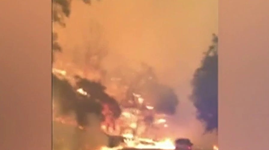
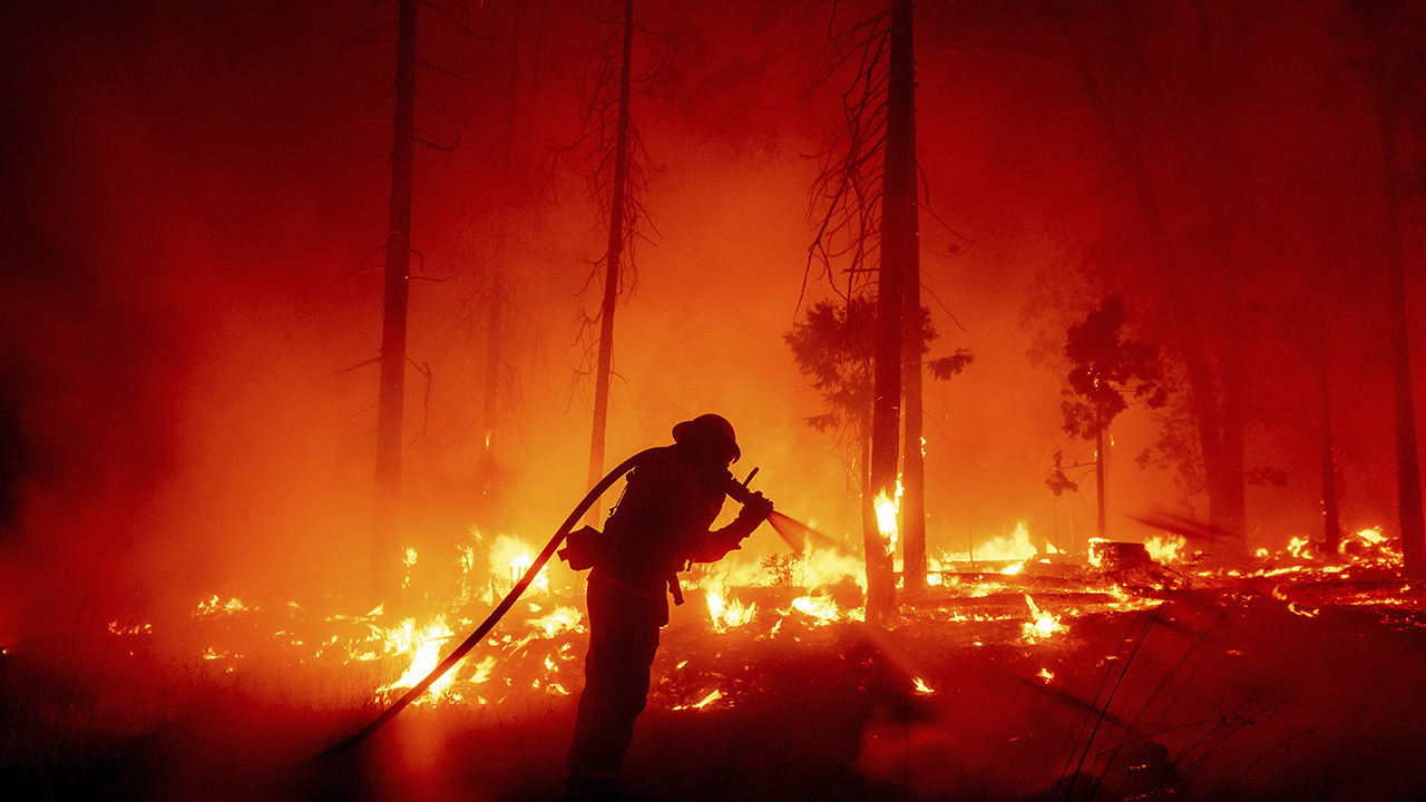
3 people killed in California’s Zogg Fire
California Gov. Gavin Newsom declares emergency in three counties amid wildfires.
While conditions have slightly improved Tuesday, western wildfires continue to be the big weather story across the country.
More than 70 large, 100-acre or greater fires still burn across the West.
With winds lessening, red flag warnings have been lifted across much of the region.
CALIFORNIA WILDFIRE TRIPLES IN SIZE AS GLASS FIRE RAGES THROUGH NAPA, SONOMA COUNTIES
Even though the winds may have eased, drought conditions and abnormally warm weather have gripped the region.
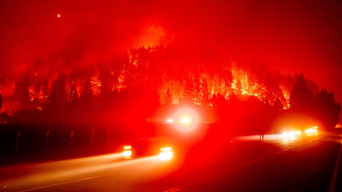
An emergency vehicle drives along Silverado Trail as the Glass Fire burns in St. Helena, Calif., Sunday, Sept. 27, 2020. (AP Photo/Noah Berger)
On Tuesday, temperatures once again reach into the 90s and 100s for most of California. Moderate to severe drought conditions continue for many of the western states as no rain is forecast through the middle of the week.
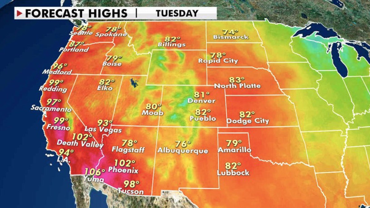
Forecast high temperatures for Tuesday, Sept. 29, 2020. (Fox News)
Elevated fire weather conditions exist across Southern California, where heat advisories and red flag warnings are in effect.
WILDFIRE THREAT SIMMERS IN CALIFORNIA AS RED FLAG WARNINGS STRETCH THROUGH STATE
Inland temperatures in the 90s and 100s across Southern California will keep wildfire conditions elevated throughout the day.
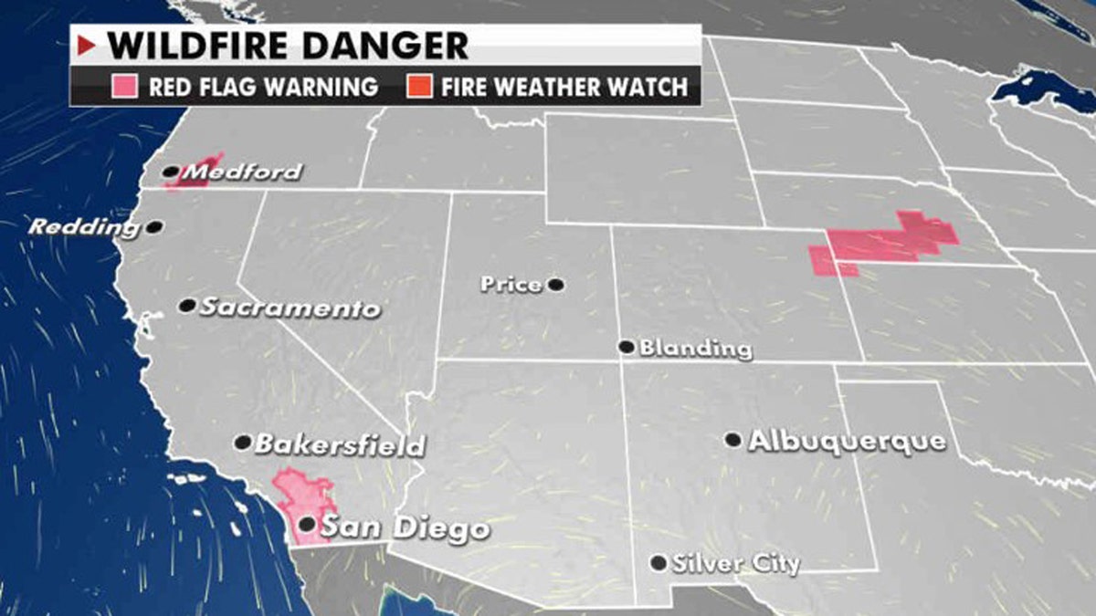
The greatest fire danger on Tuesday is in Southern California. (Fox News)
In the eastern US, more fall-like weather is anticipated. Temperatures have cooled, with forecasted highs largely in the 70s on Tuesday.
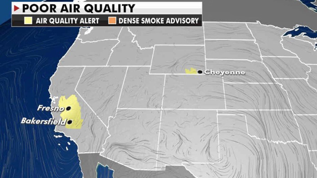
Poor air quality can be expected on Tuesday in Northern California due to ongoing wildfires. (Fox News)
Conditions for the first presidential debate in Cleveland look party cloudly and cool.
CLICK HERE FOR MORE WEATHER COVERAGE FROM FOX NEWS
Temperatures will reach the low to mid-60s for Tuesday afternoon, falling into the upper 50s in the evening. Skies will be mostly cloudy in the morning hours with gradually clearing skies later today, with showers looking less likely.
A frontal system is bringing rain from the Midwest and South to the East Coast.
Heavy rain is possible in some of the storms that form along the cold front, with the possibility of severe weather in the eastern Carolinas and southeast Virginia.
The risk of flash flooding is also possible across the region, but drier conditions are expected to arrive by Wednesday afternoon.
CLICK HERE FOR THE FOX NEWS APP
In the tropics, while still in peak hurricane season, no tropical cyclones are forecast in the next five days.

True Crime
The hottest stories ripped from the headlines, from crime to courts, legal and scandal.
By entering your email and clicking the Subscribe button, you agree to the Fox News Privacy Policy and Terms of Use, and agree to receive content and promotional communications from Fox News. You understand that you can opt-out at any time.
