


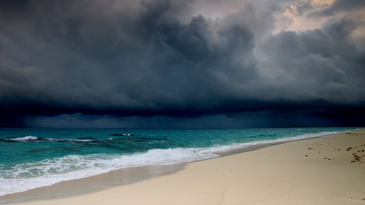
What is a meteotsunami?
Tsunamis can be triggered by more than just earthquakes, air pressure can also play a roll in creating the dangerous waves.
It's not just earthquakes that can trigger tsunamis.
The National Weather Service (NWS) says that from time to time, weather-generated tsunamis, known as a meteotsunami, can be caused by air pressure disturbances that are associated with fast-moving severe thunderstorms, like squall lines.
"Like an earthquake-generated tsunami, a meteotsunami affects the entire water column and can become dangerous when it hits shallow water, which causes it to slow down and increase in height and intensity," the NWS states in a fact sheet. "Even greater magnification can occur in semi-enclosed water bodies like harbors, inlets, and bays."
NORTHEAST STORMS WERE POWERFUL ENOUGH TO GENERATE 'METEOTSUNAMI' ALONG COAST
When severe storm fronts move through and have the right conditions, they can generate a wave that moves toward the shore that can be amplified by coastal features.
Conditions for destructive meteotsunamis are most favorable along the East Coast, Gulf of Mexico, and in the Great Lakes, according to the National Weather Service.
According to the National Ocean Service, meteotsunamis have been observed to reach heights of six feet, or more.
"They occur in many places around the world, including the Great Lakes, Gulf of Mexico, Atlantic Coast, and the Mediterranean and Adriatic Seas," the agency states.
Intense thunderstorms that moved across the Chesapeake Bay near Tolchester Beach in Kent County, Md. in early July 2020 generated a meteotsunami.
The NWS office in Mount Holly, N.J. said that a tidal chart showed a quick rise and subsequent fall along with several smaller "waves" that came after the initial disturbance.
"This is the classic meteotsunami signature with a tsunami wave followed by several smaller waves in response," the forecast office said on Twitter. "However this wasn't seismic!"
WHAT IS A SQUALL LINE? WHAT TO KNOW ABOUT THIS THREATENING WEATHER
Another one happened back in May 2018, resulting in fluctuating water levels for several hours and was picked up on buoys off stretching from New Jersey up to southern New England.
Data from buoys off the coast showed small fluctuations in water levels after 8 p.m., which lasted for several hours.
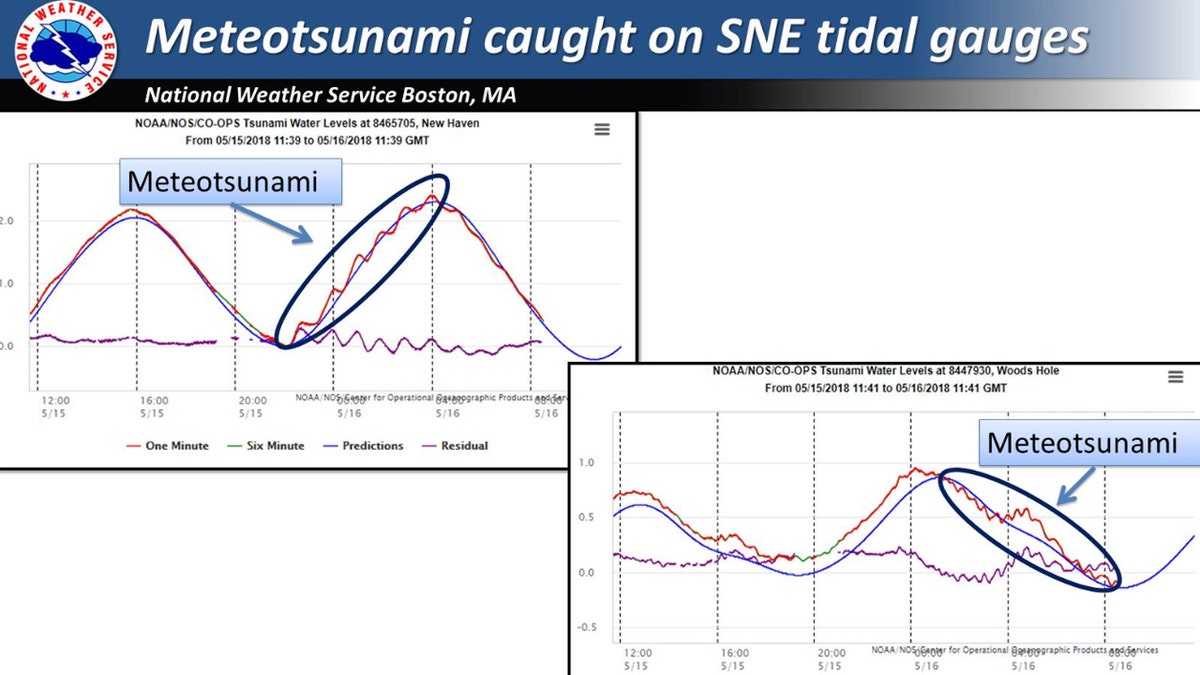
Tidal gauges show the fluctuations in water levels in Southern New England after thunderstorms generated a meteotsunami in May 2018. (NWS Boston)
The NWS says in an online fact sheet that large meteotsunamis can have "devastating coastal impacts."
CLICK HERE FOR MORE WEATHER COVERAGE FROM FOX NEWS
"Damaging waves, flooding, and strong currents can last from several hours to a day and can cause significant damage, injuries, and deaths," the NWS notes.
On June 13, 2013, despite clear skies and calm weather, three people were injured in New Jersey when a six-foot wave swept them off a jetty and into the water as a result of a reported meteotsunami. In May 2012, a seven-foot wave in Lake Erie near Cleveland swept beachgoers off their feet and swamped boats in harbors, according to the NWS.
CLICK HERE FOR THE FOX NEWS APP
The weather agency said that conditions for destructive meteotsunamis are most favorable along the East Coast, Gulf of Mexico, and in the Great Lakes.

True Crime
The hottest stories ripped from the headlines, from crime to courts, legal and scandal.
By entering your email and clicking the Subscribe button, you agree to the Fox News Privacy Policy and Terms of Use, and agree to receive content and promotional communications from Fox News. You understand that you can opt-out at any time.
