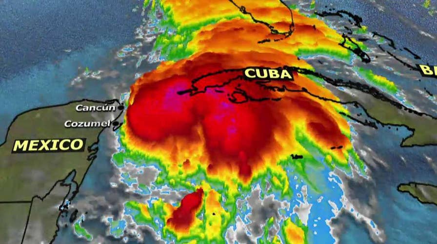
Tropical Storm Michael was upgraded to hurricane status mid-morning on Monday as the storm continues to pick up momentum ahead of an anticipated landfall in Florida later this week.
The storm, which has maximum sustained winds of 75 mph, was about 90 miles east of Cozumel, Mexico Monday morning and is producing "heavy rainfall" and "flash-flooding" over Cuba, the National Hurricane Center said.
“Michael is forecast to be a dangerous major hurricane when it reaches the northeastern Gulf Coast on Wednesday, and life-threatening storm surge is possible along portions of the Florida Gulf Coast regardless of the storm’s exact track or intensity,” the Center said in an advisory.
“Heavy rainfall from Michael could produce life-threatening flash flooding from the Florida Panhandle and Big Bend region into portions of the Carolinas through Thursday,” it added.
Forecasters said towns and cities in Southwest Florida will begin experiencing tropical storm-force winds as early as Tuesday morning. By Tuesday night, those winds are expected to be felt along the entire Gulf of Mexico coastline up to Louisiana.
The hurricane is currently moving north at 7 mph and is expected to close in on Florida on Wednesday before projections have it turning northeast and passing over much of the Atlantic coast, including parts of the southeast still reeling from last month’s Hurricane Florence.
Storm preparations are already underway in Florida though, with Tallahassee opening two locations Sunday where residents can get sandbags to protect against flooding.
Florida Gov. Rick Scott issued an order for a state of emergency for 26 counties to rush preparations in the Florida Panhandle and the Big Bend area, freeing up resources and activating 500 members of the Florida National Guard ahead of Tropical Storm Michael.
"This storm will be life-threatening and extremely dangerous," Scott said Sunday after receiving a briefing at the State Emergency Operations Center.

This satellite image provided by the National Oceanic and Atmospheric Administration shows a view of Tropical Storm Michael, lower right, churning as it heads toward the Florida Panhandle. (AP/NOAA)
The National Hurricane Center is already estimating that Michael could dump up to 15 inches of rain on some parts of the Florida panhandle – and that number could increase as the storm picks up strength.
“Families should take the opportunity TODAY to make sure they have three days of food and water, as well as all needed medications,” Scott tweeted Monday morning.
The Associated Press contributed to this report.


