


High heat and humidity expand from the Northwest into the central U.S. and lower Mississippi Valley this week with temperatures in the high 90s to 100-degree range.
Thunderstorms with the risk of heavy rain continue over parts of the Southwest and California. Flood watches are posted.

Heat advisories currently in effect. (Fox News)
A front moving into the upper Midwest traveling across the Great Lakes will bring some strong to severe storms today and Tuesday.
CLICK HERE TO GET THE FOX NEWS APP
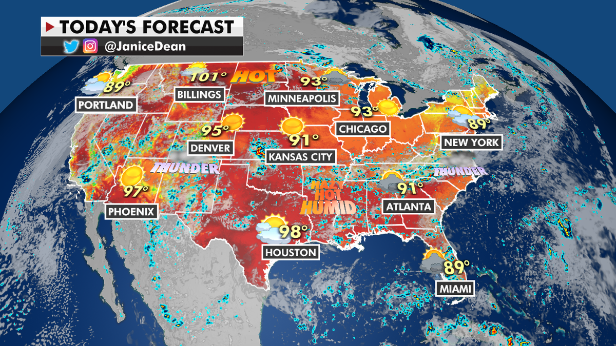
The national forecast for Monday, July 26.
The main risks will be strong winds, hail and isolated tornadoes.
Upper-level winds will push some of the smoke from wildfires into the Northern Tier of the country in the next few days.

True Crime
The hottest stories ripped from the headlines, from crime to courts, legal and scandal.
By entering your email and clicking the Subscribe button, you agree to the Fox News Privacy Policy and Terms of Use, and agree to receive content and promotional communications from Fox News. You understand that you can opt-out at any time.
