National weather forecast for December 17
Fox News senior meteorologist Janice Dean has your FOX Weather forecast.
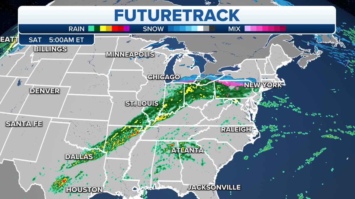
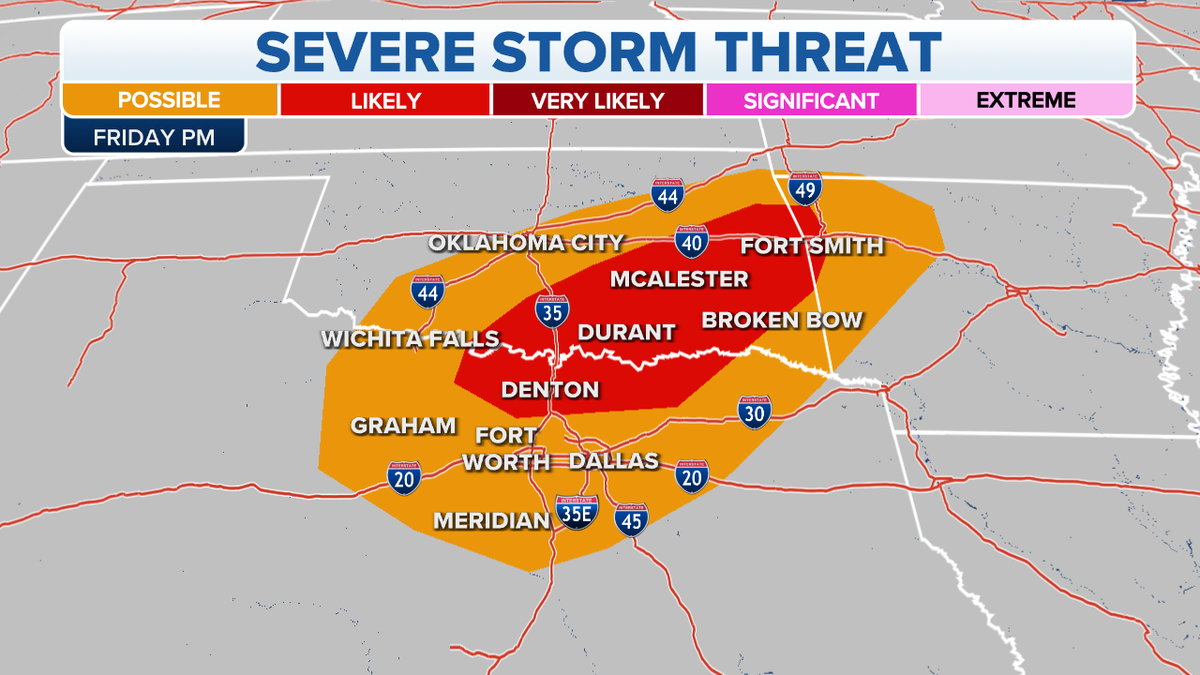
A cold front slicing across the Plains up into the Mid-Atlantic will bring the risk of thunderstorms, some of which could turn severe for parts of the South through the mid-Mississippi Valley.
THOUSANDS WITHOUT POWER AS IOWA, MINNESOTA SLAMMED WITH MOST HURRICANE-FORCE WIND GUSTS SINCE 2004
Heavy rain, large hail, damaging winds and some isolated tornadoes will be possible.

Eastern futuretrack (Credit: Fox News)
Behind the front, temperatures will drop significantly, along with wintery and possibly icy weather.

Severe storm threat in the South (Credit: Fox News)
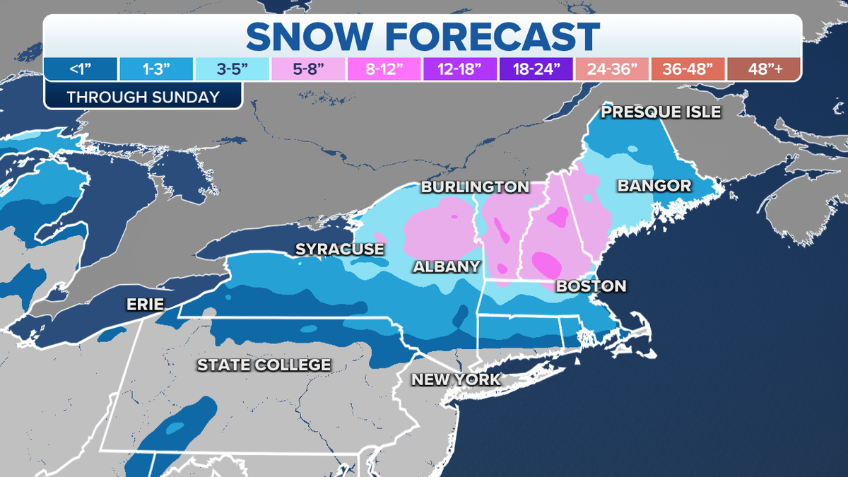
Moderate-to-heavy snow is forecast to spread from upstate New York to New England over the weekend.

Northeast, New England snow forecast (Credit: Fox News)
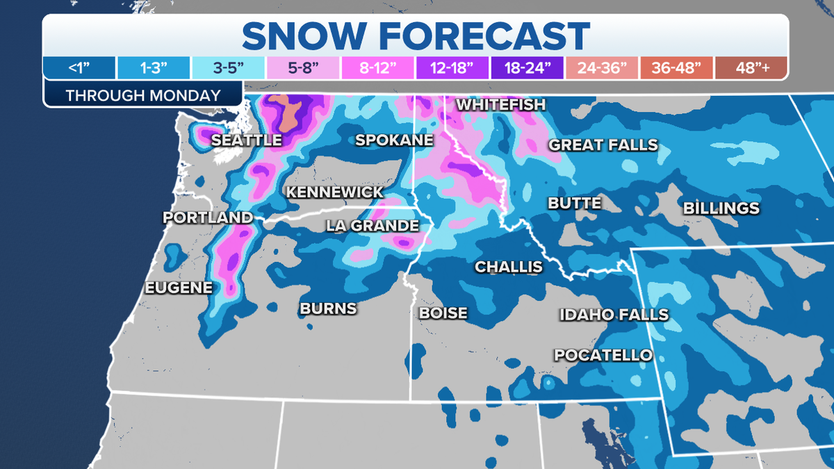
Meanwhile, the Pacific Northwest will get active again on Saturday, with more coastal rain and mountain snow.

Western snow forecast (Credit: Fox News)
CLICK HERE TO GET THE FOX NEWS APP
In addition, a pair of Alberta clippers will dive across the northern Plains, bringing snow and strong gusty winds.


