


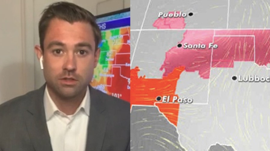
Another round of Saharan dust will move into the Gulf of Mexico and bring a haze along the Gulf Coast starting Tuesday.
The Saharan Air Layer has been incredibly impressive this year. The dry air mass, known as SAL, mostly travels above the ocean surface at 5,000 to 20,000 feet. It causes sinking air and shear, which inhibits tropical activity over the Atlantic Ocean.
The thick layer of Saharan dust continues to flow off the coast of Africa across the Atlantic and into the Caribbean, Gulf of Mexico and into the southeastern U.S.
While the latest round won't be as thick or as widespread as the past weekend, dust will be seen from Tuesday to Thursday from Texas to Louisiana.
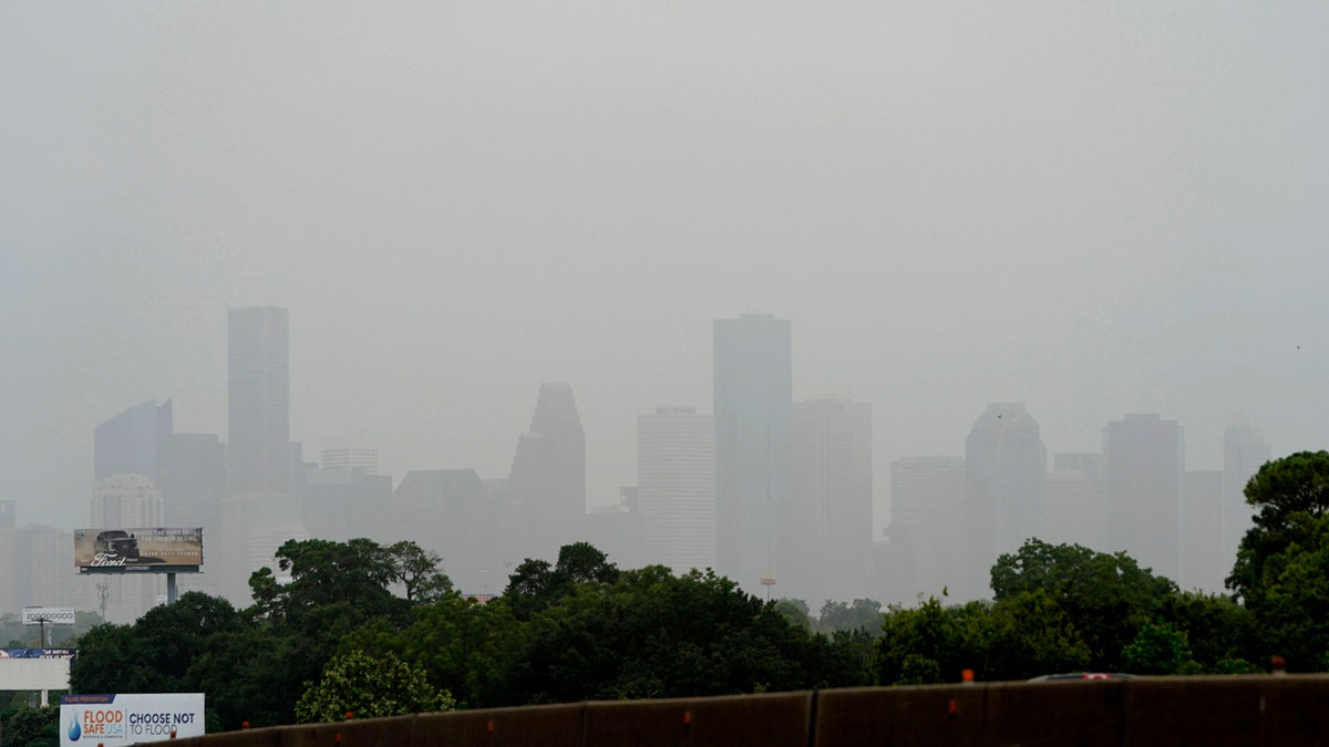
Downtown Houston is shown as a Saharan Dust cloud moves over parts of Texas, June 26, in Houston. (AP Photo/David J. Phillip)
Coastal areas, such as the Houston area and New Orleans, may see hazy skies in the days ahead.
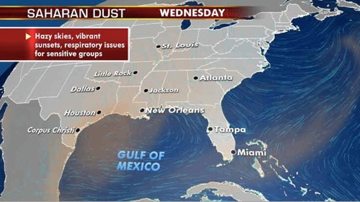
Another round of Saharan dust will move into the Gulf Coast starting on Tuesday. (Fox News)
The dust may continue to cause respiratory issues for sensitive groups.
Otherwise, dust in the atmosphere prevents hurricane development, and no activity is expected across the Atlantic for at least the next week.
INDIA CRATER LAKE THAT'S UP TO 50,000 YEARS OLD JUST MYSTERIOUSLY TURNED PINK

The dry Saharan air that's blown off the coast of Africa and filled the lower latitudes has helped put a pause on what's been an active hurricane season so far. According to NOAA, the dry, dusty air has about 50 percent less moisture than the typical tropical atmosphere, which weakens any disturbance that tries to develop.
So far in 2020, two tropical storms, Arthur and Bertha -- both in the Atlantic -- already formed this year in May.
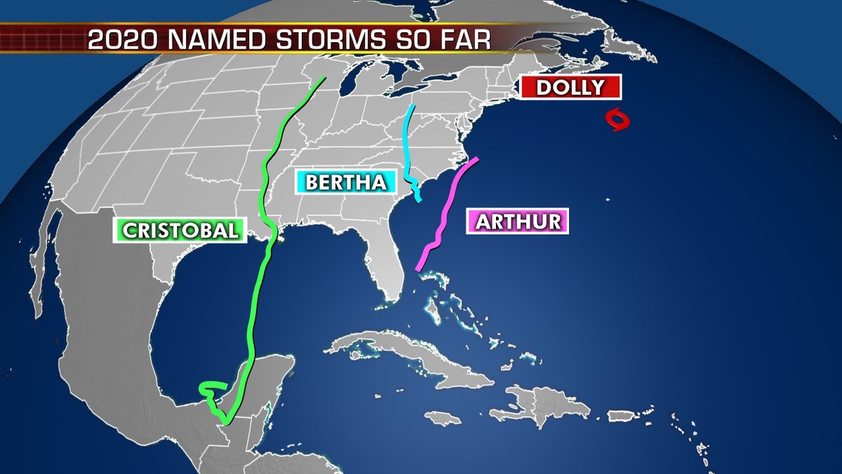
Named tropical storms so far this 2020 Atlantic hurricane season. (Fox News)
The third named storm, Cristobal, swept from Louisiana to the Upper Midwest earlier this month, bringing high winds and heavy rain. Tropical Storm Dolly became the fourth named storm of 2020 last Tuesday after forming far from land over the North Atlantic.
CLICK HERE FOR MORE WEATHER COVERAGE FROM FOX NEWS
There are as many as 13 to 19 named storms predicted during the Atlantic hurricane season, which runs from June 1 to Nov. 30, forecasters from the National Oceanic and Atmospheric Administration's (NOAA) Climate Prediction Center (CPC) said last month.
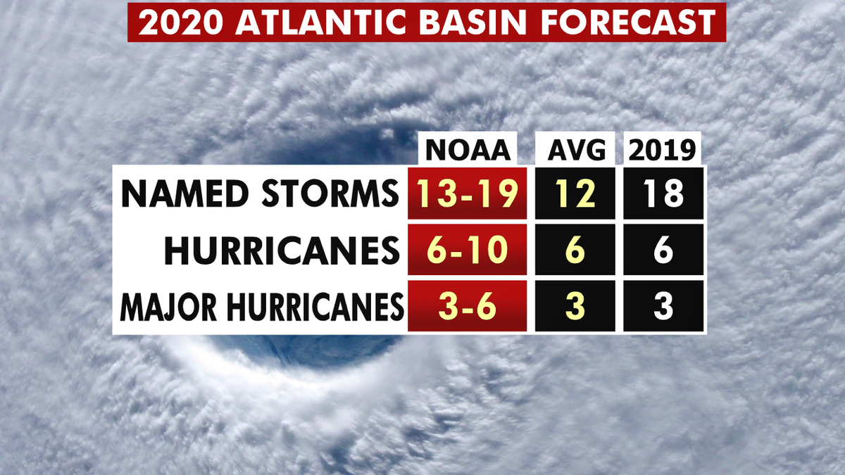
The 2020 hurricane season forecast from NOAA. (Fox News)
Six to 10 of those could develop into hurricanes, with winds of 74 mph or more, and three to six could even become major hurricanes, capable of inflicting devastating damage.
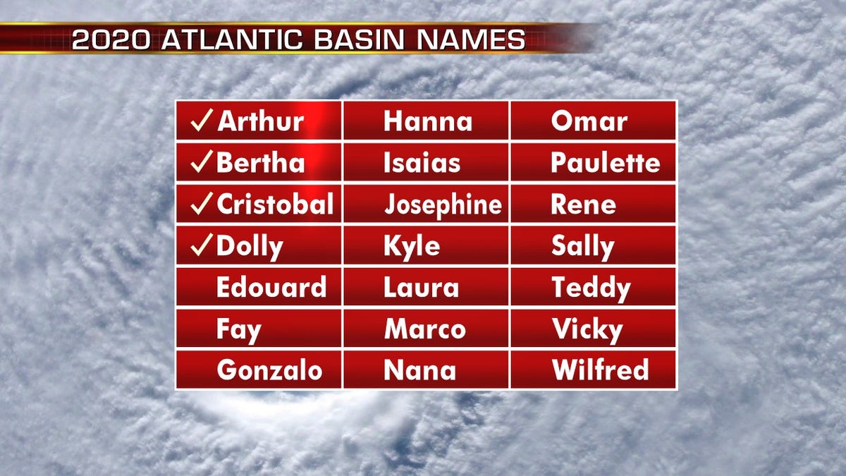
The list of names for the 2020 Atlantic hurricane season. (Fox News)
This forecast is well above the averages of 12 named tropical storms, six hurricanes, and three major hurricanes during the season.
CLICK HERE FOR THE FOX NEWS APP
The 2020 Atlantic Hurricane Season runs from June 1 to Nov. 30, and will include the names: Arthur, Bertha, Cristobal, Dolly, Edouard, Fay, Gonzalo, Hanna, Isaias, Josephine, Kyle, Laura, Marco, Nana, Omar, Paulette, Rene, Sally, Teddy, Vicky, and Wilfred.
Fox News' Travis Fedschun contributed to this report.

True Crime
The hottest stories ripped from the headlines, from crime to courts, legal and scandal.
By entering your email and clicking the Subscribe button, you agree to the Fox News Privacy Policy and Terms of Use, and agree to receive content and promotional communications from Fox News. You understand that you can opt-out at any time.
