


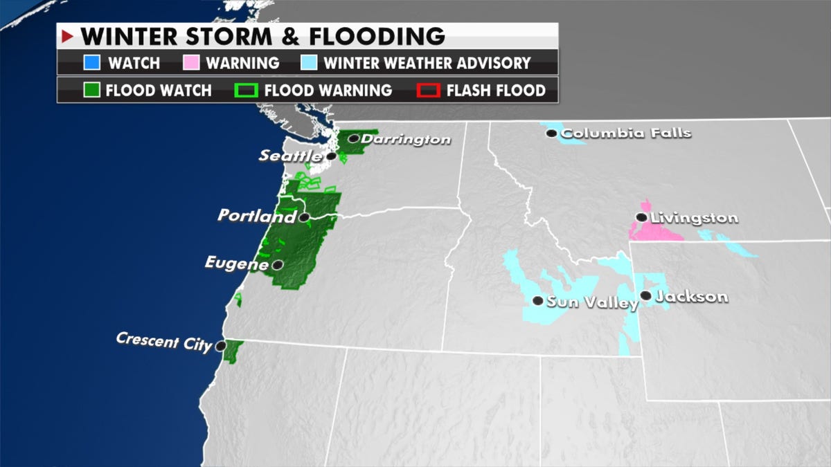
Another day of rain and mountain snow is expected Wednesday across the Northwest down into Northern California.
Flood watches are in effect along the coast with winter storm and high wind warnings as energy from this system moves into the Rockies and the Plains. Meanwhile, forecasters are monitoring the potential for some measurable snow for the Upper Midwest toward the end of the work week.
"A damaging high wind event is expected Wednesday through Friday across the Northern Rockies into portions of the Central and Northern Plains," tweeted the National Weather Service. "Travel could become hazardous, and at least minor property damage and some power outages are likely."
WHICH STATE IS AMERICA’S 'LIGHTNING KING'?

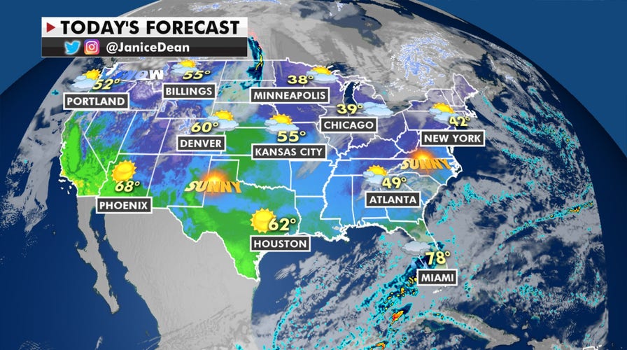
Forecast for Jan. 13, 2021. (Fox News)
Enjoy the mild temperatures across the Plains and Midwest because things are going to change as we get into next week. Temperatures this week could be warm enough to break records.
That will change next week when much colder air plunges from the north. Over the next few weeks, arctic air that has been mostly up in Canada this winter is going to come knocking on our door and that could not only bring frigid temperatures but a pattern change more conducive for snowmaking.
(Fox News)
On Tuesday, the National Weather Service Weather Prediction Center said that it will be unseasonably warm on Wednesday across the central and northern Plains.
CLICK HERE TO GET THE FOX NEWS APP
Record highs are possible in the Dakotas, forecasters said, with temperatures as much as 25 degrees above normal.

True Crime
The hottest stories ripped from the headlines, from crime to courts, legal and scandal.
By entering your email and clicking the Subscribe button, you agree to the Fox News Privacy Policy and Terms of Use, and agree to receive content and promotional communications from Fox News. You understand that you can opt-out at any time.
