


Fox News Flash top headlines for June 5
Fox News Flash top headlines are here. Check out what's clicking on Foxnews.com.
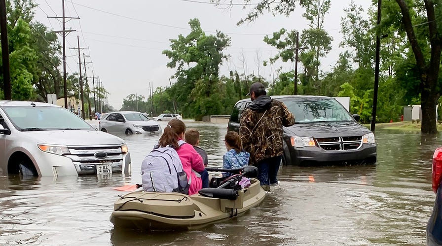
While much of the Northern and Western U.S. bakes under sweltering, triple-digit heat, Southern states will be threatened this weekend by another round of severe storms and heavy rainfall.
Already battered by weeks of flooding, baseball-sized hail and tornadoes, states along the Gulf Coast will be impacted by a slow-moving system.
CALIFORNIA FACES WORST DROUGHT IN DECADES: 'ECONOMIC DISASTER'
The National Weather Service (NWS) said Saturday that the system would extend across the region for the next several days.
In particular, the agency's Weather Prediction Center noted that the Central Gulf Coast region, Southern Louisiana and Southern Mississippi would feel its effects.
"A wet start to the weekend is in store for southeast Texas and southwest Louisiana as rain/t-storms continue along a stationary front north of the Gulf Coast," the agency tweeted last week. "Slight Risks for excessive rainfall are in effect both Friday and Saturday, with several more inches of rain forecast."
On Saturday, a moisture-rich flow moving north from the Gulf of Mexico is expected to intercept a weak low-level boundary over the region and spur the development of showers and storms through Saturday.
Between 2 to 5 inches of rain are anticipated, leading to some instances of flooding.
In addition, heavy rain is also expected to fall over the Ark-La-Tex region in connection with the slow-moving upper low.

Rain is expected to linger through midweek for many, according to The Weather Channel.
CLICK HERE FOR THE FOX NEWS APP
The East Coast and Mid-Atlantic have also seen severe thunderstorms over the past few days.
After wildfire threats and extremely hot temperatures across the Pacific Northwest – also threatened by historic drought – the Cascades region will feel some relief as a couple of Pacific disturbances pass overhead.

True Crime
The hottest stories ripped from the headlines, from crime to courts, legal and scandal.
By entering your email and clicking the Subscribe button, you agree to the Fox News Privacy Policy and Terms of Use, and agree to receive content and promotional communications from Fox News. You understand that you can opt-out at any time.
