


As the winter solstice marks the official start of the season in December, it's time for the term that means breaking out the snow shovel: "bomb cyclone."
Winter weather that impacts public safety and transportation – such as snow, sleet, ice – typically occurs between Oct. 14 and April 14, the National Weather Service says. The winter solstice begins Dec. 21 and runs through March 19, 2020.
As they do throughout the year, meteorologists work to clearly and accurately report weather forecasts to the public.
"A forecast that's accurate, that's not properly communicated is a worthless forecast," Dr. Joel N. Myers, CEO of AccuWeather, recently told Fox News.
LENTICULAR CLOUD HOVERS IN COLORADO SKY OVER MOUNTAIN LIKE A 'FLYING SAUCER'
Myers, who founded AccuWeather in 1962, told Fox News one of the most difficult things to forecast in winter is where rain and snow will hit during storms, particularly along the Northeast coast where 10 miles could be the difference between heavy rain or a foot of snow.
Here are what those winter weather terms really mean, according to weather experts:
BLIZZARD
A blizzard is defined as having winds stronger than 35 mph, combined with snow and "very poor visibility." (iStock)
The National Weather Service defines a blizzard as having strong winds greater than 35 mph, combined with heavy or blowing snow to produce "very poor visibility."
Visibility needs to be under a quarter-mile to qualify as a blizzard. Previously, there also was a temperature criterion for blizzards, according to Myers.
Temperatures needed to be below 20 degrees for a storm to officially be a blizzard, with the "severe" title added when the thermostat dipped below 10 degrees, but that requirement was taken away.
"It's much easier to get a blizzard," he told Fox News.
NOR'EASTER
The swirling storms that typically bring heavy snow, rain and coastal flooding to areas in the Northeast are known as "nor'easters."
Nor'easter vs. Alberta Clipper: Here's the difference
In winter you’ll often hear meteorologists refer to two types of snowmakers, a Nor’easter and an Alberta Clipper. But just because these winter storms make snow, doesn’t make them the same.
The storms moving up the East Coast of the U.S. received their name because their winds typically blow from the northeast, even though the storm is moving from southeast to northeast. That's because the winds are moving in a counter-clockwise [around the area of low pressure], according to Myers.
The storms were noted by Benjamin Franklin and used in early navigational manuals.
"He noted the storm was moving up the coast, hit Philadelphia before Boston, and so the storm must be moving from the southeast to northeast, and the air circulating around it caused a northeast wind," Myers told Fox News.
BOMB CYCLONE
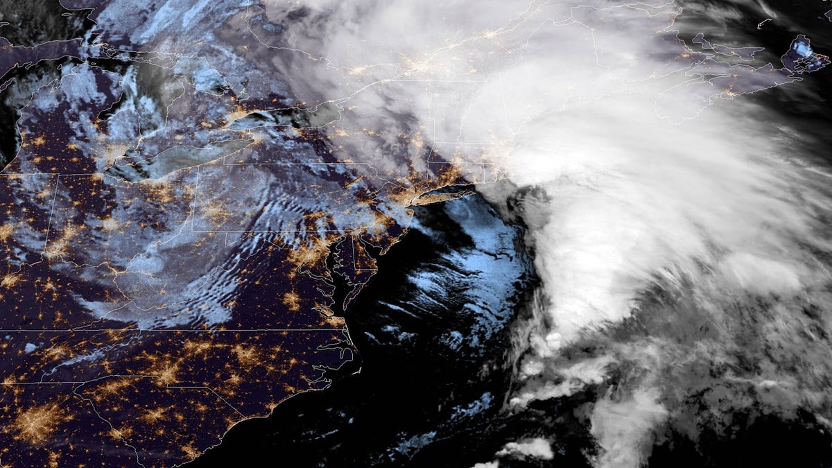
The "bomb cyclone" can be seen off the coast of the Northeast on Oct. 17, 2019. (NOAA/GOES East)
Winter storms that strengthen rapidly – including nor'easters – are dubbed "bomb cyclones."
The term “bombogenesis” comes from mid-latitude storms that intensify rapidly, dropping 24 millibars (or atmospheric pressure) over a 24-hour span, according to the National Oceanic and Atmospheric Administration (NOAA). A typical range in millibar change is around 10 to 15 in 24 hours.
HURRICANE GETS UPGRADE TO CATEGORY 4 STORM, 54 YEARS AFTER MAKING LANDFALL
A bombogenesis storm can be tropical or non-tropical, AccuWeather senior meteorologist Alex Sosnowski said in a blog post.
“The term bombogenesis comes from the merging of two words: bomb and cyclogenesis. All storms are cyclones, and genesis means the creation or beginning,” Sosnowski said. “In this case, bomb refers to explosive development. Altogether the term means explosive storm strengthening.”
SLEET
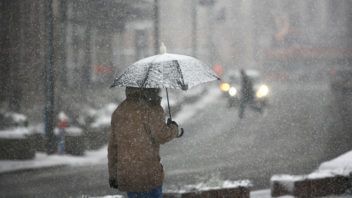
Sleet is known as a combination of a snowflake and water that is frozen, according to forecasters. (iStock)
One of the types of precipitation people commonly describe as "hail" is actually sleet.
Sleet is ice pellets or granulates of frozen rain, and occurs when rain falls through the air with temperatures below freezing, according to the NWS.
While the raindrop is falling, if it goes through above-freezing air, it turns back into liquid - until it refreezes before hitting the ground.
"It's a combination of a snowflake and water that is frozen," Myers told Fox News.
FREEZING RAIN
Freezing rain is defined as rain that falls and lands on a surface with a temperature that is below freezing, causing it to freeze on contact. The rain that falls and freezes eventually forms a coating of ice or glaze that can make walking or driving extremely difficult.
FREEZE, FLASH FREEZE, and FROST
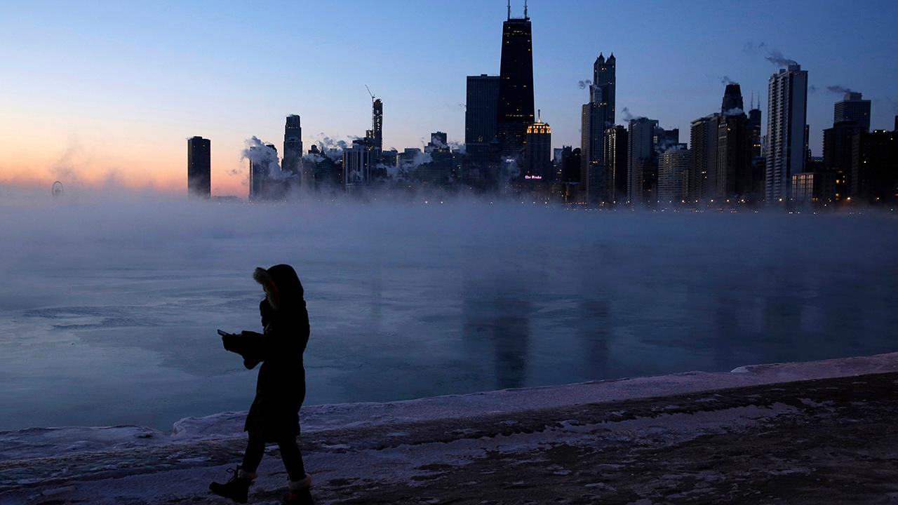
Big freeze a breathtaking sight in the Midwest
Mist from Lake Michigan forms an ice cave in Chicago; Mike Tobin reports from the scene.
When temperatures at or near the ground are expected to be 32 degrees Fahrenheit or colder, a freeze warning can be issued.
A freeze may or may not be accompanied by a frost, which is the formation of ice crystals that develop when dew gathers in temperatures of at least 32 degrees.
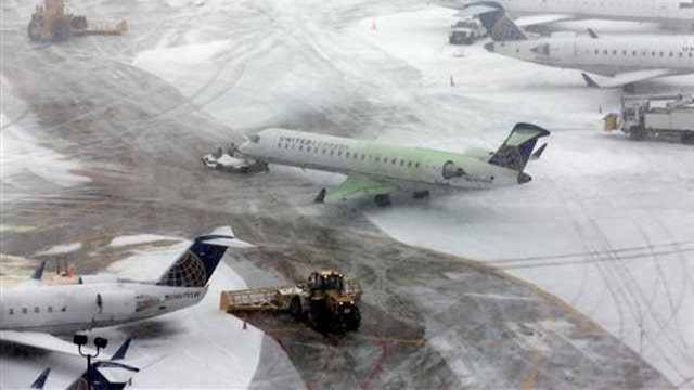
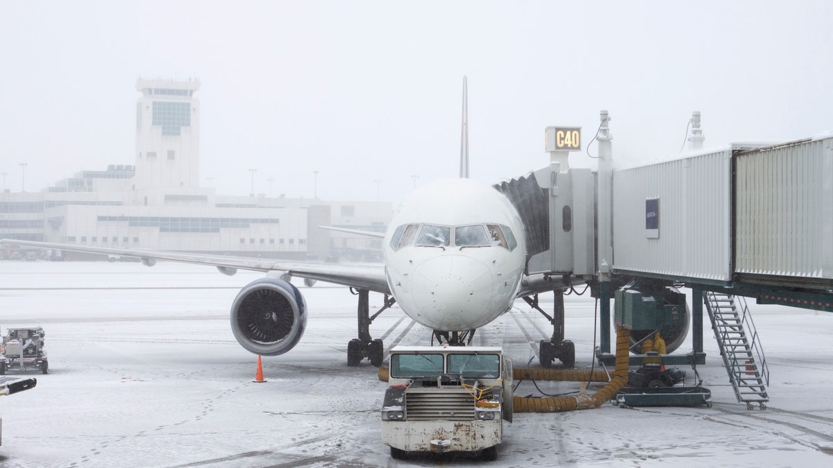
Flash freeze creates travel nightmare in Northeast
Winter weather cancels thousands of flight into and out of Northeast
A flash freeze occurs when temperatures drop quickly below 32 degrees and cause a rapid freeze. If there is moisture on surfaces such as roadways or vehicles, for instance, the temperatures can impact locks on cars, according to Myers.
BLACK ICE
When there is a flash freeze, water on untreated surfaces can form "black ice."
2019 ATLANTIC HURRICANE SEASON COMES TO AN END: HERE'S HOW IT STACKED UP
If the water present is very thin and on a surface such as black asphalt, it can be difficult to see, according to Myers.
"It can be extremely dangerous and very slippery," he told Fox News.
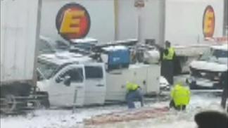
Pileup on Interstate 71 triggered by snow squall
Raw video: Pileup on Interstate 71 in Ohio triggered by snow squall.
SNOW SHOWERS AND SNOW SQUALLS
The NWS counts snow showers as snow falling with varying intensity over brief periods, possibly accumulating.
Snow squalls, however, are more intense snow showers and the most common, according to Myers.
Snow squalls come off the Great Lakes before they freeze, with the cold air picking up moisture that can produce very heavy snow in lake areas and farther inland, according to Myers.
Brief, intense weather is typically accompanied by strong, gusty winds and may produce "significant" accumulations.
WIND CHILL AND ACCUWEATHER REALFEEL
In addition to temperatures on a thermometer, "wind chill" tells us how it feels outside.
The NWS defines a wind chill index as the apparent temperature, plus the effect of falling temperatures and the rate of heat loss from a human body, caused by the wind.
"As the wind increases, heat is carried away from a person's body at a more accelerated rate, driving down the body temperature," according to the NWS.
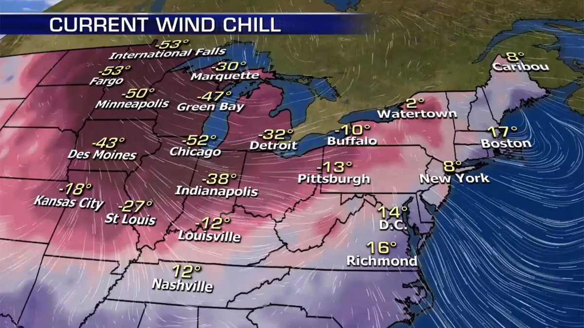
The windchills during the Polar Vortex in January 2019. The National Weather Service defines a wind chill index as the apparent temperatures which take into account the combined effect of lowering temperatures and the rate of heat loss from a human body. (Fox News)
AccuWeather has taken that to the next level with the "RealFeel" temperature in its forecasts. It describes "how people feel" given all the factors when they step outside, according to Myers.
CLICK HERE FOR THE FOX NEWS APP
That takes into account temperature, humidity, cloud cover, sun intensity, even air density, which is different in the mountains than in more coastal areas like New York.
Myers told Fox News that such a detailed forecast is important since extreme hot and cold threaten safety and health.
POLAR VORTEX
In the winter months, bitterly cold outbreaks of Arctic air across the Midwest and the Northeast can be tied to what is known as the "polar vortex."
What is a polar vortex?
The polar vortex could sweep across the east coast this winter, bringing with it harsh conditions, climate scientists have warned.
The polar vortex refers to the cold air and low pressure that constantly surrounds both of the Earth’s poles. In the winter, a disruption in the polar vortex can occur as it tends to expand in the northern hemisphere, pushing that cold air further south, according to the NWS.
"This occurs fairly regularly during wintertime and is often associated with large outbreaks of Arctic air in the United States," the Weather Service states.
While the name seems menacing, the greatest danger a polar vortex brings is a decrease in temperature as it expands – particularly in areas that don’t normally experience drastically cold weather.
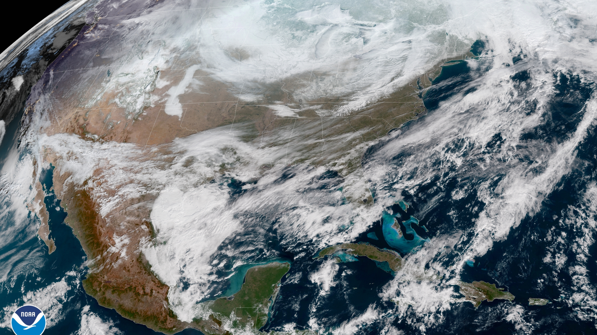
A frigid look at the United States in the midst of the polar vortex in 2019. (NOAA)
"In short, there is no cause to be alarmed when you hear about the polar vortex, but you should be prepared for colder temperatures," according to the Weather Service. "It is also a good idea to check the items in your home and car emergency kits at the beginning of each winter season to ensure you are prepared for any type of hazardous winter weather."

True Crime
The hottest stories ripped from the headlines, from crime to courts, legal and scandal.
By entering your email and clicking the Subscribe button, you agree to the Fox News Privacy Policy and Terms of Use, and agree to receive content and promotional communications from Fox News. You understand that you can opt-out at any time.
