


National forecast for Thursday, April 23
Fox News senior meteorologist Janice Dean has your FoxCast.
Get all the latest news on coronavirus and more delivered daily to your inbox. Sign up here.
A powerful line of thunderstorms that triggered a tornado warning for part of New York City on Tuesday actually whirled up what's known as "gustnado," according to forecasters.
The National Weather Service (NWS) office in New York said the thunderstorm whirlwind moved over the Harlem River around 2:30 p.m. in the afternoon, south of the Broadway Bridge that connects Northern Manhattan with the Bronx.
The gustnado then hit the shoreline of the Bronx before dissipating north of Fordham Road, according to forecasters.
MASSIVE 'ICE SHOVE' PILES UP ALONG MINNESOTA LAKEFRONT, THREATENING BUILDINGS
Radar velocity estimates and a wind observation of 71 mph from Fordham in the Bronx indicate the gustnado had estimated wind speeds of between 70 to 75 mph.

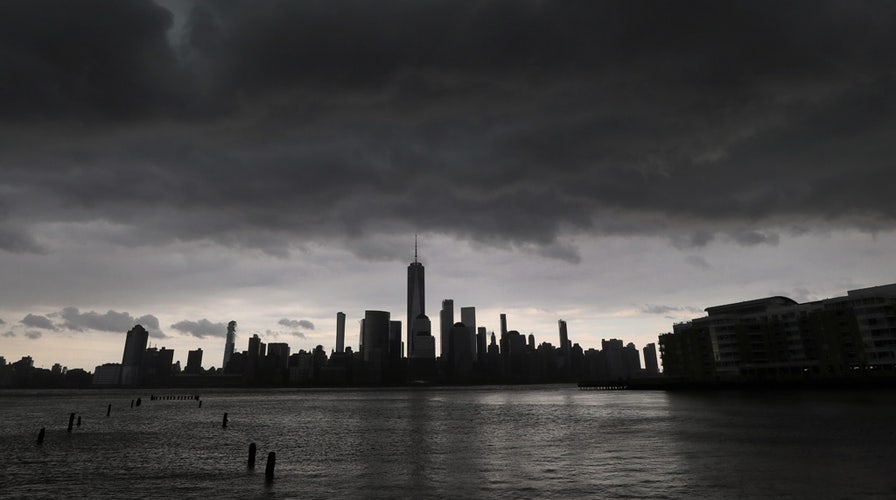
A thunderstorm passes over lower Manhattan and One World Trade Center in New York City, April 21, 2020. A "gustnado" was reported in Northern Manhattan from the storms. (Photo by Gary Hershorn)
According to the National Oceanic and Atmospheric Administration (NOAA), a gustnado is a small, whirlwind which forms as an eddy in thunderstorm outflows.
"They do not connect with any cloud-base rotation and are not tornadoes," the NOAA states.

A thunderstorm passes over midtown Manhattan and the Empire State Building in New York City, April 21, 2020. A "gustnado" was reported in Northern Manhattan from the storms. (Gary Hershorn)
The whirlwinds are classified as thunderstorm wind events, and like dust devils, "some stronger gustnadoes can cause damage," according to the agency.
TORNADO IN OKLAHOMA FORMS BEHIND RAINBOW AS SEVERE WEATHER STRIKES REGION
Video obtained by WNBC-TV shows the gustnado as it made its way over the Harlem River.
The NWS said that a severe thunderstorm warning was initially issued for the area around 2:12 p.m. as the line of storms approached, with strengthening detected in radar prompting forecasters to upgrade it to a tornado warning by 2:33 p.m.
"At this point though, observational evidence is inconclusive of a tornado touchdown," the NWS stated on Wednesday.
CLICK HERE FOR MORE WEATHER COVERAGE FROM FOX NEWS
The powerful line of thunderstorms also caused damage in neighboring New Jersey, where wind gusts were reported between 60 to 80 mph.
Numerous homes in Toms River were damaged and trees were downed when the thunderstorms struck.
The Toms River Police Department said on Facebook over 100 calls were received for fallen trees on houses and cars, wires down, traffic signals out, and destroyed property.
CLICK HERE FOR THE FOX NEWS APP
Forecasters from the NWS office in Mount Holly, N.J. concluded that the damage was caused by straight-wind lines associated with thunderstorms moving rapidly towards the coast, and not a tornado.

Lightning strikes behind lower Manhattan and One World Trade Center during a thunderstorm in New York City, April 21, 2020. (Gary Hershorn)
“Small-scale circulations were seen and recorded immediately ahead of the advancing cold front, which in some cases induced waterspouts over a few back bays and oceanfront areas, but were not strong enough to cause the damage experienced by numerous communities across the state,” forecasters said.

True Crime
The hottest stories ripped from the headlines, from crime to courts, legal and scandal.
By entering your email and clicking the Subscribe button, you agree to the Fox News Privacy Policy and Terms of Use, and agree to receive content and promotional communications from Fox News. You understand that you can opt-out at any time.
