


A low-pressure system that is slowly moving through the Mississippi Valley over the next couple of days is likely to bring moderate to heavy rain along with severe storms across the southern U.S.
The Storm Prediction Center has issued an enhanced risk of severe weather -- including tornado, wind and hail threats -- over the Lower Mississippi Valley for this afternoon into tonight.
These risks are centered over southeastern Arkansas and northeastern Louisiana.
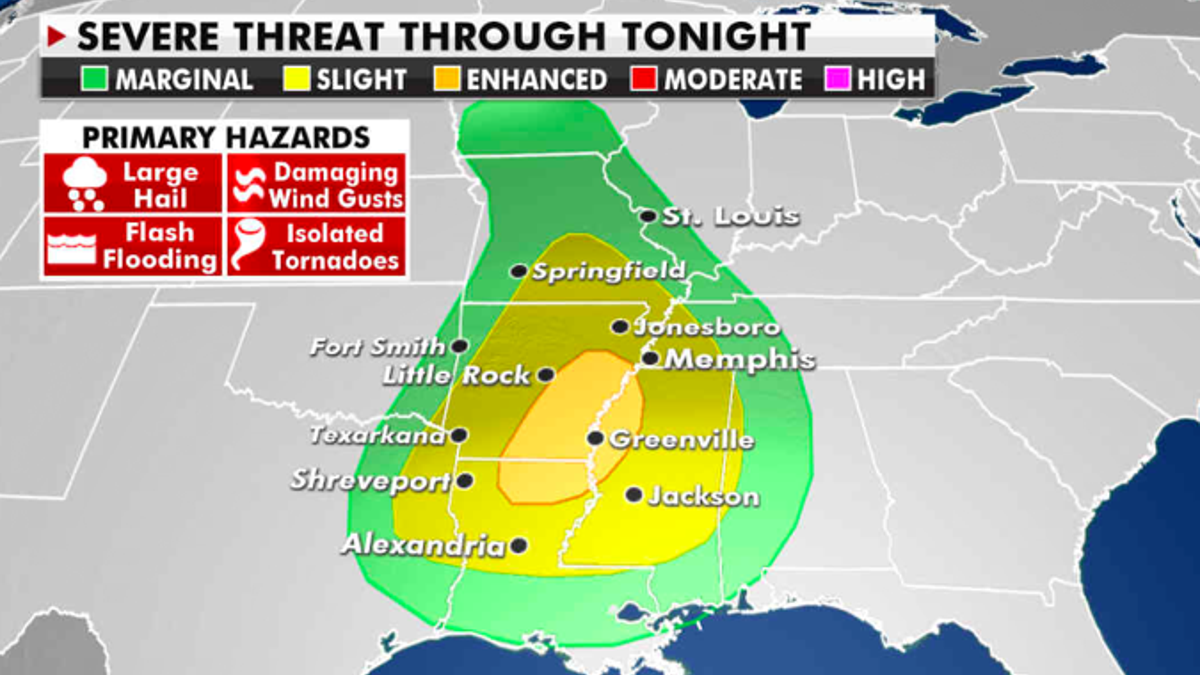
The current risk of severe weather. (Fox News)
SPACEX DETERMINES CAUSE OF STARSHIP SN11 PROTOTYPE CRASH
Some locations in the region could see several inches of rain and localized flooding is possible into early Thursday morning.
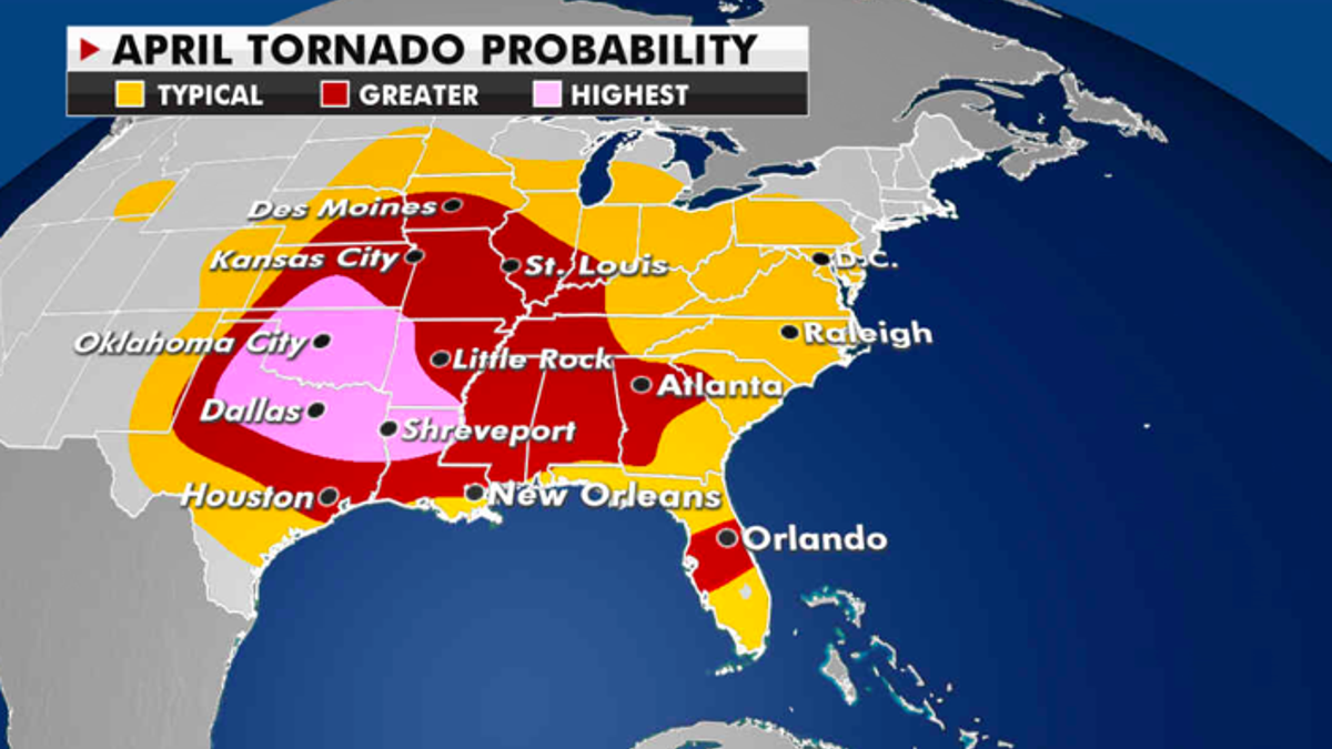
Where tornadoes are most likely to be reported this month. (Fox News)
Otherwise, in general, most of the contiguous U.S. will see higher than normal temperatures over the next few days.
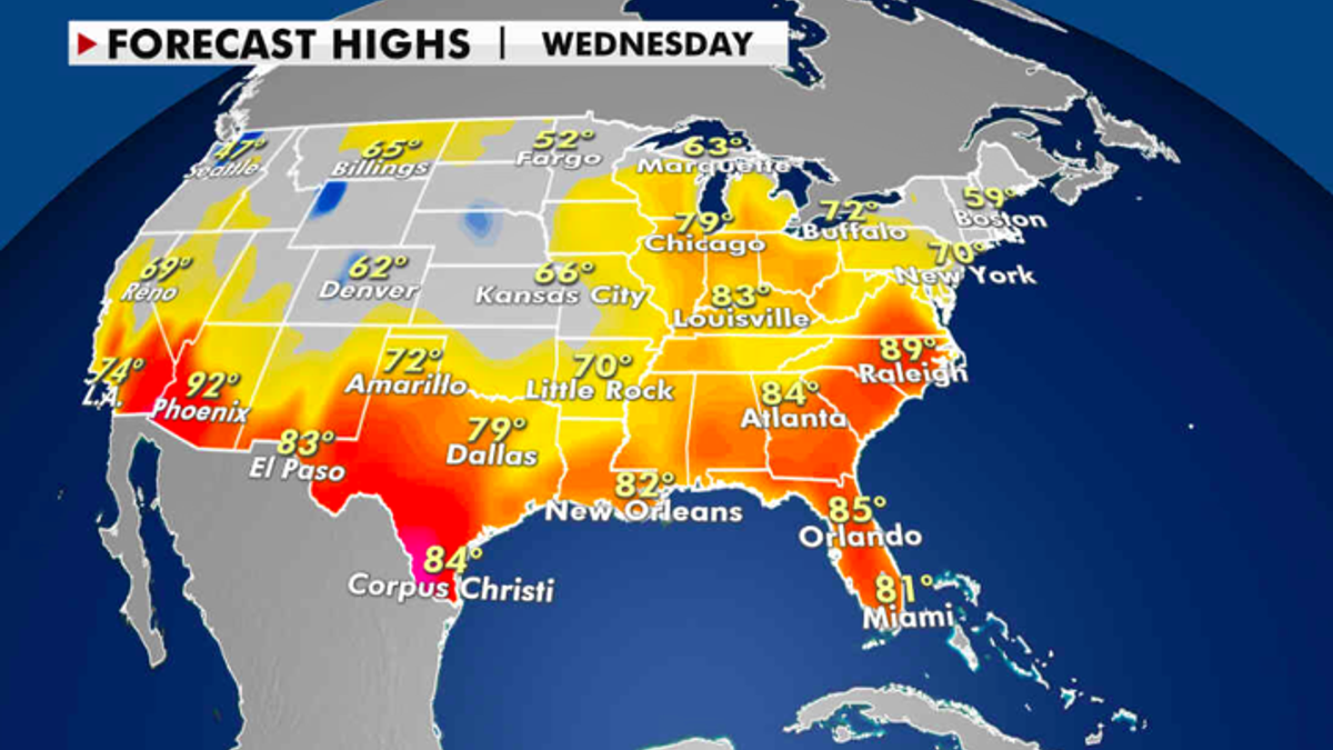
Expected high temperatures for Tuesday. (Fox News)
CLICK HERE TO GET THE FOX NEWS APP
The Great Lakes region can again expect high temperatures to be around 15 to 25 degrees above normal on Wednesday. A few daily records could be set.
The Southwest and southern Texas will experience temperatures around 90 to 100 degrees over the next few days.

True Crime
The hottest stories ripped from the headlines, from crime to courts, legal and scandal.
By entering your email and clicking the Subscribe button, you agree to the Fox News Privacy Policy and Terms of Use, and agree to receive content and promotional communications from Fox News. You understand that you can opt-out at any time.
