After many days of severe storms -- including dozens of reports of tornadoes across the U.S -- the cold front associated with the destructive weather will finally exit the East Coast on Wednesday night.
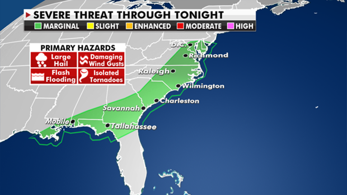
We could still see some stronger storms as the front extends from the Gulf Coast up to the Northeast, but not as volatile as what some experienced over the last few days.

Storm reports in the last 72 hours. (Fox News)
Heavy rain could cause pockets of flash flooding.
The rest of the country is fairly quiet.

The threat of severe weather for Wednesday. (Fox News)
CLICK HERE TO GET THE FOX NEWS APP
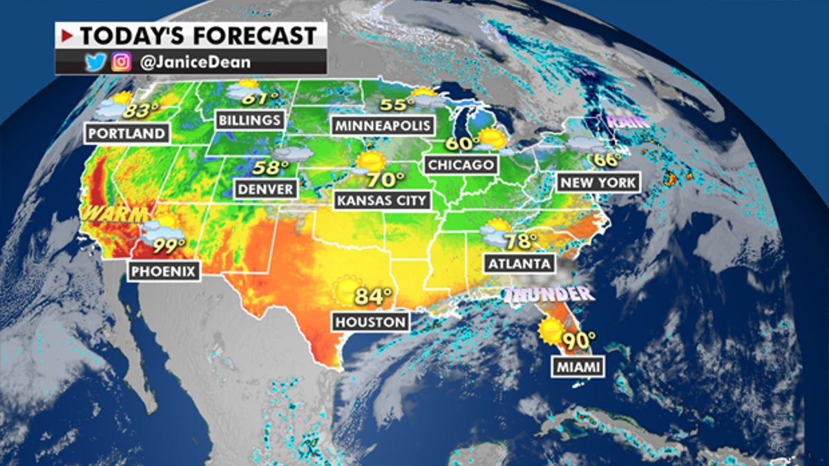
A weak system will bring some scattered storms across the Ohio Valley and the Pacific Northwest will see some rain and light mountain snow through Friday morning.

The national forecast for Wednesday, May 5. (Fox News)
Temperatures will be 10 to 20 degrees above average across the Western U.S., while cooler drier air moves into the East.


