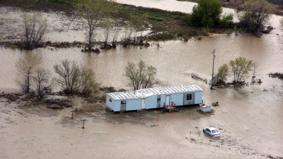
May 27: A flooded mobile home near Crow Agency, Mont. Recent flooding displaced hundreds of residents of the Crow Indian Reservation and damaged an estimated 200 homes. (AP) (AP2011)
HELENA, Mont. – More rain began falling Sunday on soaked Montana communities after more than a week of floods in the region, along with a heavy mountain snowpack and burgeoning dams, prompted states downstream to also prepare for flooding.
A break in rainy weather at the start of the long holiday weekend allowed Montana residents to clear flood debris from homes and roads, but the respite wasn't expected to last long. The National Weather Service predicted up to 3 inches of rainfall from Sunday to Monday in the wake of a previous storm that brought as much as 8 inches to some areas of the state.
Officials warned ongoing flooding could ultimately be the worst in decades for the state, with an unusually heavy snowpack in the mountains, persistent spring rains and waterlogged ground incapable of soaking up any more moisture.
As much as 18 inches of snow is predicted for the region's Beartooth Mountains this week, said Marc Singer of the National Weather Service in Billings, and temperatures at lower elevations could be above 70 degrees by Thursday.
"No part of the state is expected to not have some type of flooding," Monique Lay, spokeswoman for the state Emergency Coordination Center, said in anticipation of more rain and melting snowpack. "It's statewide, corner to corner."
The weather service for the second weekend in a row blanketed much of the central and eastern regions of Montana with flood warnings on Sunday, and Gov. Brian Schweitzer sent 36 National Guard soldiers to Roundup, a town northwest of Billings in central Montana that remained inundated by several feet of water for a fourth day.
Only one road leading into the agriculture and mining town was open, and the governor's order to deploy the National Guard to the community came a day after he sent 50 guardsmen to the Crow Reservation, which also has been inundated by heavy flooding. The National Guard contingents were to provide unarmed security checkpoints.
About 1,500 North Dakota National Guard soldiers also have been summoned to help in the flood effort there as residents in Bismarck, N.D., and nearby Mandan brace for mass amounts of water to be released in the coming weeks at Garrison Dam, a Missouri River reservoir bloated by large inflows of rain and melting snow in Montana, Wyoming and western North Dakota.
The Missouri River on Sunday was slightly below flood stage of 16 feet.
In South Dakota, several hundred homeowners in low-lying areas of Pierre and Fort Pierre also have been working feverishly for several days, moving their belongings to higher ground and laying sandbags around the houses.
Water had already moved into some residential areas of Fort Pierre, and was expected to rise another 4 feet in Pierre and Fort Pierre within a couple of weeks.
In perhaps a sign of weariness in Montana, the state Emergency Coordination Center on Sunday felt compelled to issue a statement saying Fort Peck Dam is not in danger of failing in an effort to quell what spokeswoman Lay said were persistent rumors being voiced at many local meetings.
"There is a lot of frustration and devastation," said Lay about what residents are facing.
The spillway at Fort Peck Dam, which backs up the 134-mile long Fort Peck Lake, operated earlier this month for the first time since 1997, said Jody Farhat, Chief of the Missouri River Basin Water Management office with the U.S. Corps of Engineers.
She said water will pass over the spillway again starting Thursday as the Corps plans to build to a record release of 50,000 cubic feet per second by June 6. The previous record, she said, was 35,000 cfs in 1975. She reiterated that the dam is absolutely safe.
Farhat said all six mainstem dams on the Missouri River are being operated in a coordinated way to handle what she said is likely a record runoff for the basin.


