


2019 Atlantic Hurricane season comes to an end: Here's how it stacked up
2019 Atlantic Hurricane season was an above-normal season with 12 named storms, six hurricanes, and three major hurricanes. NOAA is now asking people to prepare for the season ahead.
Get all the latest news on coronavirus and more delivered daily to your inbox. Sign up here.
Just a few weeks before hurricane season officially gets underway in the Atlantic Basin, forecasters revealed upcoming changes to the way they inform people about approaching storms.
On average, 12 tropical storms – six of which become hurricanes – form over the Atlantic Ocean, Caribbean Sea or the Gulf of Mexico during hurricane season, according to the National Weather Service (NWS).
The National Hurricane Center (NHC) said it's making minor changes to the information it puts out during hurricane season, which runs six months, from June 1 to Nov. 30.
WHAT WAS THE WORST HURRICANE TO HIT THE US? HERE ARE THE COSTLIEST STORMS
According to the NHC, it will now include a graphical depiction of its storm surge forecast. Forecasters previously used only a text format to give storm surge information.
The graphic forecasters plan to use in 2020 will give expected storm surge inundation values for the United States Gulf and Atlantic coasts, Puerto Rico and the U.S. Virgin Islands.
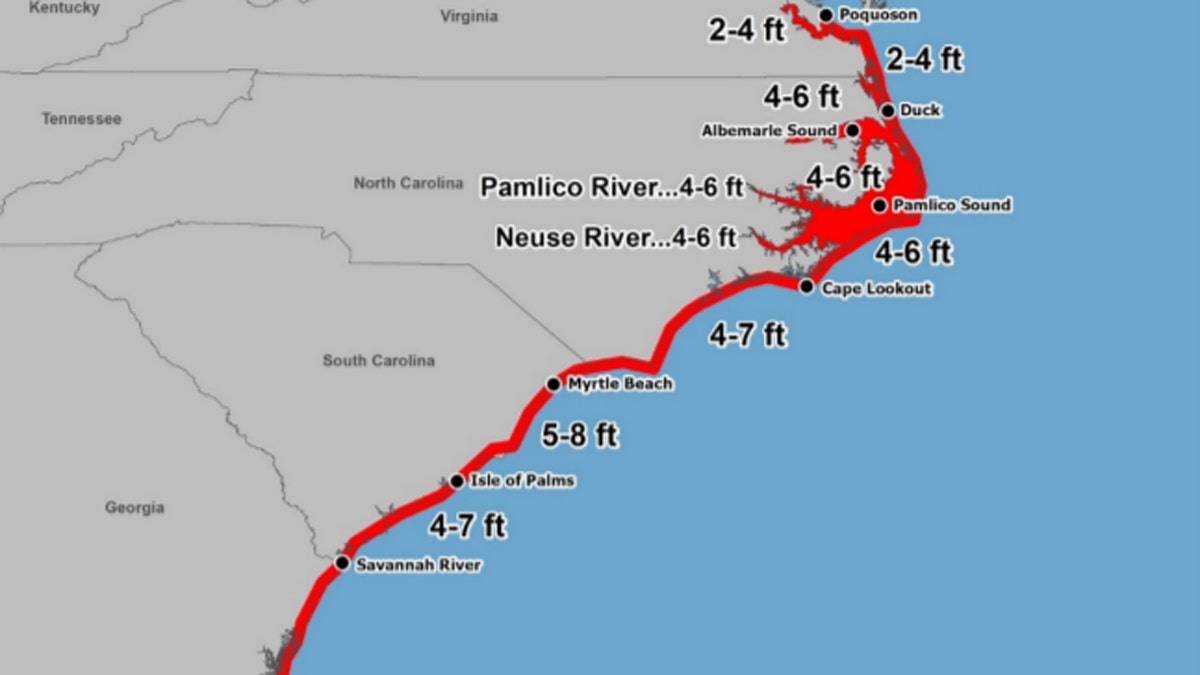
A new graphic of storm surge inundation values will accompany hurricane forecasts in 2020. (NHC)
"These values represent the peak height the water could reach above normally dry ground somewhere within the specified areas," the NHC said.
In addition to the storm surge graphic, forecasters will add a wind speed and wind radii forecast at 60 hours, which will include in the time-of-arrival and storm surge forecasts
The new 60-hour mark also will be noted on the “cone of uncertainty” over areas possibly affected by a future storm.
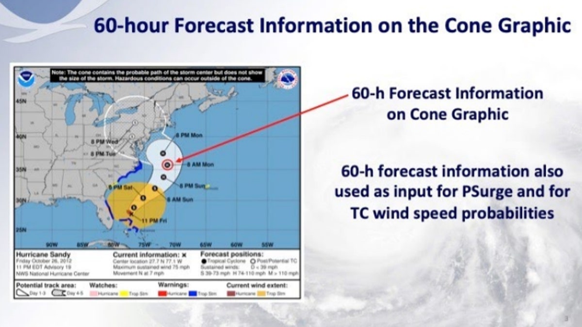
A 60-hour mark will also be added to hurricane forecasts in 2020. (NHC)
Previously, forecasters used a cone for 48 hours and 72 hours ahead of the storm.
WHAT WAS THE WORST HURRICANE TO HIT THE US? HERE ARE THE DEADLIEST STORMS EVER
The NHC said that the size of the tropical cyclone track forecast error cone for the Atlantic basin will be mostly unchanged in 2020.
"The cone represents the probable track of the center of a tropical cyclone and is formed by enclosing the area swept out by a set of imaginary circles placed along the forecast track (at 12, 24, 36 hours, etc.)," according to the NHC.
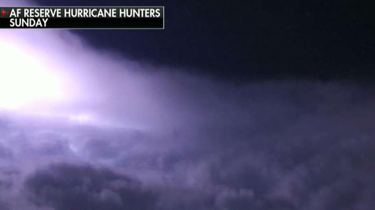
Hurricane hunters take us inside the eye of Hurricane Dorian
Air Force Lt. Col. Jeff Ragusa on the dangers of flying directly into the eye of the storm.
One other tweak for Atlantic hurricane forecasts in 2020 is the addition of new local time zones for systems in the far eastern Atlantic.
Tropical cyclones centered in the central and western Gulf of Mexico use Central Time, while those near the East Coast of the U.S. or Gulf have used Eastern Time. Other systems in the Atlantic basin use Atlantic Standard Time.
"This however, can be problematic for systems affecting the Cabo Verde Islands or other locations in the northeastern Atlantic basin where locations are 3 to 4 hours ahead of Eastern Time," the NHC said.
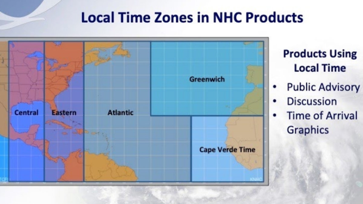
A breakdown of the local time zones in the Atlantic basin. (NHC)
So starting this year, systems far north and east will have appropriate local time zones noted in their associated forecasts.
CLICK HERE FOR MORE WEATHER COVERAGE FROM FOX NEWS
While the National Oceanic and Atmospheric Administration Climate Prediction Center will provide its initial seasonal outlook for the Atlantic basin in May, researchers at Colorado State University are predicting an above-average hurricane season this year, citing the likely absence of El Niño as a primary factor.
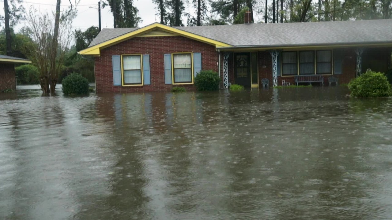
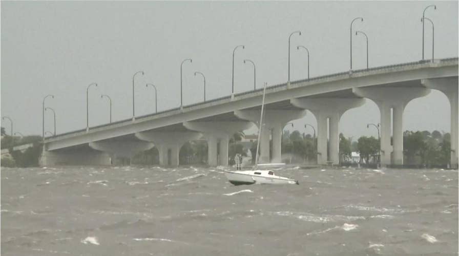
Storm surge during hurricanes: What are they and how can you prepare
What is a storm surge and how can you prepare for them?
CLICK HERE FOR THE FOX NEWS APP
Researchers at Colorado State are predicting 16 named storms, of which eight are forecast to become hurricanes. Four are expected to reach major hurricane strength with winds greater than 111 mph.
The 2020 Atlantic Hurricane Season runs from June 1 to Nov. 30, and will include the names: Arthur, Bertha, Cristobal, Dolly, Edouard, Fay, Gonzalo, Hanna, Isaias, Josephine, Kyle, Laura, Marco, Nana, Omar, Paulette, Rene, Sally, Teddy, Vicky, and Wilfred.

True Crime
The hottest stories ripped from the headlines, from crime to courts, legal and scandal.
By entering your email and clicking the Subscribe button, you agree to the Fox News Privacy Policy and Terms of Use, and agree to receive content and promotional communications from Fox News. You understand that you can opt-out at any time.
