While the cleanup from Hurricane Laura has only just begun along the Gulf Coast, forecasters are monitoring four disturbances for tropical development heading into the busiest month of hurricane season.
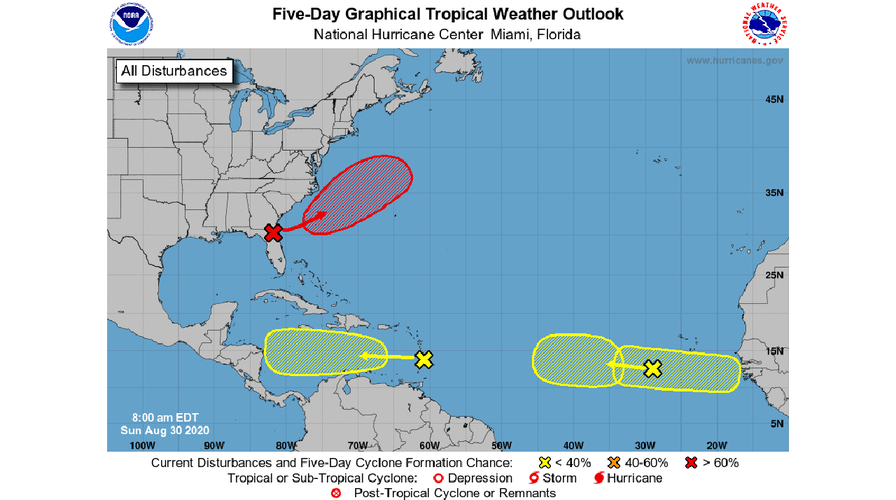
The U.S. National Hurricane Center (NHC) in Miami said Sunday it's monitoring a "quartet of systems" over the Atlantic basin.
"The headliner is a low pressure area forecast to form near the U.S. East Coast with a high (70%) chance of becoming a tropical depression later this week," the NHC tweeted.
ATLANTIC HURRICANE SEASON: WHERE DO TROPICAL STORMS FORM IN AUGUST?
According to the NHC, an area of low pressure is forecast to form off the southeastern coast of the U.S. in a day or two.
A tropical depression is then likely to form by the middle of the week while the system moves northeastward, parallel to the coast before heading away from land. The NHC gives a 70% chance the system forms somewhere over the next five days.
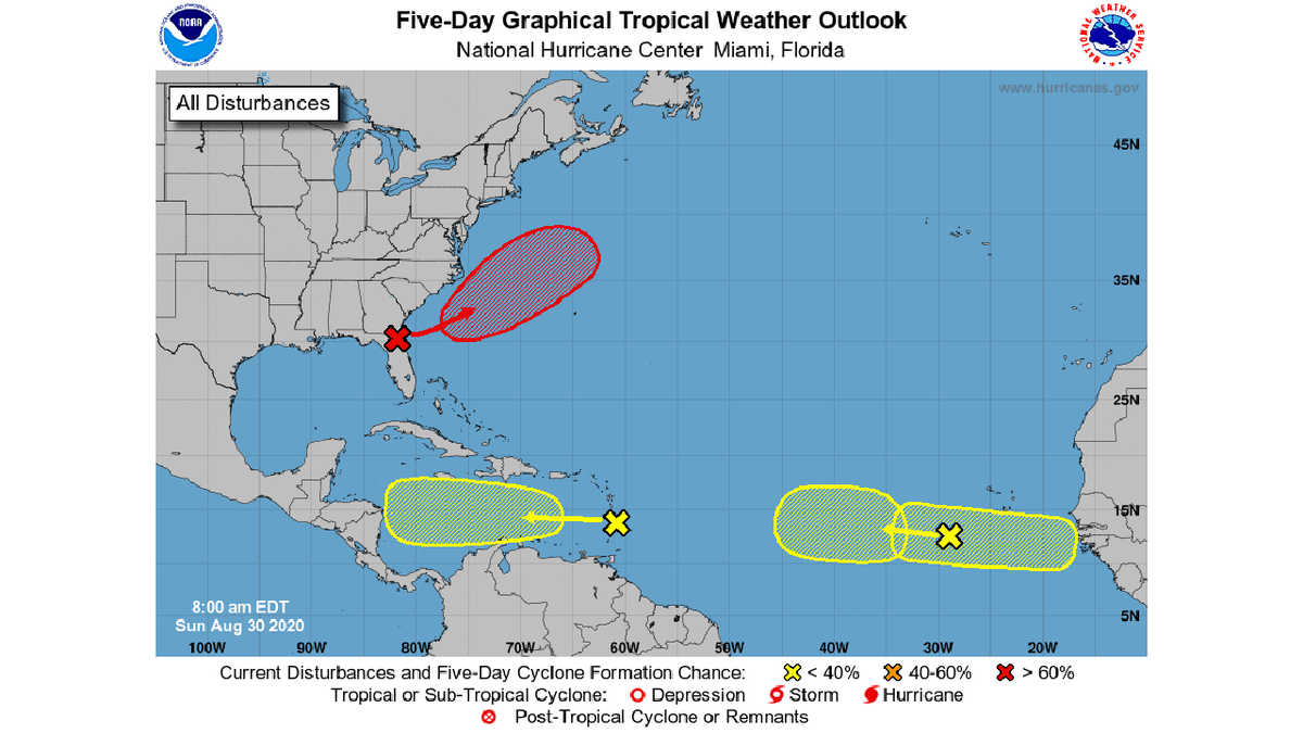
Four areas over the Atlantic are being monitored for possible tropical development, according to the National Hurricane Center (NHC). (NHC)
A cold front draped across the region can sometimes allow such systems to form at the tail end, according to Fox News' Chief Meteorologist Rick Reichmuth.
"Sometimes, we see these kind of redevelop into something tropical, and there is a chance of that," Reichmuth said on "Fox & Friends Weekend." "If this happens, that little disturbance around Florida, we'll see this kind of move off the shore."
If it does develop into the next named storm, it would have the name "Nana," but remain heading out to sea.
2020 ATLANTIC HURRICANE SEASON NAMES: HERE'S THE FULL LIST FROM ARTHUR TO WILFRED
Besides the feature off the southeast U.S., the NHC said an area of showers and thunderstorms are beginning to show signs of organization on Saturday afternoon as it moves westward away from the Lesser Antilles.
"Recent satellite-derived surface winds also indicated that a broad low-pressure system has formed in association with the wave," the NHC said in a special advisory.
The NHC said that a tropical depression could form during the next couple of days while the system moves westward around 15 mph across the Caribbean Sea. There's now a 60% chance of formation over the next five days.
"Interests in Jamaica, Honduras, Belize, Guatemala, and Yucatan should monitor the progress of this disturbance," the NHC said.
A third tropical wave moving over the eastern Atlantic several hundred miles southwest of the Cabo Verde Islands may also develop as it moves westward, with a 30% chance over the next five days.
A fourth region is also being monitored, where a tropical wave is expected to emerge off the coast of Africa in a couple of days and could also develop toward the end of the week while it slowly moves west over the far-eastern tropical Atlantic.
CLICK HERE FOR MORE WEATHER COVERAGE FROM FOX NEWS
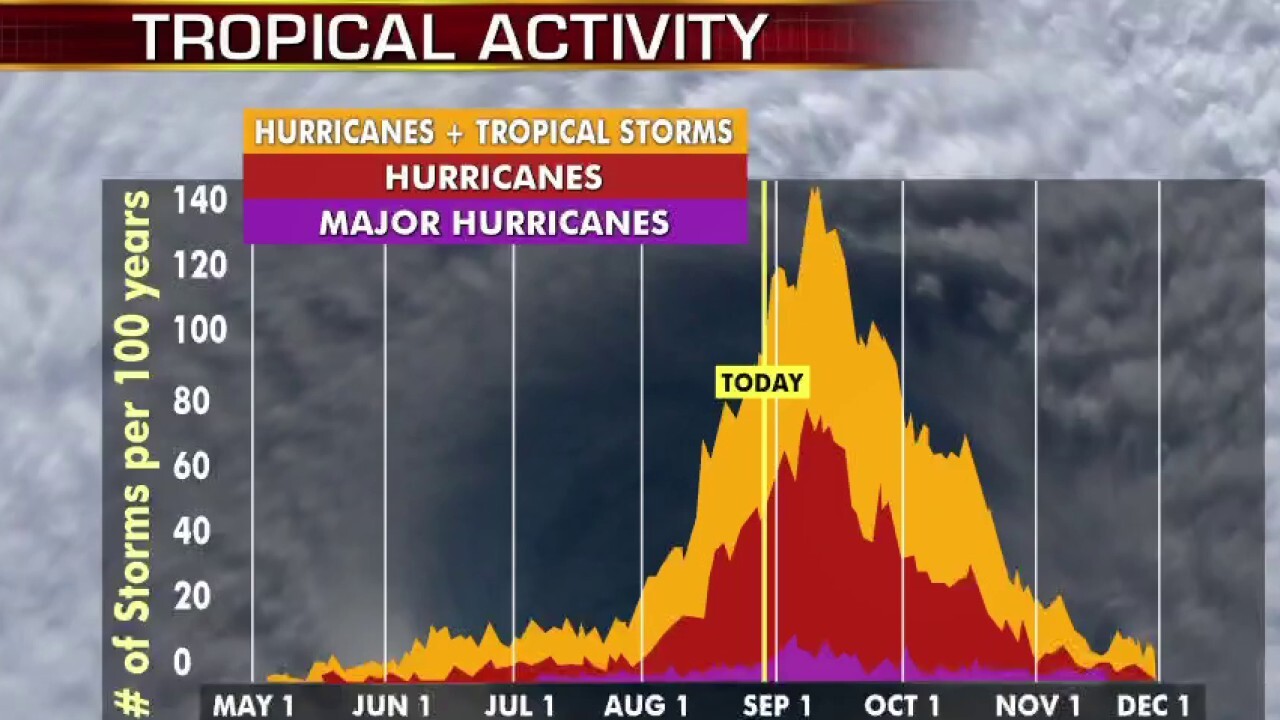
The recent activity comes as the hurricane season has entered the most active portion. The historical hurricane activity climbs through August until Sept. 10, where it peaks and starts to slowly go back down.
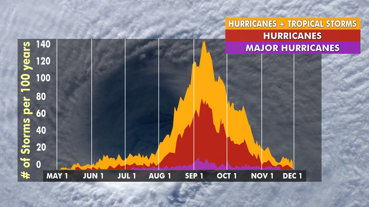
Hurricane season peaks from late August through early October. (Fox News)
Historically, about two-thirds of all Atlantic hurricane activity happens between Aug. 20 to Oct. 10, Colorado State University hurricane research scientist Phil Klotzbach tweeted earlier this month.
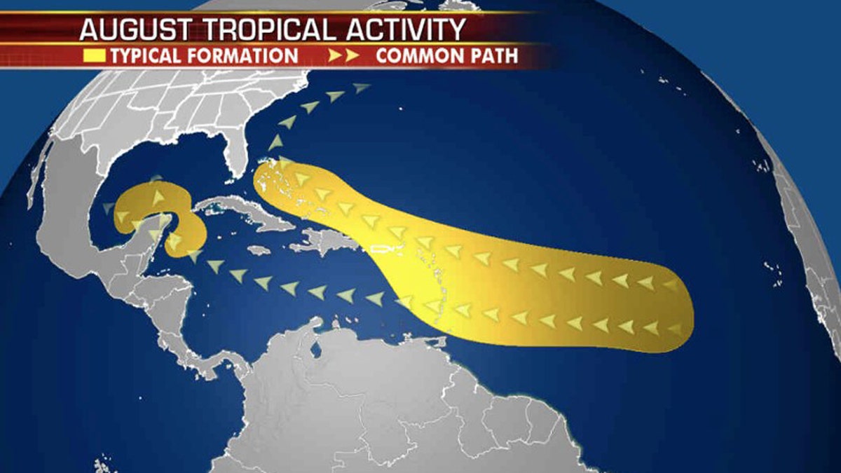
A look at where tropical systems tend to form and track during the month of August. (Fox News)
NOAA forecasters are now calling for up to 25 named storms with winds of 39 mph or higher; of those, seven to 10 could become hurricanes. Among those hurricanes, three to six will be major, classified as Category 3, 4, and 5 with winds of 111 mph or higher.
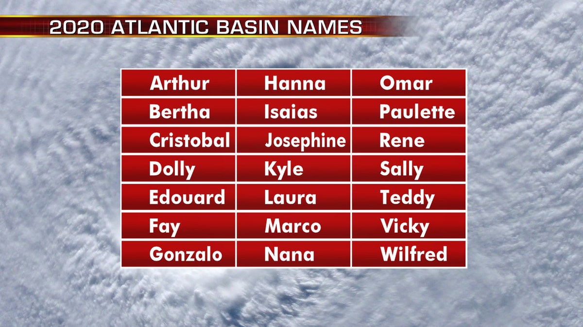
The names for the 2020 Atlantic hurricane season. (Fox News)
That's far above an average year. Based on 1981 to 2010 data, that is 12 named storms, six hurricanes, and three major hurricanes. So far this year, there have been 13 named storms, including three hurricanes.
CLICK HERE FOR THE FOX NEWS APP
The 2020 Atlantic Hurricane Season runs from June 1 to Nov. 30 and includes the names: Arthur, Bertha, Cristobal, Dolly, Edouard, Fay, Gonzalo, Hanna, Isaias, Josephine, Kyle, Laura, Marco, Nana, Omar, Paulette, Rene, Sally, Teddy, Vicky and Wilfred.


