


How robotic drones are revealing secrets about nature's deadliest hurricanes
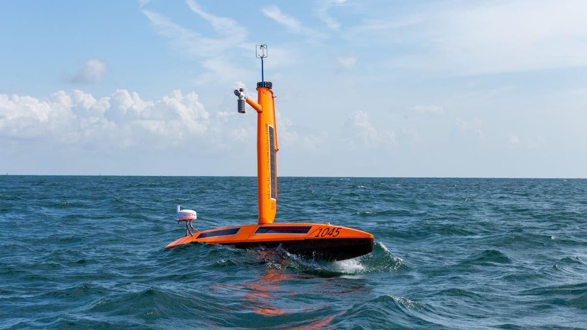
Saildrone is an unmanned sailboat packed full of high-tech sensors.
Have you ever wondered why some hurricanes transform from relatively mild storms into monsters in just a day? This process, called rapid intensification, is one of the biggest challenges in hurricane forecasting.
Imagine you're living in a coastal town, preparing for what you think will be a moderate tropical storm. Suddenly, within 24 hours, it becomes a Category 5 hurricane. That's exactly what happened with Hurricane Otis in October 2023, catching many by surprise and causing widespread destruction in Acapulco, Mexico.
This rapid transformation isn't just scary. It's becoming more common. So, how can we better predict these sudden intensifications? That is where Saildrone comes in.
GET SECURITY ALERTS, EXPERT TIPS - SIGN UP FOR KURT’S NEWSLETTER - THE CYBERGUY REPORT HERE
Robotic drone (Saildrone)
The robot explorers sailing into hurricanes
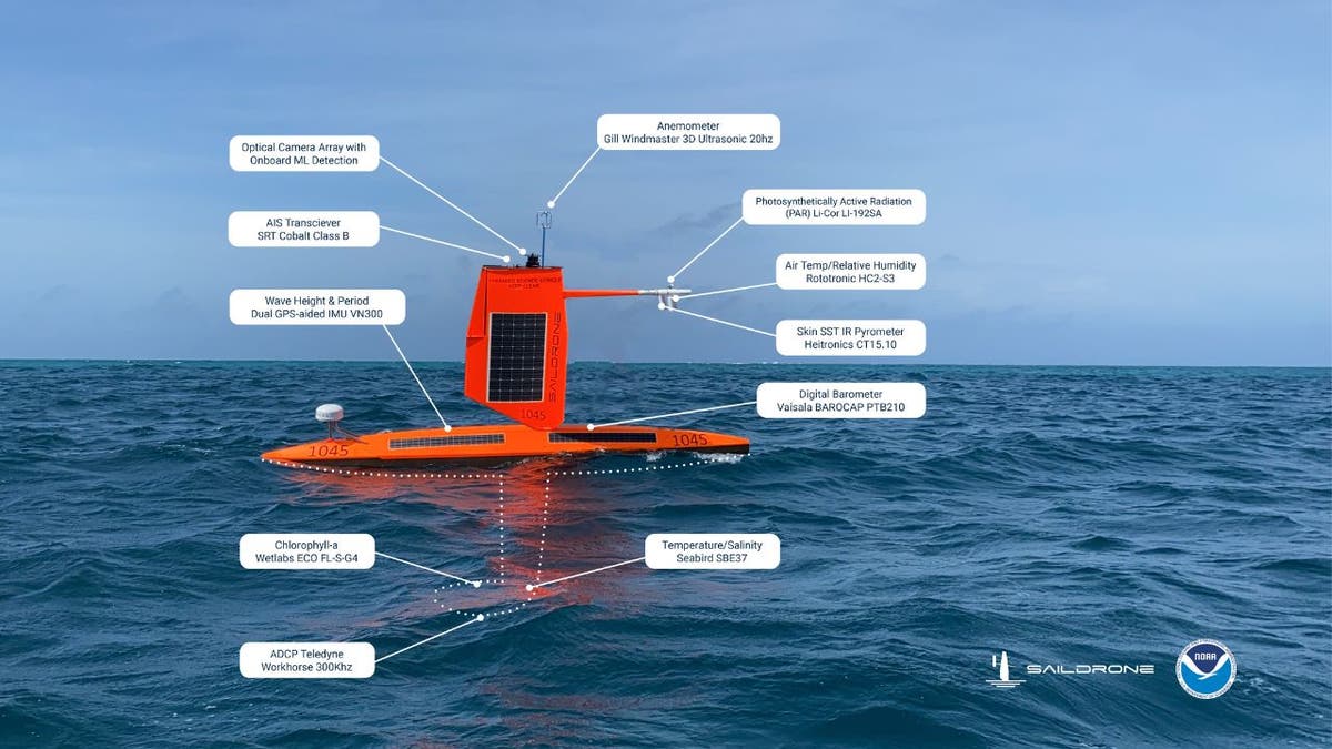
Picture a sailboat but without any people on board and packed full of high-tech sensors to collect data about the oceanic and atmospheric conditions. That's essentially what a Saildrone Explorer is. The drones come in a variety of sizes, either 23, 33 or 65 feet ong.
These wind-propelled, solar-powered vehicles are designed to sail directly into hurricanes, collecting crucial data where it matters most. They allow scientists to measure the track, or path, that a hurricane is taking along with changes in its intensity over time.
HOW TO REMOVE YOUR PRIVATE DATA FROM THE INTERNET
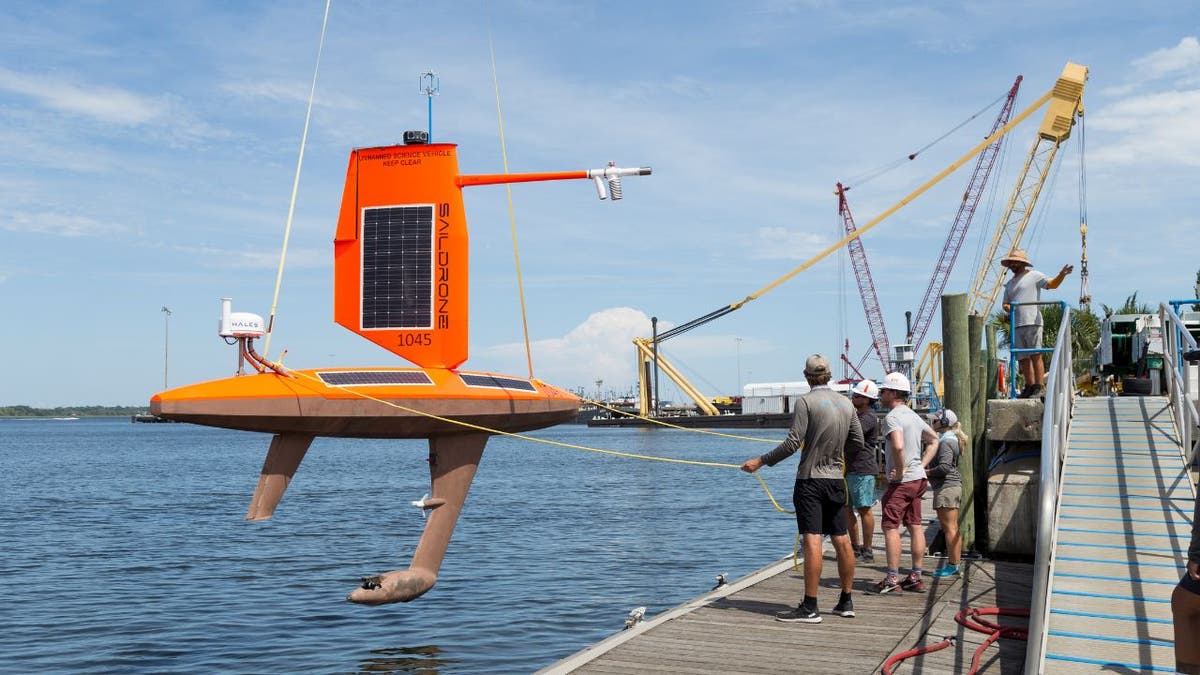
A robotic drone being lowered into the water (Saildrone)
What makes a saildrone so special?
Unlike traditional research ships, a saildrone can stay at sea for months at a time; the longest mission lasted more than a year. They're also much safer and more cost-effective than sending crewed vessels into dangerous storms.
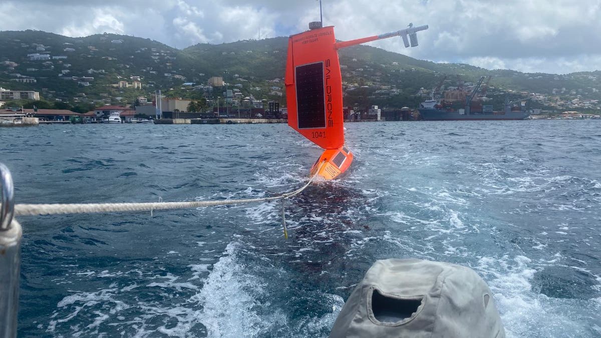
A robotic drone being deployed (Saildrone)
WHAT IS ARTIFICIAL INTELLIGENCE (AI)?
What data does a saildrone collect?
So, what kind of information do these brave little drones gather? Everything from wind speed and direction to air and water temperatures, wave heights and even underwater currents. It's like having a weather station, oceanographic buoy and underwater probe all in one package.
This data fills critical gaps in our understanding of hurricanes. Satellites can show us where storms are, but they can't tell us everything that's happening at the ocean surface and below. A saildrone gives us that missing piece of the puzzle, helping scientists create a more complete picture of how hurricanes form and intensify. This year's Saildrone mission officially starts on August 7th and runs through the end of October.
Robotic drone being deployed (Saildrone)
STORM SURVIVAL ESSENTIALS: YOUR ULTIMATE GADGET GUIDE
Can saildrone data help improve hurricane predictions?
All this information isn't just interesting, it's potentially life-saving. Scientists at NOAA (that's the National Oceanic and Atmospheric Administration) are using Saildrone data to improve their hurricane forecast models.
The goal? To better predict not just where a hurricane will go but how strong it will become. This is crucial for coastal communities deciding whether to evacuate. As one NOAA scientist put it, "It's very costly to evacuate, to pick up millions of people and move them somewhere." Better forecasts mean better decisions and potentially saved lives.
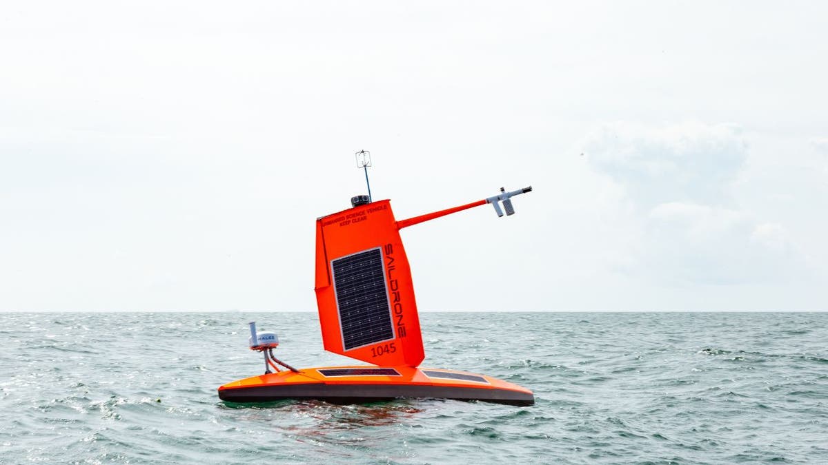
Robotic drone being deployed (Saildrone)
GET FOX BUSINESS ON THE GO BY CLICKING HERE
Beyond saildrones: A multipronged approach
Saildrones are just one part of a larger strategy to improve hurricane forecasting. Underwater gliders dive deep beneath the waves, collecting data on ocean temperatures and currents. The famous "Hurricane Hunter" aircraft still fly directly into storms, providing invaluable data from inside the cyclone.
Together, these tools are helping scientists create a complete picture of hurricanes, from 30,000 feet in the air to several thousand feet below the ocean surface.
Speaking of tools, stay informed and prepared to survive Mother Nature's fury with the five best weather apps for 2024.
BAD WEATHER? HOW TO GET SURVIVAL READY IN ANY STORM
Kurt's key takeaways
As climate change continues to influence hurricane patterns, the race is on to improve our forecasting capabilities. Saildrones and other innovative technologies are giving us unprecedented insight into these powerful storms. While we can't prevent hurricanes, better understanding and prediction can help communities prepare, potentially saving lives and reducing damage. As we face an uncertain climate future, these ocean-going robots might just be our new best allies in the ongoing battle against nature's most powerful storms.
CLICK HERE TO GET THE FOX NEWS APP
How do you think advancements in hurricane forecasting technology might influence policy decisions regarding coastal development and infrastructure? Let us know by writing us at Cyberguy.com/Contact.
For more of my tech tips and security alerts, subscribe to my free CyberGuy Report Newsletter by heading to Cyberguy.com/Newsletter.
Ask Kurt a question or let us know what stories you'd like us to cover.
Follow Kurt on his social channels:
Answers to the most asked CyberGuy questions:
- What is the best way to protect your Mac, Windows, iPhone and Android devices from getting hacked?
- What is the best way to stay private, secure and anonymous while browsing the web?
- How can I get rid of robocalls with apps and data-removal services?
- How do I remove my private data from the internet?
Copyright 2024 CyberGuy.com. All rights reserved.

Get a daily look at what’s developing in science and technology throughout the world.