Massive field of strange holes discovered on sea floor off CA coast
Scientists with the the Monterey Bay Aquarium Research Institute discovered thousands of mysterious holes in the seabed off Big Sur, Calif. The research team was surveying the seafloor when the discovery was made. The large holes are on average about 600 feet across and 16 feet deep. The smaller holes are, on average, 11 feet across and three feet deep.
Scientists have discovered thousands of mysterious holes in the seabed off Big Sur, Calif.
Researchers from the Monterey Bay Aquarium Research Institute (MBARI) were surveying the deep seafloor off Big Sur when they discovered the strange holes.
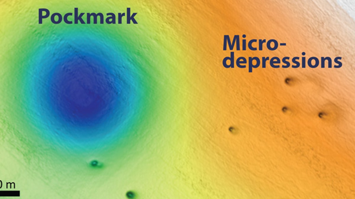
The larger holes, described as pockmarks, are on average about 600 feet across and 16 feet deep. In a statement, MBARI noted that it first discovered some of the pockmarks in 1999. However, subsequent surveys by MBARI and other organizations have revealed over 5,200 pockmarks spread across 500 square miles.
'NUCLEAR BATTLEFIELD' REVEALED AS SCIENTISTS MAP BIKINI ATOLL TEST CRATERS AND SUNKEN WARSHIPS
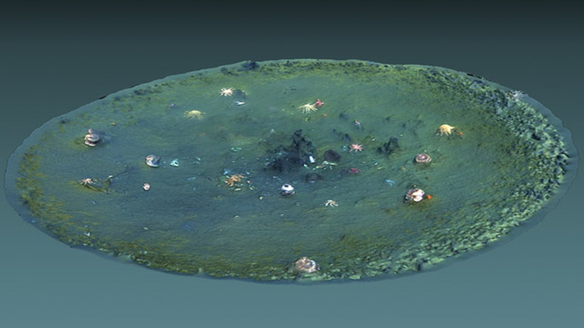
Thousands of smaller holes, known as micro-depressions. have been discovered. Researchers have spotted around 15,000 micro-depressions, which are, on average, 11 feet across and three feet deep.

A computer-generated 3D view of a micro-depression. The image was created using underwater video from an underwater drone. (Image: Ben Erwin © 2019 MBARI)
The discovery was described by MBARI researchers Eve Lundsten and Charles Paull at the Fall Meeting of the American Geophysical Union in San Francisco.
“The pockmarks and micro-depressions in this area are both holes in the seafloor that occur in softer sediments, but they are morphologically distinct,” said Lundsten, in the statement. “The cause and persistence of the pockmarks still remains a mystery, but we find no evidence they were created from gas or fluid in the seafloor in the recent past. The micro-depressions are recently formed erosional features; they are not ‘incipient pockmarks.’ Overall, a lot more work needs to be done to understand how all these features were formed, and this work is in progress.”
STUNNING VOLCANIC 'LOST WORLD' DISCOVERED DEEP IN THE OCEAN
Scientists are keen to understand how the holes formed in the seabed because the area where they were found is the site of a proposed wind farm.

A map of the seafloor off Big Sur showing a pockmark and micro-depressions. (Image: © 2019 MBARI)
In a separate study revealed at the Fall Meeting of the American Geophysical Union researchers gave fresh insight into the site of a "nuclear battlefield" by mapping test craters and sunken warships at Bikini Atoll in the Pacific.

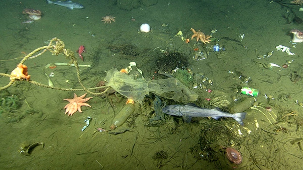
A close-up view of a micro-depression, showing trash, rocks, seafloor animals, and fish. (Image: © 2019 MBARI)
Last year, scientists announced the discovery of a stunning volcanic "lost world" off the coast of Tasmania.
CLICK HERE TO GET THE FOX NEWS APP
Follow James Rogers on Twitter @jamesjrogers


