


The Facility crew reacts to a live 5.0 earthquake on national TV | The Facility
Emmanuel Acho, LeSean McCoy, James Jones and Chase Daniel react to a live 5.0 earthquake in Malibu on national TV.
Scientists are deploying monitors at the volcanic Mount Adams in Washington State, after a spike in seismic activity.
The U.S. Geological Survey (USGS) said Mount Adams typically experiences an earthquake every two to three years, but in September, there were six earthquakes alone, marking the most in a single month since monitoring began in 1982.
The earthquakes were monitored by the USGS Cascades Volcano Observatory (CVO) and Pacific Northwest Seismic Network (PNSN) and ranged in magnitudes from 0.9 to 2.0. None of the earthquakes were felt at the surface, the USGS said.
With only one seismic station near the volcano, the USGS said monitoring capabilities are limited.
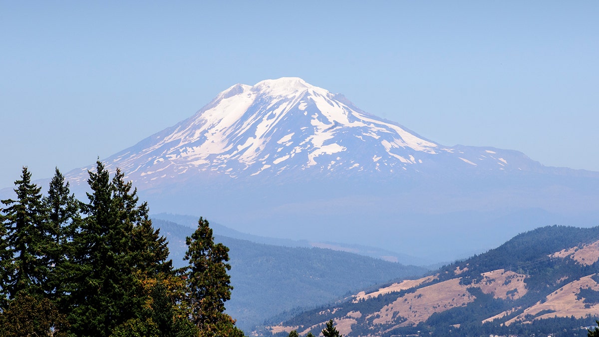
Washington, Mount Adams in the Cascade range is the second-highest mountain in the state of Washington. It is a potentially active stratovolcano in the Cascade Range. (Education Images/Universal Images Group via Getty Images)
CVO and PNSN plan to install temporary seismic stations near Mount Adams to help detect smaller earthquakes while acquiring better estimates of size, location and depth. The data will help scientists assess the significance of the increased seismic activity near the volcano.
With permission from the U.S. Forest Service, CVO will place the temporary stations south and southwest of Mount Adams. Once activated, the data will be transmitted to CVO and PNSN in real-time.
LATEST ICELAND VOLCANIC ERUPTION SUBSIDES, BUT EXPERTS WARY OF MORE SOON TO COME
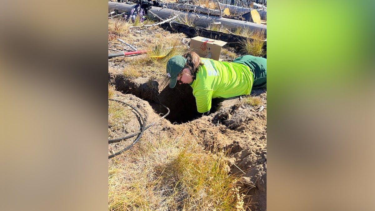
On October 3, 2024, scientists from the USGS Cascades Volcano Observatory and U.S. Forest Service installed new temporary seismic stations at Mount Adams volcano in south central Washington. (USGS)
Despite the spike in seismic activity, the USGS says there is no indication that there is cause for concern and the alert level and color code for Mount Adams remains at Green and Normal.
Mount Adams is located in south central Washington, nearly 50 miles west-southwest of Yakima, Washington.
INDONESIA'S RUANG VOLCANO SPITS MORE HOT ASH AFTER ERUPTION FORCES SCHOOLS AND AIRPORTS TO CLOSE
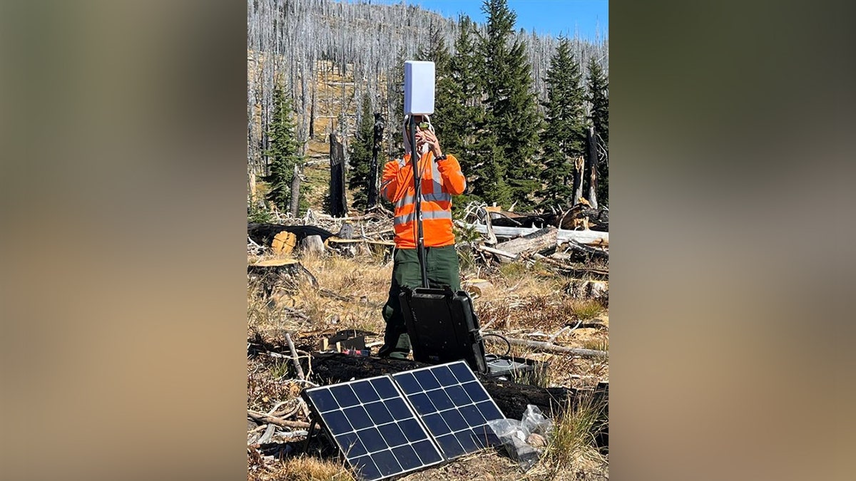
Scientist with the USGS Cascades Volcano Observatory install a temporary seismic station at Mount Adams. (USGS)
In the north-south trending Mount Adams-King Mountain volcanic field of over 120 smaller volcanos, Mount Adams is the most prominent summit. It is also the second-tallest volcano in Washington and is the state's largest active volcano in volume and area, according to the USGS.
The agency said over the past 12,000 years, there have been four lava flows that started on the apron of the volcano and two vents along the south ridge. The flows have typically only traveled a few miles from their vents.
7.1 MAGNITUDE EARTHQUAKE STRIKES OFF JAPAN'S COAST, TSUNAMI ADVISORY ISSUED
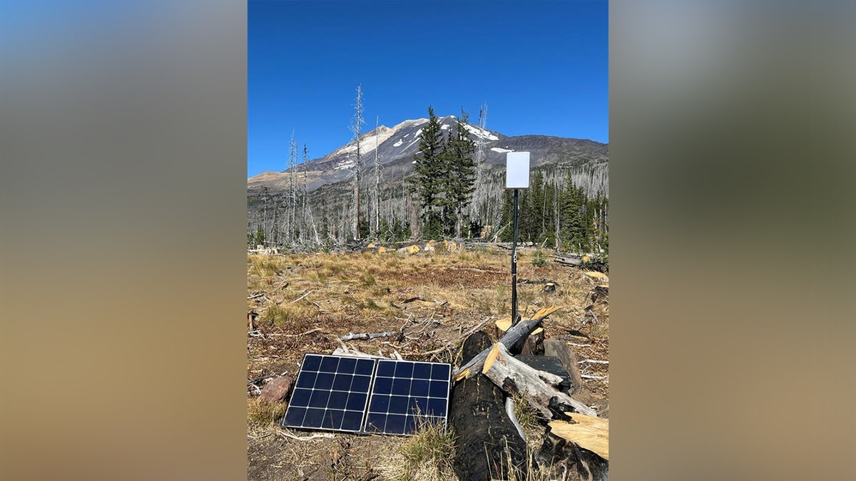
On October 3, 2024, USGS and the USFS installed a new temporary seismic station Adams South Climbers Route (ASCR) at Mount Adams. (USGS)
The last time Mount Adams erupted was between 3,800 and 7,600 years ago, the USGS added.
But one of the biggest threats to people who live near the volcano are lahars, or muddy flows of rock, ash and ice that rush downstream like fast flowing concrete.
CLICK HERE TO GET THE FOX NEWS APP
The summit, which is covered in ice, also covers up large volumes of hydrothermally weakened rock, which, if weakened by future landslides, could generate lahars.
Related Article
Fox News Artificial Intelligence
Stay up-to-date on the latest AI technology advancements and learn about the challenges and opportunities AI
By entering your email and clicking the Subscribe button, you agree to the Fox News Privacy Policy and Terms of Use, and agree to receive content and promotional communications from Fox News. You understand that you can opt-out at any time.