


Fox News Flash top headlines for June 24
Fox News Flash top headlines are here. Check out what's clicking on Foxnews.com.
Deep beneath the Pacific Ocean, most of the remnants of a 2 million square mile lost continent known as Zealandia have fascinated scientists since 2017.
Now, researchers from GNS Science in New Zealand have mapped the submerged land mass in stunning new detail.
“We’ve made these maps to provide an accurate, complete and up-to-date picture of the geology of the New Zealand and southwest Pacific area – better than we have had before," lead author of the maps, geologist Nick Mortimer, said in a statement.
The maps, which can be accessed through a new interactive website, reveal the lost eighth continent's tectonic profile, along with the shape and depth of the ocean floor surrounding it.
NASA CAPTURES SMOKE TRAIL FROM MASSIVE ARIZONA BUSH FIRE
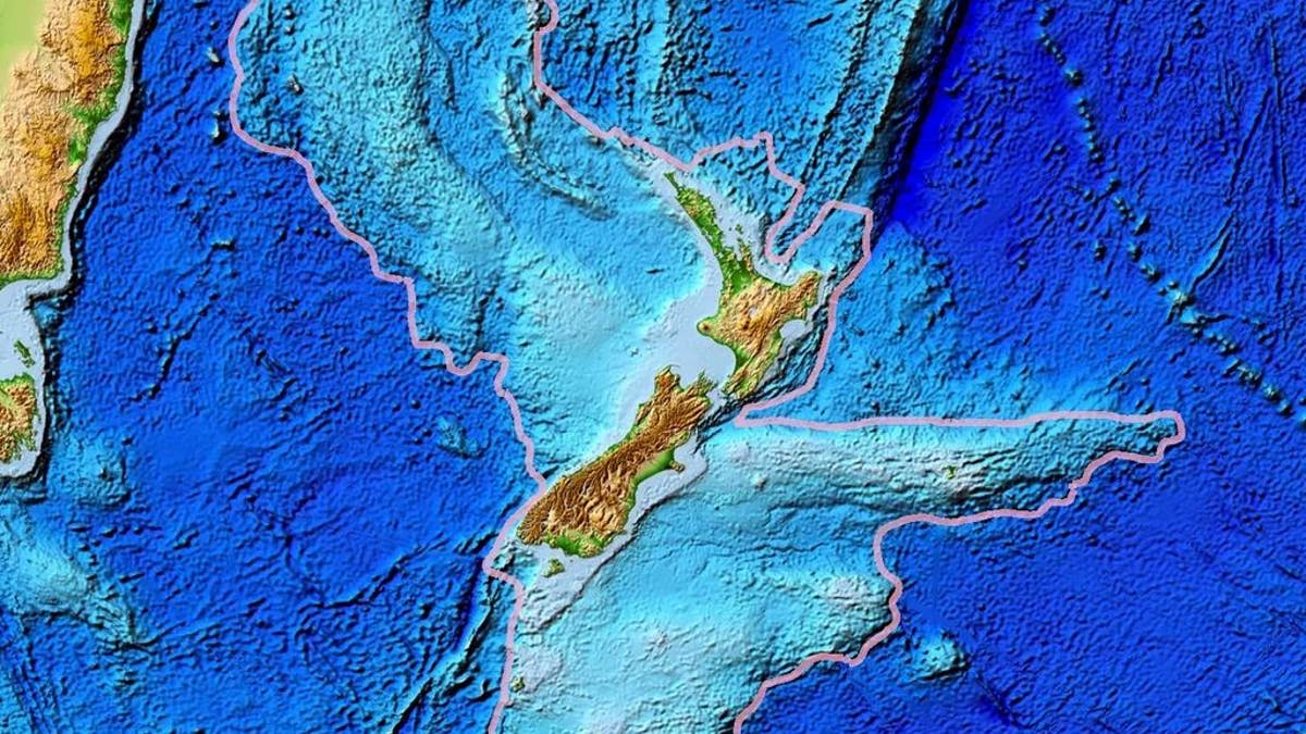
A map of Zealandia, outlined in gray, is seen above. (World Data Center for Geophysics & Marine Geology/National Geophysical Data Center, NOAA)
“Their value is that they provide a fresh context in which to explain and understand the setting of New Zealand’s volcanoes, plate boundary and sedimentary basins," Mortimer said.
The researchers' work, which is part of a worldwide effort to map the planet's entire ocean floor by 2030, depicts coastlines, territorial limits and the names of major undersea features.
Mortimer told Business Insider that the new maps offer more proof that Zealandia was actually a separate continent – as opposed to a "microcontinent," which was its classification before 2017.
"If we could pull the plug on the world's oceans, it would be quite clear that Zealandia stands out," he told Science News in 2017, adding, "if it wasn't for the ocean level, long ago we'd have recognized Zealandia for what it was — a continent."
HUGE HYBRID SEA TURTLE PARTAKES IN 'RACE' NEAR FLORIDA KEYS
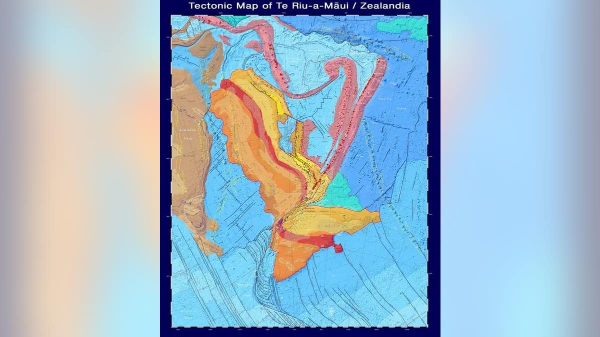
A tectonic map of New Zealandia, which shows the types and age of the crust, major faults, and volcanoes that make up the continent. (GNS Science) (GNS Science)
“Users can zoom and pan around different thematic geoscience web maps of the region. They can readily view and interrogate the maps and turn layers on or off. They can also query features in the layers and generate custom maps of their own,” program leader Vaughan Stagpoole said.