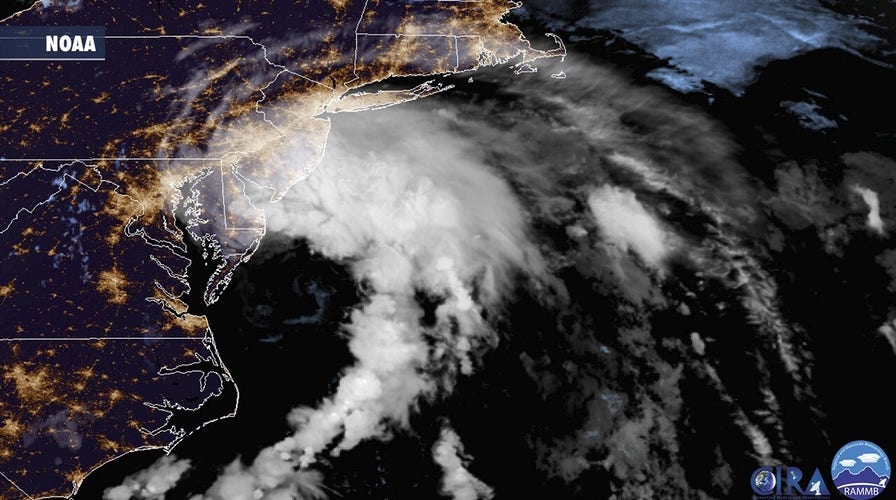
Northeast braces for Tropical Storm Fay
Flash flood warnings are in effect across the Northeast as the New York City area prepares for the storm; Laura Ingle reports from Lido Beach, N.Y.
MIAMI — Tropical depression Fay moved north over New York early Saturday and was expected to continue to weaken through the weekend, forecasters said.
The depression had maximum sustained winds of 35 mph (55kph), the National Hurricane Center in Miami said in its 2 a.m. advisory. It was located about 50 miles (80 kilometers) north of New York City.
TROPICAL STORM FAY BRINGS RAIN, FLOODING TO MID-ATLANTIC AND PARTS OF NEW ENGLAND
Fay had closed beaches and flooded shore town streets after it made landfall Friday afternoon in New Jersey. It weakened once it hit land and was expected to quickly become a post-tropical low, then dissipate on Sunday, forecasters said.
The forecast track put the depression over portions of eastern New York later Saturday, then moving into western New England and southeastern Canada. The depression was moving at 17 mph (28 kph), forecasters said.
A tropical storm warning that had been issued from East Rockaway, New York, to Watch Hill, Rhode Island was ended with the National Hurricane Center’s early morning update. No watches or warnings were in effect for the depression.
Forecasters said Fay was expected to produce 1 to 3 inches (3 to 7 centimeters) of rain, with flash flooding possible in some areas.
CLICK HERE TO GET THE FOX NEWS APP
Fay was the earliest sixth-named storm on record, according to Colorado State University hurricane researcher Phil Klotzbach. The previous record was Franklin on July 22, 2005, Klotzbach tweeted.
Two named storms formed before the official June 1 start of the hurricane season. None of this season’s previous five named storms strengthened into hurricanes.


