'Apple' fire explodes east of Los Angeles
8,000 people evacuated from their homes; Christina Coleman reports.
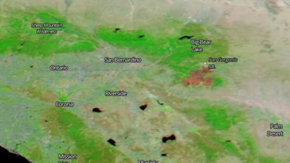
NASA’s Aqua satellite has revealed an Apple Fire burn scar in the mountains east of Los Angeles.
The satellite used its MODIS (Moderate Resolution Imaging Spectroradiometer) instrument to image the area near Big Bear Lake.
“Burned areas or fire-affected areas are characterized by deposits of charcoal and ash, removal of vegetation and/or the alteration of vegetation structure,” explained NASA’s Goddard Space Flight Center, in a statement.
The Apple Fire, which was sparked by a vehicle malfunction, forced thousands of people from their homes.
APPLE FIRE IN CALIFORNIA WAS SPARKED BY VEHICLE MALFUNCTION, BLAZE SCORCHES 41 SQUARE MILES

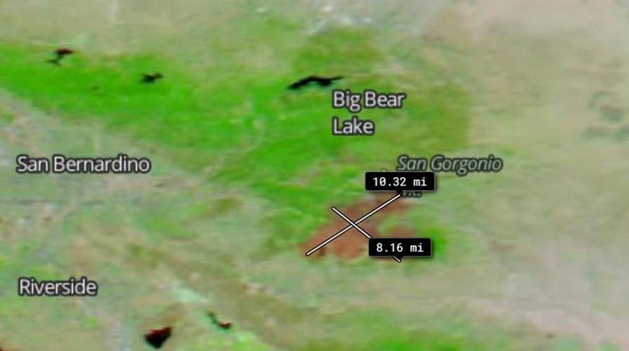
The measurement tool on NASA's Worldview app was used to show the size of the burn scar. Using the tool, the scar was measured to be approximately 10.32 miles long and 8.16 miles wide. (NASA Worldview)
The scar was imaged on Aug. 9 and the MODIS instrument images were produced using “corrected reflectance,” which provides natural-looking images by removing atmospheric effects such as the scattering of light from visible color bands. Because MODIS’ corrected reflectance imagery is only available as near real-time imagery, the scar data was visualized using NASA’s Worldview app and the Global Imagery Browse Service (GIBS). Using Worldview, the scar was measured to be approximately 10.32 miles long and 8.16 miles wide.
The Apple Fire remains active in Riverside County, spanning 32,905 acres and is 50% contained, CalFire said late Monday.
CLICK HERE TO GET THE FOX NEWS APP

NASA's Aqua satellite imaged the Apple Fire near Big Bear Lake in California on Aug. 9. The satellite used its false-color bands to distinguish burn scars from the surrounding area more easily. (NASA Worldview)
“Based out of remote spike camps along the northern flank of the Apple Fire, firefighters worked on cooling several hotspots along ridgelines,” CalFire said, in a statement. “In some interior islands of vegetation in the north, the fire continues to burn out. Helicopters supported fire suppression efforts with water drops in areas inaccessible by foot. Crews continue to patrol, cool down areas of heat, and backhaul equipment.”
Fox News’ Travis Fedschun contributed to this article.
Follow James Rogers on Twitter @jamesjrogers


