Concerned about wildfire smoke? Check the AC filter
Health officials are urging Americans to check their AC filters as wildfire season heats up.
Smoke from Canadian wildfires has crossed the Atlantic Ocean and reached southwestern Europe.
An image from NASA's Terra satellite taken Monday morning shows the plume drifting over northern Portugal and Spain.
Beyond the scope of the image, the agency said it also extended northward over other European countries.
The satellite used its Moderate Resolution Imaging Spectroradiometer to capture the image.

Smoke from wildfires, which have been burning in the Canadian province of Quebec for weeks, has crossed the Atlantic Ocean to southwestern Europe. This image was taken by NASA's Terra satellite on Monday morning. (NASA Earth Observatory)
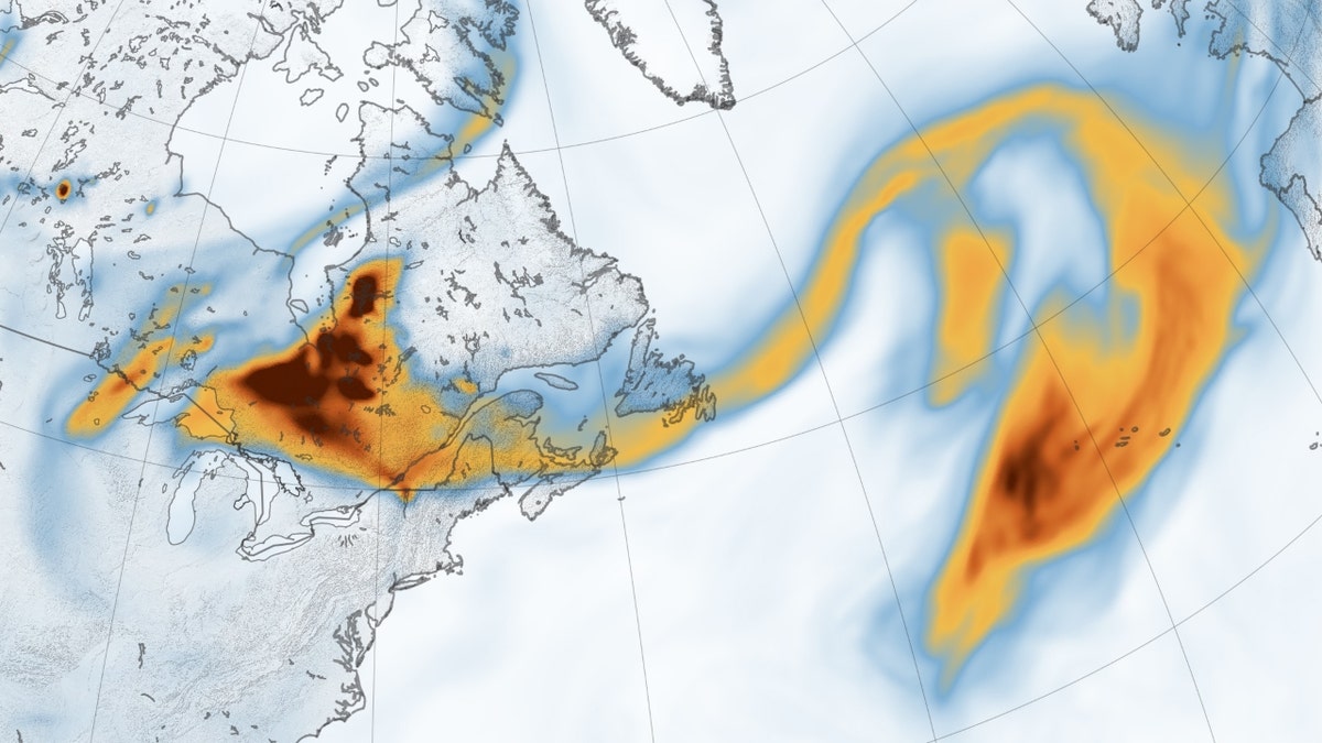
The black carbon particles, also known as soot, traveled more than 2,000 miles.
Black carbon density data shared by NASA comes from its Goddard Earth Observing System forward processing model. The model assimilates data from satellite, aircraft and ground-based observing systems, as well as incorporates meteorological data – like air temperature, moisture and winds – to project the plume’s behavior.

The smoke’s widespread reach, stretching over thousands of miles, is apparent in the NASA map. (NASA Earth Observatory)
The hazy skies have also been observed by a network of ground sensors called the Aerosols Robotic Network.
The network, known as AERONET, contains more than 500 sun photometer instruments that measure global aerosol optical depth.
The sensors in Spain and France saw depth measurements greater than 0.5. Typically, that measurement in these areas is close to 0.1, with a perfectly clear sky with a measurement of less than 0.05.

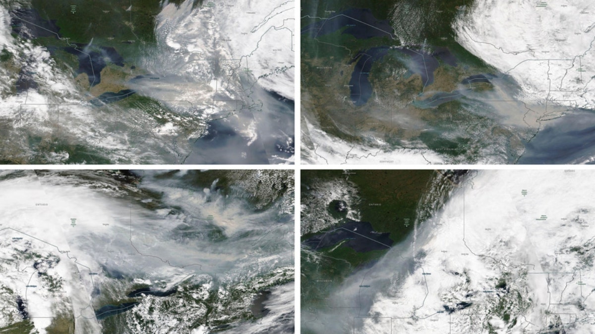
These satellite images from June 6, from top left, June 7, June 25, and June 27, 2023, show the wind movement from wildfire smoke in Quebec, Canada. Heavy smoke from wildfires in Canada has blanketed parts of the Midwest, causing hazardous air for residents, just weeks after drifting smoke did the same thing along parts of the East Coast. (NASA Worldview, (EOSDIS) via AP)
TEXAS' RECORD-BREAKING HEAT AMONG HOTTEST IN THE WORLD, BLAMED FOR MORE THAN A DOZEN DEATHS
That said, air quality in parts of Europe impacted by the smoke remained mostly fair.
The reason for that is that most of the smoke was higher in the atmosphere and is less likely to impact human health.

A haze is seen over the Milwaukee Art Museum, Tuesday, June 27, 2023, in Milwaukee. Forecasters say there will not be large breaks for much of America anytime soon from eye-watering dangerous smoke from fire-struck Canada. (AP Photo/Morry Gash)
Comparatively, 120 million residents in the U.S. were under air quality alerts on Wednesday.
Some of the poorest Air Quality Index readings were in Northeast Ohio, where several communities reported an AQI value above 300, according to FOX Weather.

The One World Trade Center and the New York skyline is seen in the background as a man jogs through the Liberty State Park while the smoke from Canada wildfires covers the Manhattan borough on June 8, 2023, in New Jersey. (Photo by Eduardo Munoz Alvarez/Getty Images)
CLICK HERE TO GET THE FOX NEWS APP
On Thursday, officials in New York warned that air quality levels could reach poor values – although the FOX Forecast Center said the invasion of smoke would not be as extensive as when the Big Apple set records earlier in the month.
Nearly every province in Canada has fires burning, and the Canadian government says a record 30,000 square miles have burned.
The Associated Press contributed to this report.


