National forecast for Wednesday, July 8
Fox News senior meteorologist Janice Dean has your FoxCast.
An area of disturbed weather over the Southeast is expected to get better organized over the next couple of days and possibly develop into the next tropical storm.
The National Hurricane Center (NHC) in Miami said the "elongated" low-pressure system is located along the coast of northeastern South Carolina, producing a large area of disorganized showers and thunderstorms over the Atlantic.
Over the next 48 hours, the NHC said as of 2 p.m. Wednesday, the system has a 70 percent chance of developing into a tropical cyclone.
CORONAVIRUS AND HURRICANE SEASON: HERE'S WHY THE RED CROSS SAYS NOW IS THE TIME TO PREPARE
The low-pressure system will move off the Mid-Atlantic coast Wednesday night into Thursday and could gain tropical characteristics as it moves northward, hugging the East Coast.
The NHC said there's a 70 percent chance of developing into a tropical depression or storm once over water on Thursday or Friday.
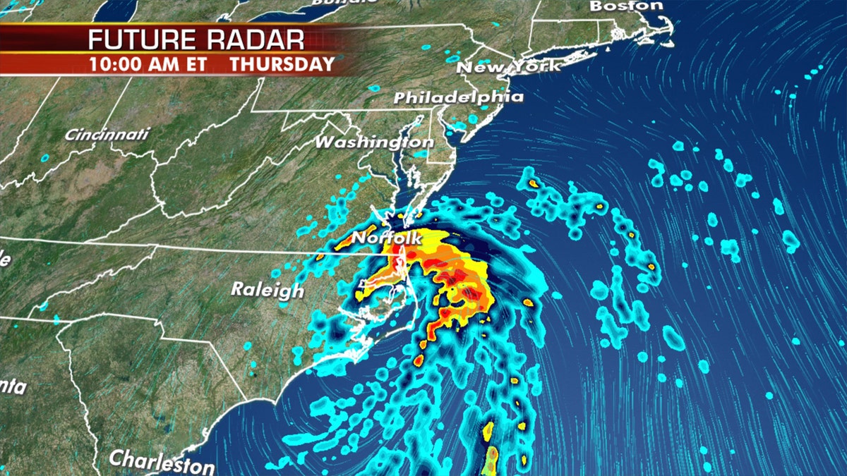
Regardless if the system becomes a tropical storm, heavy rain, flooding, and gusty winds are likely along the East Coast over the next few days.
Very warm waters and the Gulf Stream would provide plenty of energy for a tropical or subtropical system.
If it would develop into a named storm, it would be the sixth of the 2020 Atlantic hurricane season and have the name "Fay."
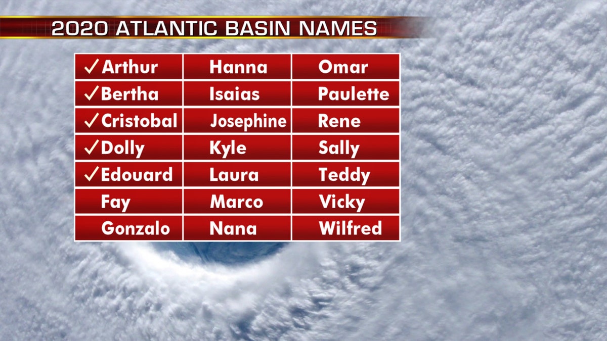
The names of storms for the 2020 Atlantic hurricane season.
Regardless of tropical classification and if it becomes Fay, heavy rain, flooding, and gusty winds are likely along the East Coast from the Mid-Atlantic to New England.
2020 ATLANTIC HURRICANE SEASON FORECAST: HERE ARE 3 BIG TAKEAWAYS
The NHC said that gusty winds are also possible in the Outer Banks of North Carolina through Thursday and along the mid-Atlantic and southern New England coasts Friday and Saturday.
Updated outlook by researchers calls for up to 20 named storms for 2020
An already busy Atlantic hurricane season is expected to stay active, with researchers on Tuesday saying that up to 20 named storms are in the forecast.
The updated forecast from Colorado State University’s Tropical Meteorology Project calls for 20 named storms, including the five tropical storms that have already formed.
Of those storms that develop the rest of this season, nine are forecast to become hurricanes, with winds of 74 mph or more, with four becoming major hurricanes, capable of inflicting devastating damage.
"One reason for continued active Atlantic hurricane season forecast from CSU is warmer than normal ocean temperatures in tropical and most of subtropical Atlantic," CSU hurricane research scientist Phil Klotzbach said on Twitter. "Warmer water provides more fuel for storms and are also associated with more unstable atmosphere and lower pressure."
CLICK HERE FOR MORE WEATHER COVERAGE FROM FOX NEWS
Klotzbach cited factors such as the odds of an El Nino this summer and fall to be "extremely low" and a "very active" West African monsoon.
"More robust easterly waves and more conducive upper-level winds for hurricanes in the tropical Atlantic are typically associated with active monsoon," he said Tuesday.
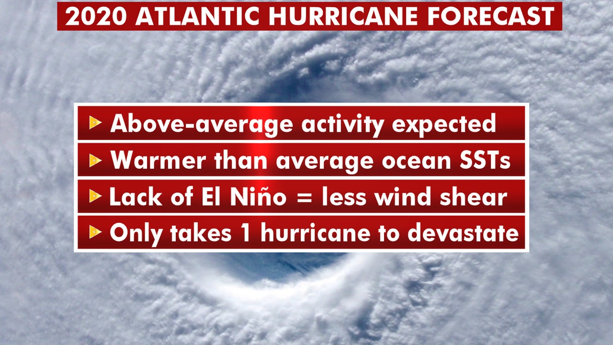
What you should about this year's 2020 Atlantic hurricane season. (Fox News)
The last time that CSU researchers predicted 20 or more named storms was an August update to the 2005 hurricane season that broke records. The 2005 hurricane season was the busiest on record, with 28 named storms, including 15 hurricanes, four of which hit the United States, including Katrina and Rita.
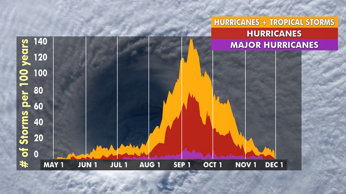
Hurricane season peaks from late August through early October. (Fox News)
The updated forecast from CSU researchers follows other outlooks that called for an active hurricane season.
Forecasters from the National Oceanic and Atmospheric Administration's (NOAA) Climate Prediction Center (CPC) said in May they were predicting 13 to 19 named storms during the Atlantic hurricane season, which runs from June 1 to Nov. 30.
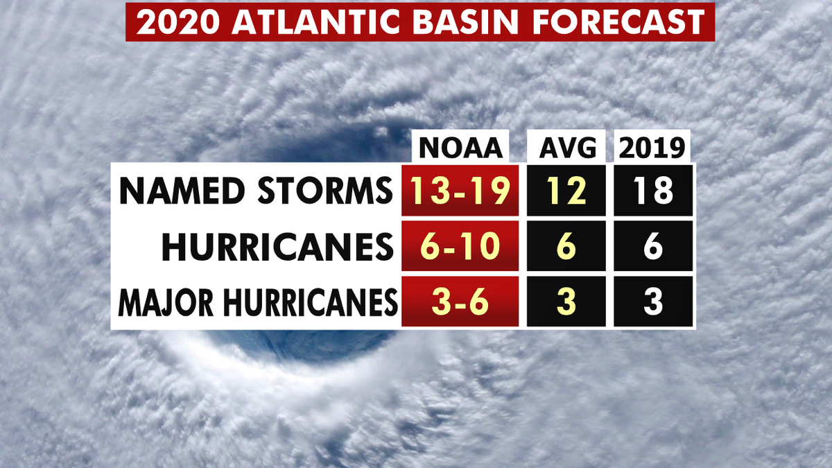
The 2020 hurricane season forecast from NOAA. (Fox News)
This forecast is well above the averages of 12 named tropical storms, six hurricanes, and three major hurricanes during the season.
CLICK HERE FOR THE FOX NEWS APP
The 2020 Atlantic Hurricane Season runs from June 1 to Nov. 30, and will include the names: Arthur, Bertha, Cristobal, Dolly, Edouard, Fay, Gonzalo, Hanna, Isaias, Josephine, Kyle, Laura, Marco, Nana, Omar, Paulette, Rene, Sally, Teddy, Vicky and Wilfred.


