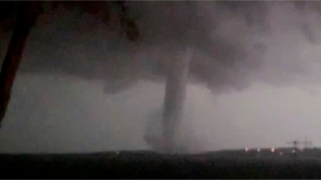
National forecast for Thursday, April 23
Fox News senior meteorologist Janice Dean has your FoxCast.
Get all the latest news on coronavirus and more delivered daily to your inbox. Sign up here.
Another round of severe weather is possible for millions across the South on Thursday, a day after powerful storms and tornadoes were blamed for several deaths in Texas, Oklahoma and Louisiana.
Severe storms developing on Thursday will bring the threat for large hail, damaging wind, flash flooding and potentially large tornadoes to the Southeast and North Florida, with the danger increasing as night falls.
"Your severe threat today extends into portions of Georgia, in toward the Carolinas and stretching back into Louisiana, Mississippi and Alabama," Fox News senior meteorologist Janice Dean said on "Fox & Friends."
TORNADOES RIP THROUGH OKLAHOMA, TEXAS AND LOUISIANA, KILLING AT LEAST 5
The National Weather Service's (NWS) Storm Prediction Center (SPC) said there were preliminary reports of 26 tornadoes throughout the day Wednesday across the Southern Plains, with the number likely to go up as the severe weather moves further east.

Damage reports after deadly storms were reported Wednesday into Thursday across the Southern Plains and the South. (Fox News)
"Those storms are going to continue to be on the move north and eastward throughout the day today and into the overnight, so that's when it could prove dangerous if you've got power outages in the area and you don't have a way to get a warning," Dean said.
Nearly 40 million people across the South could see severe storms on Thursday, with major cities such as Birmingham, Atlanta, New Orleans, Charlotte and Jacksonville, Fla., all at risk.

The threat of severe weather on Thursday, April 23, 2020. (Fox News)
According to the SPC, an initial line of storms behind the destruction in the Southern Plains will continue to sweep east through the afternoon.
"The storms will be accompanied by the potential for damaging winds, along with large hail and a few tornadoes," forecasters said.
WHERE DO TORNADOES HIT THE MOST IN THE US? HERE ARE THE TOP 5 STATES
Enough clearing during the day on Thursday will allow for conditions to set up for another line of potentially destructive thunderstorms to develop by the afternoon, stretching from Mississippi into Alabama and all the way up into Kentucky.

Severe thunderstorms are forecast to impact the Southeast on Thursday, April 23, 2020. (Fox News)
Favorable conditions for supercell thunderstorms and tornadoes could accompany those storms, with forecasters noting that a few tornadoes that develop could be "strong."
"Large hail is also expected, along with damaging winds," the SPC said.
Severe thunderstorms will the march east through the afternoon across Alabama, and eastern portions of Kentucky and Tennessee through the afternoon, and into Georgia.
"This is going to be an ongoing situation throughout the next 12 to 18 hours, certainly watches and warnings will be posted throughout the day today across the Southeast in toward the Mid-Atlantic, including the Carolinas later today," Dean said on "Fox & Friends."
CLICK HERE FOR MORE WEATHER COVERAGE FROM FOX NEWS
In addition to the severe thunderstorms, the region is also at risk of flash flooding, with several inches of rain expected to fall in a short period of time.
The NWS' Weather Prediction Center (WPC) said the heaviest rain is forecast to fall across the eastern and central Gulf Coast, regions that had very heavy rain last week.

The risk of flash flooding returns across the Southeast, as storms may bring more rain to saturated areas. (Fox News)
"These areas have stream flows that are well above normal, increasing the risk of additional flash flooding and flooding from the upcoming heavy rains," forecasters said.
CLICK HERE FOR THE FOX NEWS APP
The risk of flooding in the South is already proving to be deadly. A man in Louisiana was found dead after a witness saw him try to retrieve a trash can from water near a drainage ditch.
He lost his footing and was swept away by floodwaters, DeSoto Parish Sheriff Jayson Richardson told The Shreveport Times.
“There was some pretty extreme flooding here in Mansfield. Water like I’ve not seen in many, many years, if ever,” the sheriff told the newspaper. “Basically the water rose really fast and we had to rescue some people out of homes. I think we had about 20 or so homes that people were flooded in.”


