The threat of severe weather returns Tuesday for tens of millions of Americans as another tropical system forms, continuing an already busy 2020 Atlantic hurricane season.
A widespread area of showers and thunderstorms are possible, stretching from the Southern Plains through the Gulf Coast and into the Southeast.
Parts of New Mexico and Texas also will be more at risk for stronger storms and flash flooding.
According to the National Weather Service's (NWS) Storm Prediction Center (SPC), the greatest threat will be large hail and damaging winds, though isolated tornadoes also are possible.

The threat for severe weather on June 23. (Fox News)
The biggest risk of large hail exists from central and east Texas, into Arkansas, Louisiana and Mississippi. About 72 million Americans may see storms Tuesday, according to the SPC.
Another spot that could get hit with severe thunderstorms is over the Interior Northeast, especially later Tuesday afternoon.

Severe thunderstorms are forecast to develop in the South and interior Northeast by Tuesday afternoon. (Fox News)
Isolated damaging winds are possible from the afternoon into the early evening, as storms spread from Ohio into the Appalachians and Mid-Atlantic. Flash flooding is also possible from heavy rainfall in the central Appalachians and southeast Texas.
Heat in East, dangerous heat wave out West
Ahead of a cold front that’s helping spark some of these storms, temperatures will be very summerlike.

The national forecast for June 23. (Fox News)
Parts of Northern New York and New England should get into the 90s with possible records being broken.
12 RESCUED FROM POTOMAC RIVER IN WASHINGTON, DC, AFTER 'STORM SURGE' OF RAPIDLY RISING WATER
California also is dealing with above-average temperatures across the Central Valley and northern portions of the state.

Forecast high temperatures on June 23. (Fox News)
Heat advisories are in place from southwestern Oregon into the central valleys of California. Record high temperatures are possible on Tuesday in and near Northern California.

Heat advisories stretch from central to northern California and into Oregon. (Fox News)
The dangerous heat wave will continue through Saturday from the Central Valley to Northern California and into southwestern Oregon.
Subtropical depression forms in North Atlantic

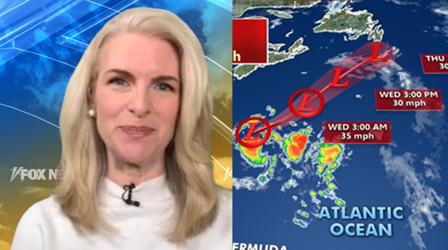
Subtropical Depression Four is moving across the North Atlantic, away from the U.S. (Fox News)
In addition to severe weather, a subtropical depression has formed in the North Atlantic.
The National Hurricane Center (NHS) said that Subtropical Depression Four is about 360 miles south-southeast of Halifax, Nova Scotia, moving northeastward at 13 mph with maximum sustained winds of 35 mph.
The storm is forecast to remain offshore and shouldn’t strengthen much over the next few days. While it's not expected to become the next named storm, the system continues the trend of above-normal activity.
CLICK HERE FOR MORE WEATHER COVERAGE FROM FOX NEWS
There are as many as 13 to 19 named storms predicted during the Atlantic hurricane season, which runs from June 1 to Nov. 30, forecasters from the National Oceanic and Atmospheric Administration's (NOAA) Climate Prediction Center (CPC) said last month.
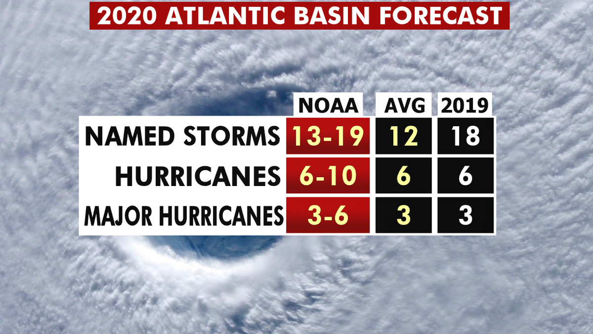
The 2020 hurricane season forecast from NOAA. (Fox News)
Six to 10 of those could develop into hurricanes, with winds of 74 mph or more, and three to six could even become major hurricanes, capable of inflicting devastating damage.
CLICK HERE FOR THE FOX NEWS APP
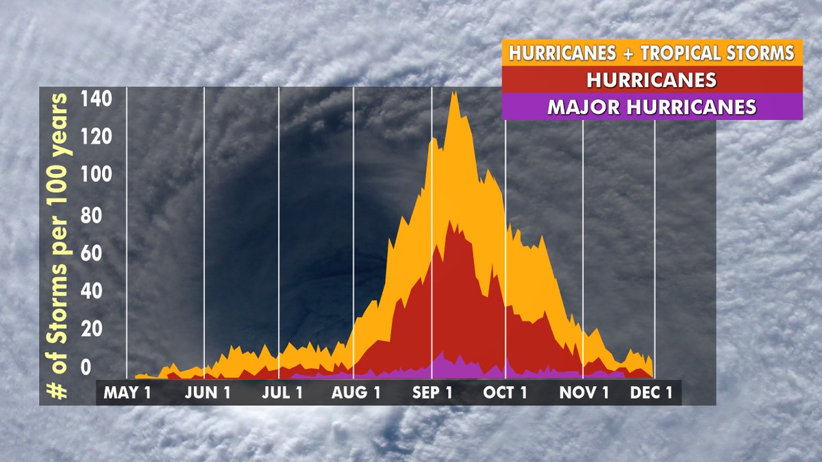
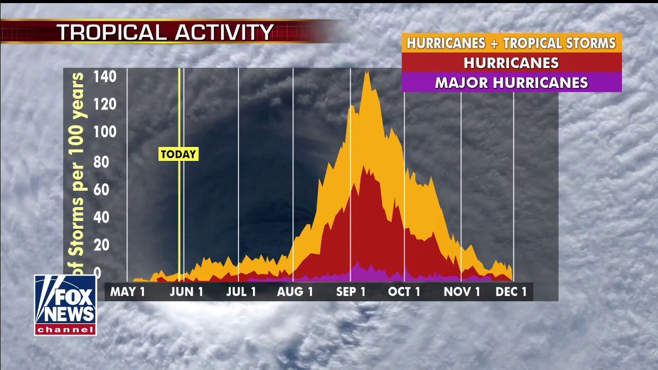
Hurricane season lates from late August through early October. (Fox News)
This forecast is well above the averages of 12 named tropical storms, six hurricanes, and three major hurricanes during the season.

The names for the 2020 Atlantic hurricane season. (Fox News)
The 2020 Atlantic Hurricane Season runs from June 1 to Nov. 30, and will include the names: Arthur, Bertha, Cristobal, Dolly, Edouard, Fay, Gonzalo, Hanna, Isaias, Josephine, Kyle, Laura, Marco, Nana, Omar, Paulette, Rene, Sally, Teddy, Vicky and Wilfred.
Fox News' Brandon Noriega contributed to this report.


