Fox News Flash top headlines for October 31
Fox News Flash top headlines are here. Check out what's clicking on Foxnews.com.
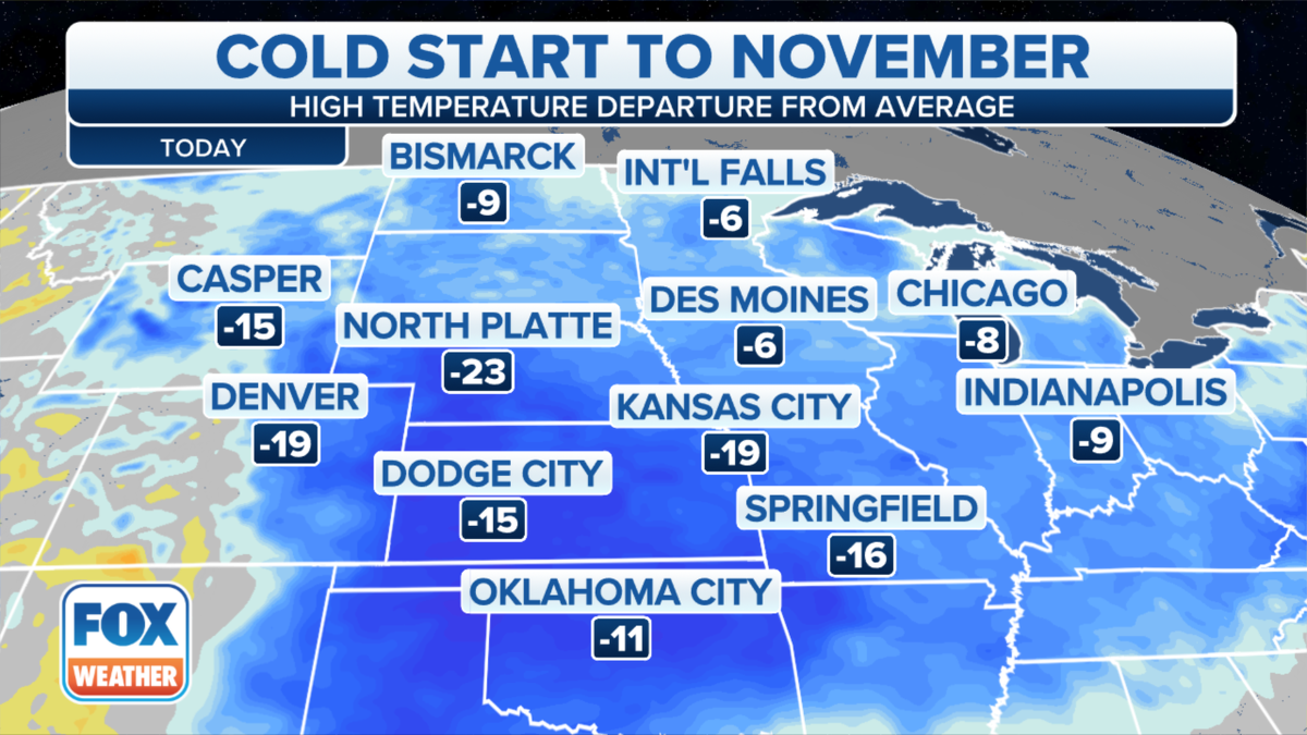
A significant cold front will bring cooler air from the Plains to the East Coast over the next 24 hours.
Freeze advisories are up from the Great Lakes and Ohio Valley back through the Midwest and parts of the Plains.
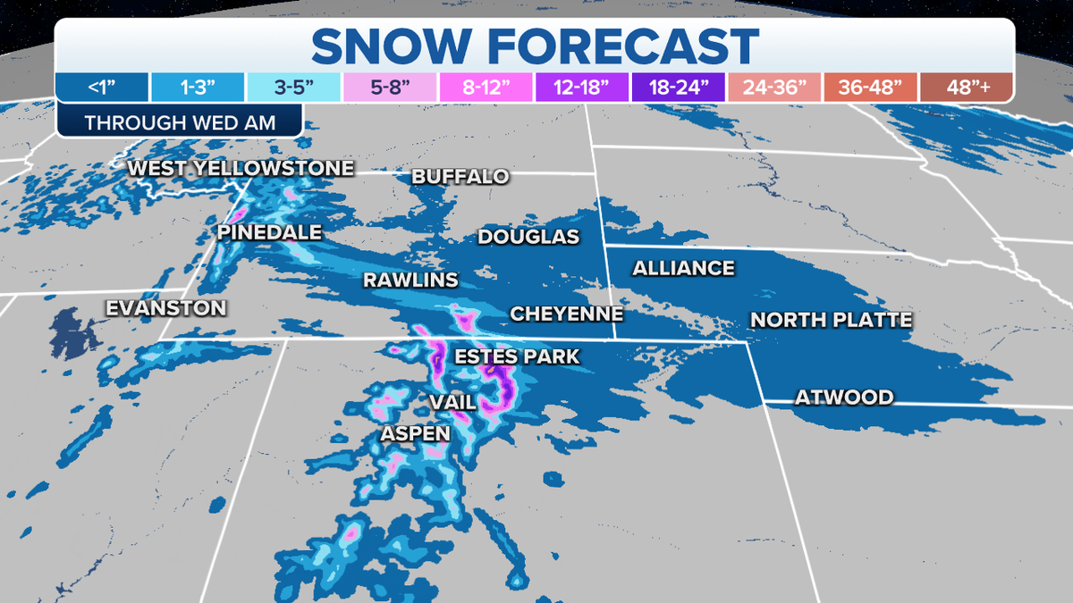
Colder air in place means any moisture will turn into a wintry mix from the Central Rockies into the Central Plains.

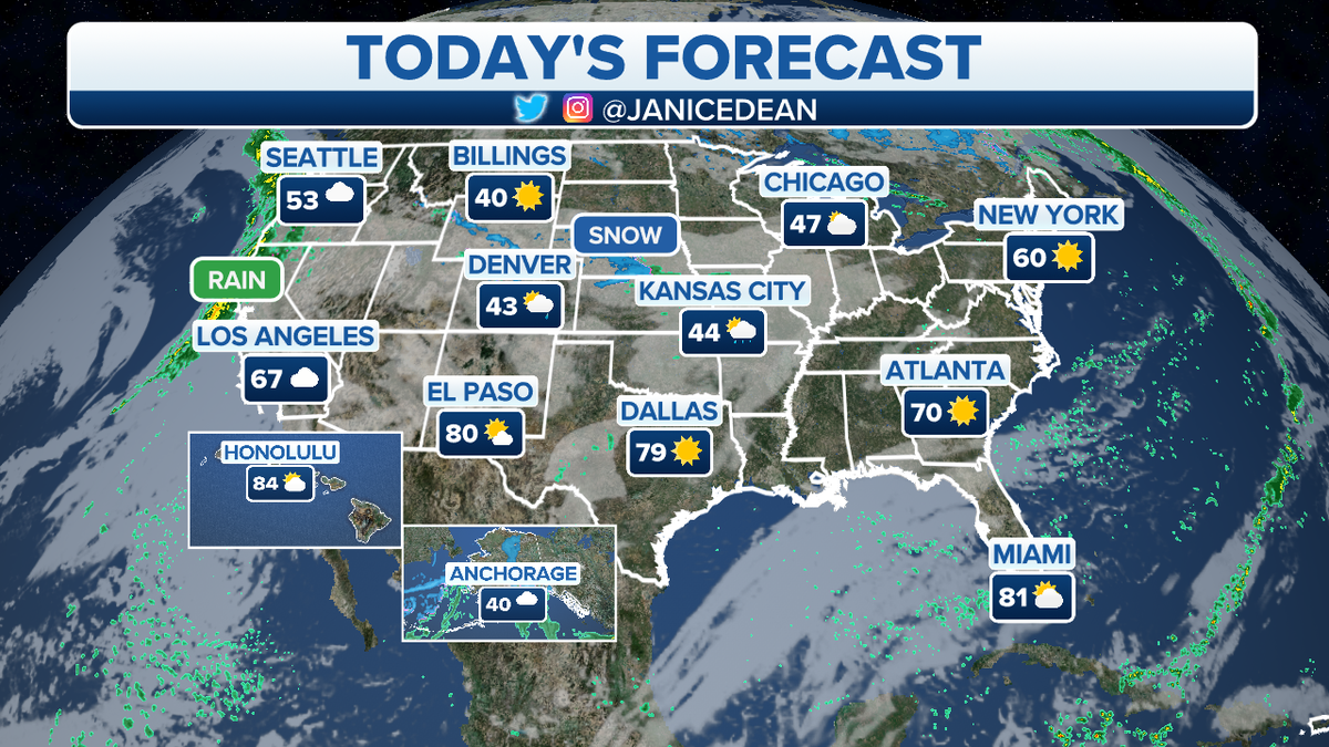
The national forecast for Monday, Nov. 1. (Fox News)
STORMY WEATHER ON TAP FOR EASTERN US
Rain will be in the forecast for the Southern Plains.
The next storm system pushing into the West Coast will bring more heavy rain and some higher elevation snow.

Expected snowfall totals for this week. (Fox News)
A storm system over Canada will help enhance rain and snow showers for the Great Lakes.
CLICK HERE TO GET THE FOX NEWS APP
Rain and snow showers will also increase for parts of the interior Northeast and New England Tuesday.

Cold temperatures are expected for the start of November. (Fox News)
Subtropical storm Wanda has formed in the Atlantic, but the system is not going to impact land.


