NOAA hurricane hunters fly through eye of Hurricane Milton
National Oceanic and Atmospheric Administration (NOAA) sent aircraft missions on Tuesday into Hurricane Milton to collect data on the impending hurricane. (Nick Underwood/OMAO/NOAA/TMX)
Researchers with the National Oceanic and Atmospheric Administration (NOAA) were in for a "bumpy" ride after they sent aircraft into the eye of Hurricane Milton to collect data on the massive storm barreling towards Florida.
The flight missions were done by the Aircraft Operations Center's WP-3D Orion #NOAA43 plane, which is affectionately called "Miss Piggy."
The government agency said in a social media post that operations, like "Miss Piggy," are sent to collect critical data that helps improve forecasts on their track and intensity and support hurricane research.
"Data collected by the agency's high-flying meteorological stations helps forecasters make accurate predictions during a hurricane and help hurricane researchers achieve a better understanding of storm processes, improving their forecast models," the agency said.

NOAA Lockheed WP-3D Orion "hurricane hunter" aircraft (N43RF) departing Lakeland Linder International Airport in Lakeland, Fla. (NOAA)

NOAA Programs and Integration Engineer Nick Underwood stands next to an aircraft system and underneath one of NOAA's two Lockheed WP-3D Orion "hurricane hunter" aircraft. (Sophie Talbert NOAA)
NOAA Programs and Integration Engineer Nick Underwood captured the intense flight through the Category 5 cyclone.
The video captured the turbulent ride, with loose items — including Underwood's cellphone and wallet — left flying through the aircraft.

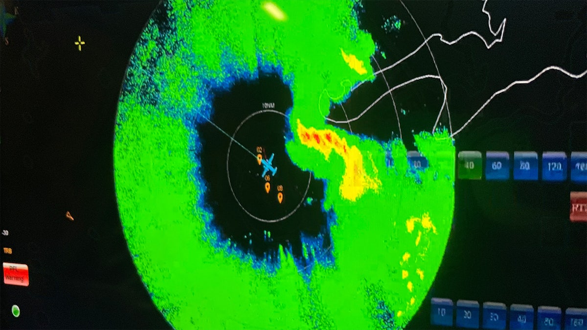
Radar display from NOAA WP-3D Orion N43RF "Miss Piggy" in the center of circulation of a tropical storm in 2023. (NOAA Nick Underwood)
The planes are flown and crewed by members of the NOAA Commissioned Officers Corp. and scientists on board use instruments that continuously transmit measurements back to the ground.
WALT DISNEY WORLD SHUTTING ITS GATES AHEAD OF HURRICANE MILTON
The crews measure the storm's pressure, humidity, temperature, wind direction and speed to provide "a detailed look at the structure of the storm and its intensity."

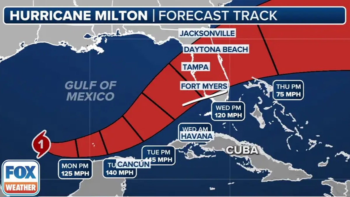
Hurricane Milton's projected path indicates it will likely impact most of the Florida peninsula. (FOX Weather)
Milton is expected to make landfall on Florida's central-west Gulf coast Wednesday night, according to forecasters.
CLICK HERE TO GET THE FOX NEWS APP
Although it will likely fluctuate in intensity, it will remain "an extremely dangerous hurricane" through landfall.


