Hurricane Humberto threatens Bermuda
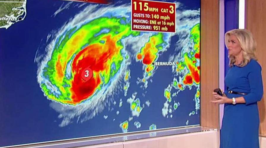
Hurricane watches and warning are in place in Bermuda as the powerful Category 3 storm is forecast to impact the island nation.
Hurricane Humberto in the Atlantic Ocean edged closer to Bermuda on Wednesday night, threatening the area with strong winds as Tropical Depression Imelda drenched Texas.
The National Hurricane Center tweeted about Humberto on Wednesday evening writing that high winds are expected to affect Bermuda, an island of about 70,000 people, through Thursday morning.
“Coastal flooding from storm surge and dangerous breaking waves is also expected tonight and Thursday,” the tweet said.
Humberto was centered about 75 miles north of Bermuda on Wednesday night with maximum sustained winds of 120 mph, making it a Category 3 storm, according to an update from the hurricane center. Humberto was reported moving east-northeast at 20 mph.
CATEGORY 3 HURRICANE HUMBERTO SET TO MAKE CLOSE PASS OFF BERMUDA AS BUSY ATLANTIC SEASON CONTINUES
The island started to experience hurricane-force winds Wednesday afternoon. The director of the Bermuda Weather Service warned that the storm could spawn tornadoes.
Earlier on Wednesday, National Security Minister Wayne Caines urged everyone to be off the streets by 5 p.m. and said non-emergency medical services would be closed until Thursday.
Bermuda Gov. John Rankin requested 120 members of the Royal Bermuda Regiment prepare for possible storm recovery efforts. Authorities had ordered early closings of schools, clinics and government offices and evening flights to Bermuda from the U.S. and Britain were canceled.
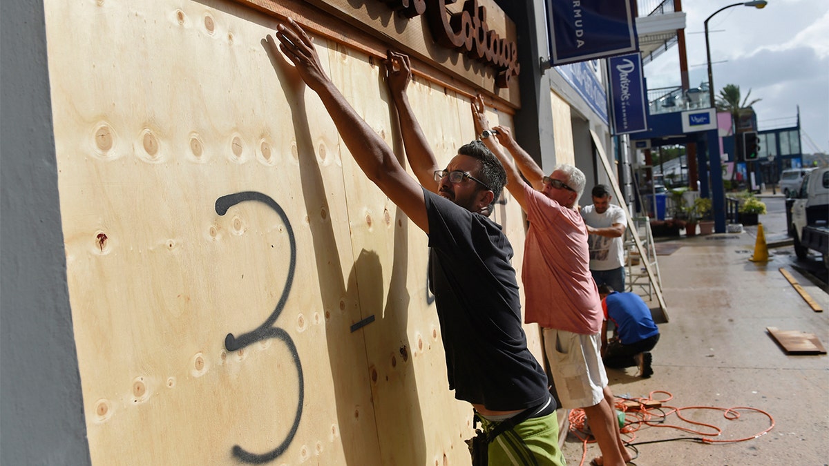
People board up an Urban Cottage store in preparation for Hurricane Humberto in Hamilton, Bermuda, Wednesday, Sept. 18, 2019. (AP Photo/Akil J. Simmons)
Meantime, Tropical Depression Imelda has drenched parts of Southeast Texas. Officials in Houston, which reportedly got hit with nearly 8 inches of rain since Imelda formed on Tuesday, and surrounding communities said even though Imelda inundated the area with rain on Wednesday, there have been no severe consequences so far.
The rainfall did, however, cause several creeks and bayous to rise to high levels. Some roads also flooded, stranding drivers in the Houston area.
Many schools in the Houston and Galveston area canceled classes Wednesday, although the Houston school district, the state’s largest, stayed open. At least five school districts canceled classes on Thursday as well, Fox 26 in Houston reported.
The Deputy emergency management coordinator in Brazoria County, which is along the Gulf Coast south of Houston, said he has seen no reports of flooded homes or people stranded, but warned, “we’ve got two more days to go on this.”
TRIPLE THREAT STORM SYSTEMS FORM, EXPECTED TO IMPACT TEXAS, BERMUDA WITH RAINFALL, WINDS
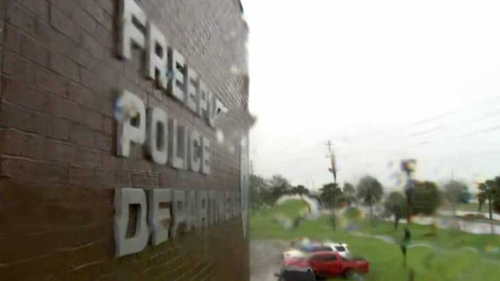
Imelda made landfall near Freeport, Texas on Tuesday with maximum sustained winds of 40 mph and had weakened to a tropical depression, according to the National Hurricane Center.
Most of the heaviest showers had moved to the east of Houston, into Beaumont, Texas, and southwestern Louisiana by late Thursday afternoon, but forecasters said the Houston area could still face some heavy rainfall Wednesday night into Thursday.
The National Weather Service said flash flood watches remained in effect through Thursday for southeast Texas and southwest Louisiana.
Several weak tornadoes from Imelda’s remnants were reported in the Baytown area, about 25 miles east of Houston, damaging trees, barns and sheds. The tornados also caused minor damage to some homes and vehicles.
As the remnants of Imelda continue moving north and away from Houston, parts of East Texas could get up to 10 inches of rain through Thursday morning, according to the National Weather Service.
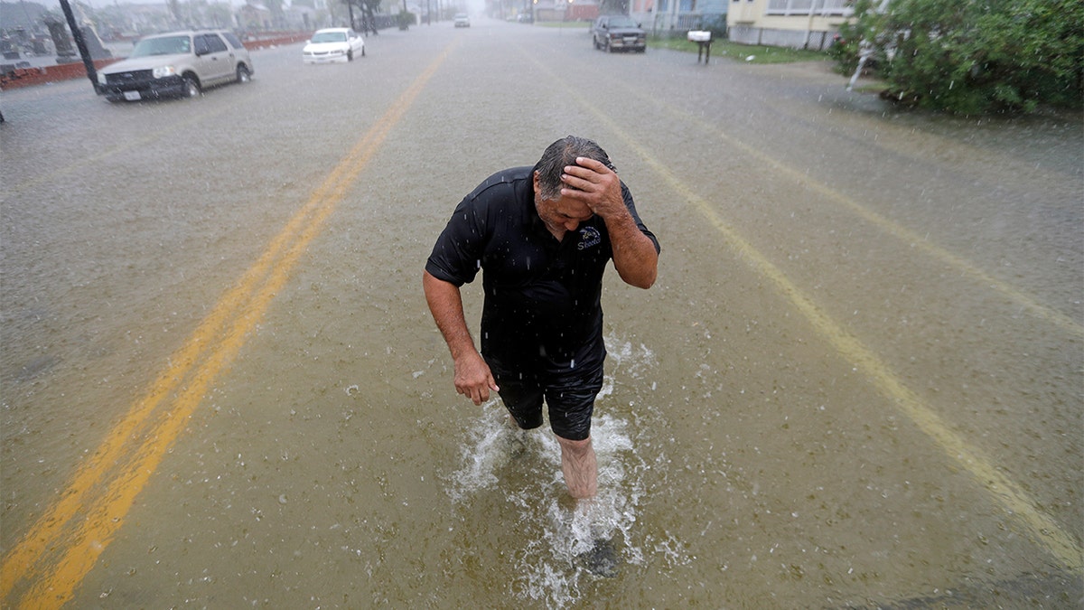
Angel Marshman wades through floodwaters from Tropical Depression Imelda after trying to start his flooded car Wednesday, Sept. 18, 2019, in Galveston, Texas. (AP Photo/David J. Phillip)
Coastal counties in Texas, including Brazoria, Matagorda and Galveston, got the most rain so far from Imelda. The city of Galveston, which experienced street flooding, had received nearly 9 inches of rain, according to preliminary totals released Wednesday afternoon by the National Weather Service.
People in Galveston were reportedly choosing to walk to work instead of drive because of the flooded streets.
Popeyes employees were seen taking their shoes off and wading into work as floodwaters surrounded the restaurant on Broadway Street.
“It’s a mess,” Fox 26 reported Popeyes manager Crystal Hardeman said.
She reportedly added, “We didn’t get dressed until we got into Popeyes..but Popeyes is open—drive-through only.”
City officials reportedly warned drivers that they could get a ticket if they drive faster than 5 miles per hour on flooded streets.
The Matagorda County town of Sargent, with a population of about 2,700, reportedly recorded nearly 20 inches of rain since Tuesday.
“The rain [Tuesday] night was just massive sheets of rain and lightning storms,” Sargent resident Karen Romero said. “The lightning looked like it was coming in your house.” She added that her home, which is along a creek, sits on stilts and, therefore, was not in danger of flooding.
The National Weather Service said Imelda is the first named storm to affect the Houston area since Hurricane Harvey, which dumped nearly 50 inches of rain two years ago. Harvey caused an estimated $125 billion in damage after more than 150,000 homes in the Houston area were flooded.
Meteorologists said newly formed Tropical Storm Lorena was already producing heavy rain along the coast in Mexico as the concern of flooding and landslides mounted.
Forecasters said Lorena, which was moving northwest at 12 mph on Wednesday night, was expected to pass “near or over the coast” somewhere between the port of Manzanillo and Puerto Vallarta by Thursday, while growing toward hurricane force. The long-term forecast, which is still uncertain, showed Lorena likely approaching the Los Cabos resort area Friday night and Saturday.
Maximum sustained winds were 70 mph by Wednesday evening and Lorena was centered about 60 miles south-southeast of Manzanillo.
CLICK HERE TO GET THE FOX NEWS APP
Hurricane warnings were in effect on Wednesday night from Punta San Telmo to Cabo Corrientes.
The Associated Press contributed to this report.


