What's left of Hurricane Delta has dissipated, but the storm's remnants are bringing a soaking on Monday to the East Coast.
Leftover moisture from the hurricane that roared ashore in Louisiana on Friday is now moving through the Mid-Atlantic and Northeast.
An additional 1 to 2 inches of rain is possible through midday on Tuesday.
GEORGIA TRAIN DERAILMENT SPARKS FIRE AFTER DELTA UNLEASHES FLASH FLOODING, TORNADOES ACROSS SOUTH
There’s also an area of low pressure moving across the Upper Midwest and Great Lakes that will keep the wet weather in the forecast through Tuesday.
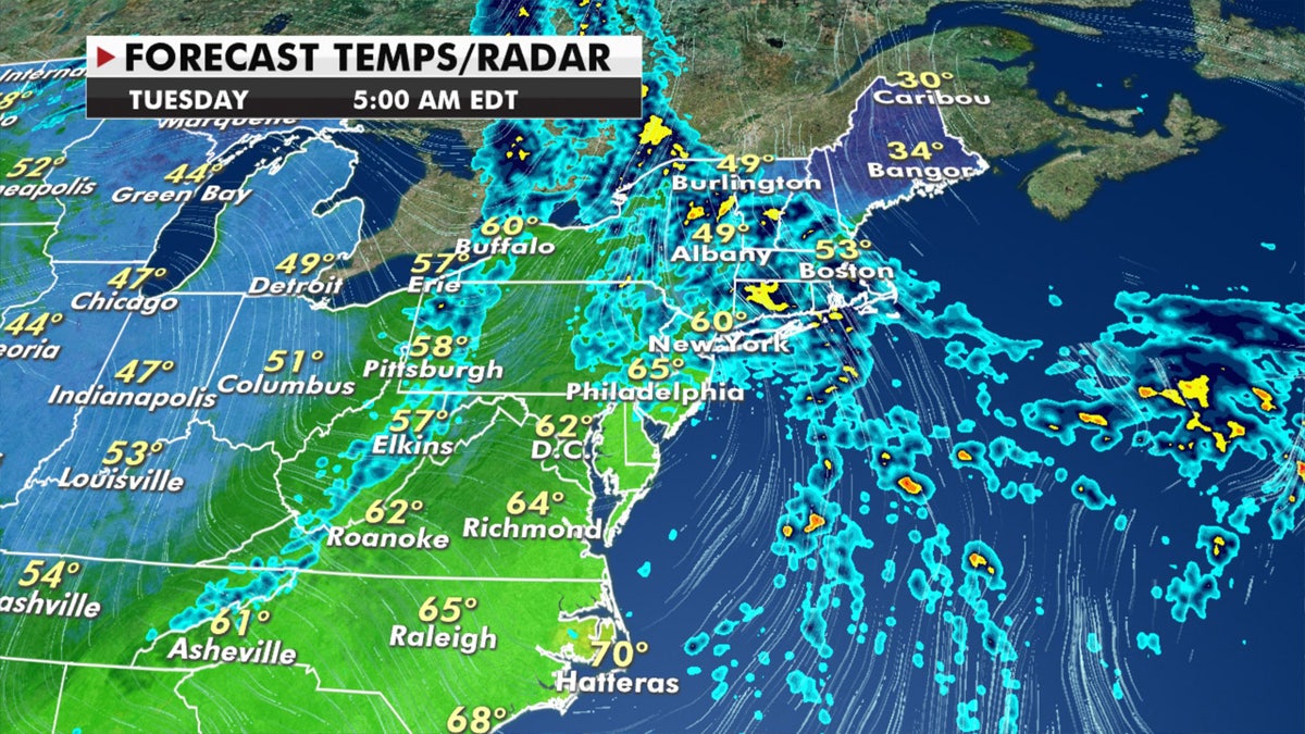
Rainy conditions can be expected in the Northeast through Tuesday. (Fox News)
The heaviest of rain will fall over parts of northern New England.
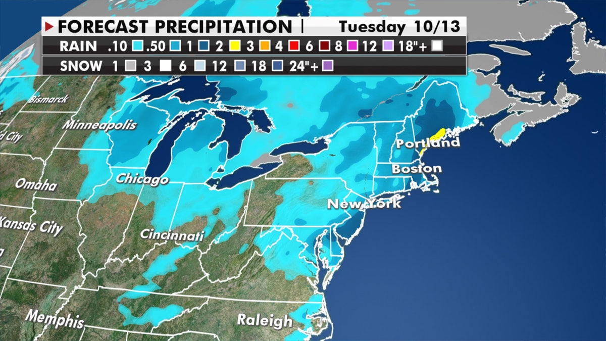
Forecast rain amounts through Tuesday across the Northeast. (Fox News)
As the East Coast deals with soaking rain, the Northwest is getting active with several systems bringing rain and higher elevation snow.
Winter weather advisories and high wind warnings are in effect across the region.
‘BUBBLE CURTAIN’ IS THE NEWEST CRAZY HURRICANE-KILLING IDEA
Several systems this week are moving onshore and continuing to spread rain and higher-elevation now inland to the Northern Rockies through Wednesday.
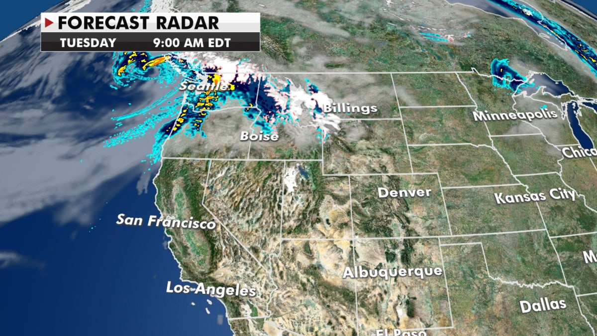
Several storm systems will be rain and mountain snow to the Pacific Northeast through midweek (Fox News)
Unfortunately, the rest of the West remains dry and the fire danger continues.
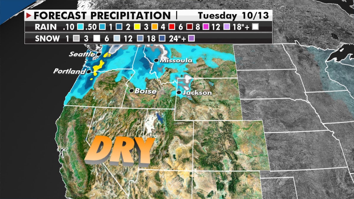
Forecasted precipitation across the West. (Fox News)
The greatest risk for fires on Monday is the Front Range and the Central Plains, where red flag warnings are posted.
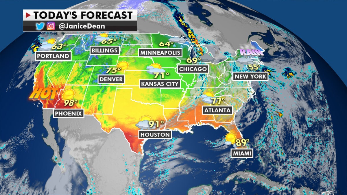
The national forecast for October 12, 2020. (Fox News)
Temperatures are above average to begin the week over the southern Plains and Southwest.
CLICK HERE FOR MORE WEATHER COVERAGE FROM FOX NEWS
Heat advisories are in effect across Southern California.
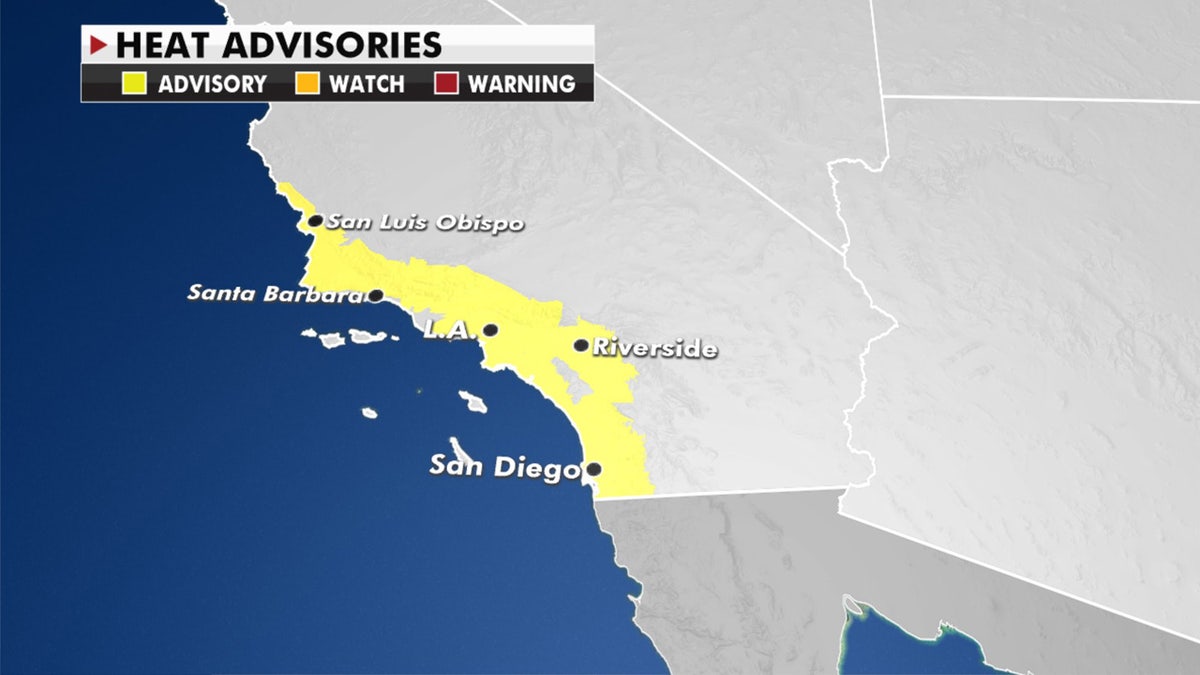
Heat advisories have been issued in Southern California for Monday, Oct. 12, 2020. (Fox News)
Dry conditions and heat will lead to a greater risk of wildfires across portions of California by later this week.
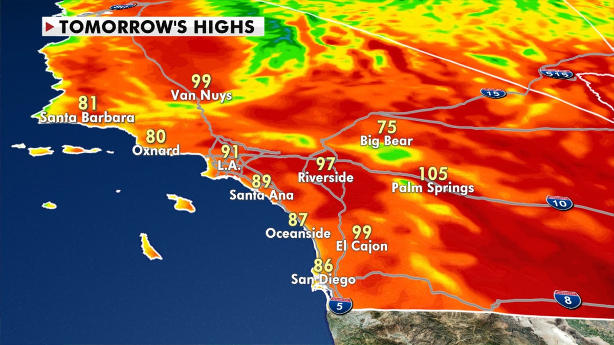
Forecast high temperatures in Southern California for Tuesday, Oct. 13, 2020. (Fox News)


