National forecast for Thursday, August 20
Fox News senior meteorologist Janice Dean has your FoxCast.
Critical fire weather danger continues for parts of California, the Great Basin and the Rockies with heat, dry conditions and the risk of dry thunderstorms producing lightning and not a lot of rainfall. Some areas of California and Colorado are dealing with poor air quality due to the ongoing wildfires in the region. The excessive heat will start to lessen a bit, but will still be dangerous over the Southwest.
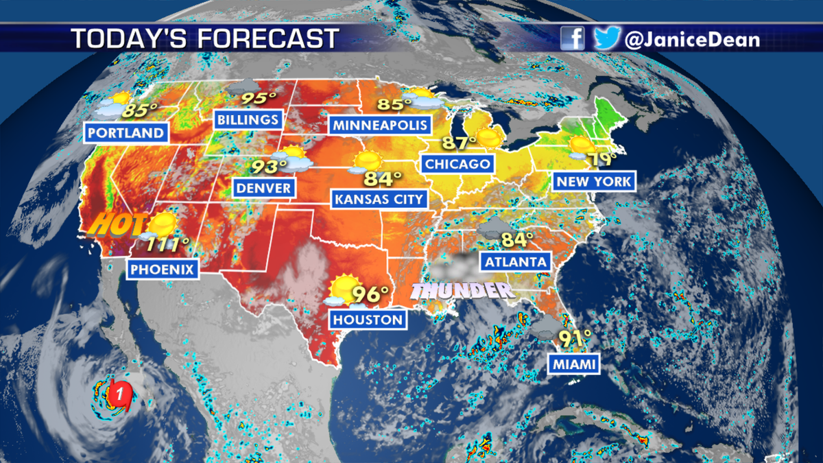
National forecast for Aug. 20, 2020. (Fox News)
Scattered showers and thunderstorms will persist over the Southeast over the next few days with the risk of locally heavy rain in some spots and flash flooding.
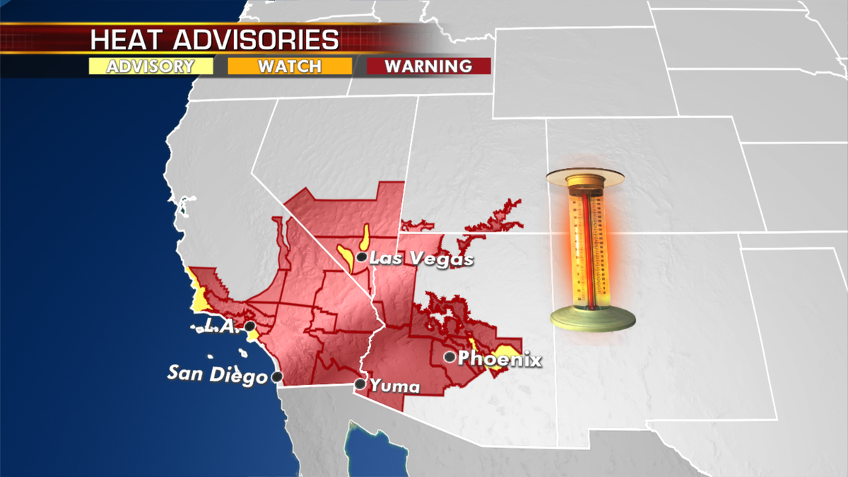
Heat advisories for Aug. 20, 2020. (Fox News)

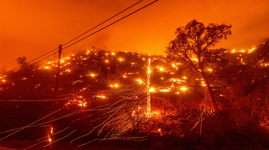
Seen in a long exposure photograph, embers burn along a hillside as the LNU Lightning Complex fires tear through unincorporated Napa County, Calif., on Tuesday, Aug. 18, 2020. Fire crews across the region scrambled to contain dozens of wildfires sparked by lightning strikes as a statewide heat wave continues. (AP Photo/Noah Berger)
The tropics are being watched closely, with a disturbance in the central Caribbean that is gradually becoming more organized. A tropical depression is likely to form in the next couple of days as it moves across the northwest Caribbean toward the Yucatán Peninsula.
A tropical depression has formed east of the Lesser Antilles and is forecast to track near Puerto Rico by Saturday. The path of this storm will have to be closely monitored as it potentially will impact Florida early next week.
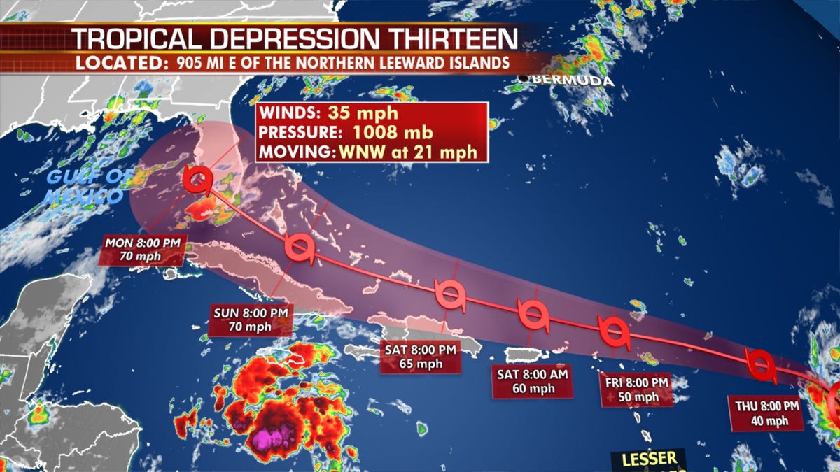
The forecast path of Tropical Depression 13. (Fox News)
"South Florida is still in the forecast cone of Depression 13, but there is still high uncertainty to determine what, if any, impacts this system may have on South Florida at this time," the National Weather Service Miami tweeted Thursday.
The tropical depression formed Wednesday in the waters of the tropical central Atlantic.
A third disturbance is about to emerge from Africa and will have the opportunity to develop this weekend or early next week.
In the East Pacific just offshore from Cabo San Lucas is a weakening Hurricane Genevieve. Cabo is susceptible to hurricane-force wind gusts, with conditions improving Thursday afternoon.
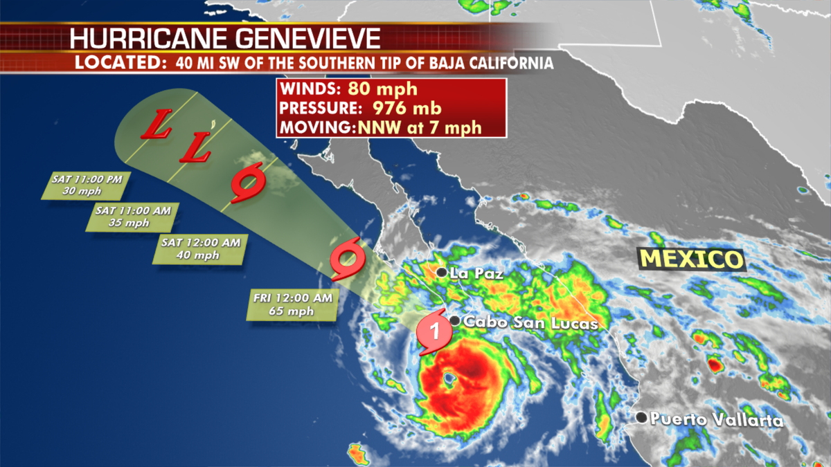
Hurricane Genevieve forecast. (Fox News)
CLICK HERE TO GET THE FOX NEWS APP
Fox News' James Rogers contributed to this article.


