


Much of Colorado will undergo some kind of weather advisory over the next 24 hours, as Labor Day’s high heat and 92-degree temperatures will be replaced by possible record-breaking cold as a front moves into the state, bringing winter-like conditions -- including snow and below-freezing temperatures, the Denver Post reported.
HEAT WAVE IN WEST BRINGING WILDFIRE THREAT AS COLORADO PREPARES FOR WINTER STORM
Temperatures are expected to drop nearly 60 degrees -- to a low of 33 with winds up to 17 mph. The state is pretty much assured of precipitation tonight with the National Weather Service pegging it at a 100% chance. Rain is expected to start late Monday night before switching to snow overnight, with mostly snow expected after 11 a.m. Tuesday.
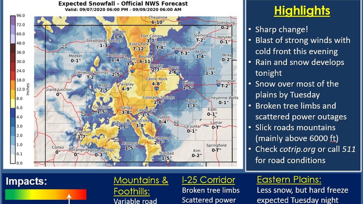
Tuesday’s temperatures aren’t expected to rise above 35 degrees, the NSW said, with the low expected to fall to 29 degrees Tuesday night. More rain and snow are expected overnight into Wednesday with a 40 percent chance of precipitation before 2 p.m., the report said.
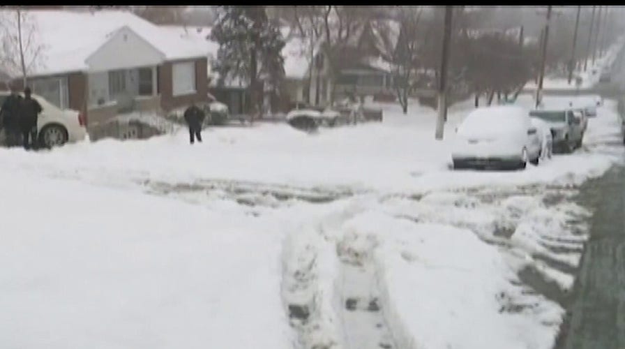
Heavier snow accumulations are expected in the mountains, the Post reported, while Denver should see slushy, wet snowfall by Tuesday morning, according to the National Weather Service in Boulder.
Possible snow accumulations for Denver and Colorado Springs are believed to be in the 5-inch range, while higher elevations could see nearly a foot of snow, the Post reported.
CLICK HERE FOR MORE WEATHER COVERAGE FROM FOX NEWS
While an early-season snowstorm like this one is uncommonly early, it is not Denver’s earliest recorded snowfall, the report said. In 1961, Denver’s Labor Day storm dropped 4.2 inches of snow. This storm, however, will tie the second-earliest snow on record when 0.7 inches fell on Sept. 8, 1962.