2020 Atlantic hurricane season is running out of names, so what happens next?
With a number of weeks left in the 2020 Atlantic hurricane season and only one name left on the official storm name list, the National Hurricane Center explains what happens next.
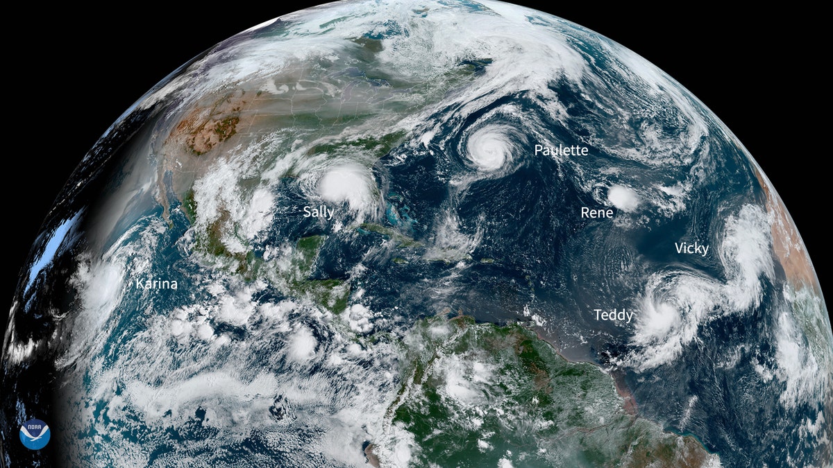
There were five named storms churning in the Atlantic Basin Monday for the first time in decades, according to the National Oceanic and Atmospheric Administration (NOAA).
They were Hurricane Sally, which is threatening the north Gulf Coast, as well as Paulette, Rene, Teddy and Vicky.
Rene dissipated early Monday evening, but the others were still churning offshore Tuesday afternoon. And another named storm, Tropical Storm Karina, was whipping up the seas southwest of Baja California in the Pacific Ocean.

This NOAA Environmental Visualization Laboratory image shows five named storms churning in the Atlantic Basin at once for the first time since 1971. (NOAA)
An image taken by the GOES-East weather satellite, from 22,000 miles above, showed all of the cyclones at the same time.
Sally was about 75 miles south of Mobile, Ala. Tuesday evening, moving north toward to the Gulf Coast at about 2 mph, according to the National Weather Service. The Category 1 storm had 85 mph winds and was expected to bring “historic, life-threatening flooding” to areas in its path.
Storm surge warnings were in effect for the stretch of land between the Mississippi and the Okaloosa/Walton County line in Florida, as well as in Mobile Bay. Peak surge could reach as high as 7 feet in some areas between Mississippi and Florida – and some flooding already had begun. Flash floods could crop up in parts of Mississippi, Alabama, Georgia and even the western Carolinas, according to forecasters.

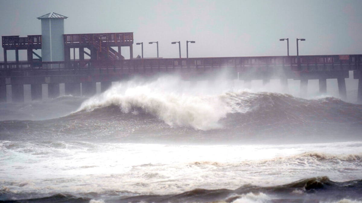
Waves crash near a pier, at Gulf State Park, Sept. 15, in Gulf Shores, Ala. Hurricane Sally is crawling toward the northern Gulf Coast at just 2 mph, a pace that's enabling the storm to gather huge amounts of water to eventually dump on land. (AP Photo/Gerald Herbrt)
HURRICANE SALLY'S EYE, CHOPPY SEAS REVEALED AS STORM LURKS OFF GULF COAST
Authorities issued a hurricane warning for the area between Bay St. Louis, Miss., and Navarre, Fla. Tropical storm warnings were in effect in outlying communities as far west as Grand Isle, La., and as far east as Indian Pass, Fla.
There is also a risk of tornadoes between the Florida Panhandle and southern Alabama.
CLICK HERE FOR MORE WEATHER COVERAGE FROM FOX NEWS
Sally was expected to make landfall near the Alabama-Mississippi state line by late Tuesday or early Wednesday and move northeast inland over Alabama later Wednesday and Thursday. The storm is expected to dump 10 to 20 inches of rainfall and as much as 30 inches in isolated areas, according to the NWS.
Paulette, a few hundred miles northeast of Bermuda, was not associated with any storm warnings or watches, but rough surf kicked up by the storm was buffeting Bermuda, the Bahamas, parts of the East Coast and other regional shorelines Tuesday, according to meteorologists.

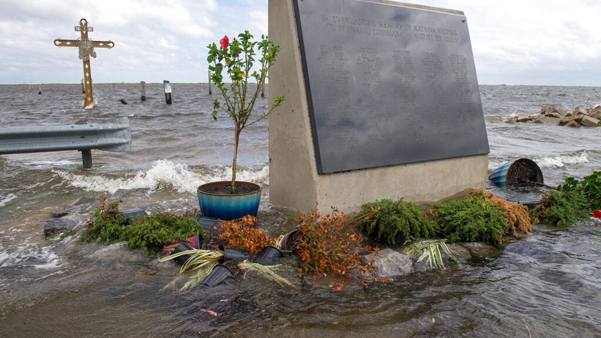
The Hurricane Katrina monument is surrounded by rising water in eastern St. Bernard Parish, La., evacuate for Hurricane Sally on Sept. 14. (Chris Granger/The Advocate via AP)
Tropical Storm Teddy could become a hurricane Tuesday night or early Wednesday, according to the National Hurricane Center, but it was more than 900 miles off the shore of the Caribbean Sea’s Lesser Antilles islands. The storm was moving west-northwest at about 13 mph.
Vicky was expected to weaken Tuesday night.
CLICK HERE FOR THE FOX NEWS APP
Overall, 2020 has already had a busy hurricane season – and peak storm activity typically arrives in September, according to the NOAA.


